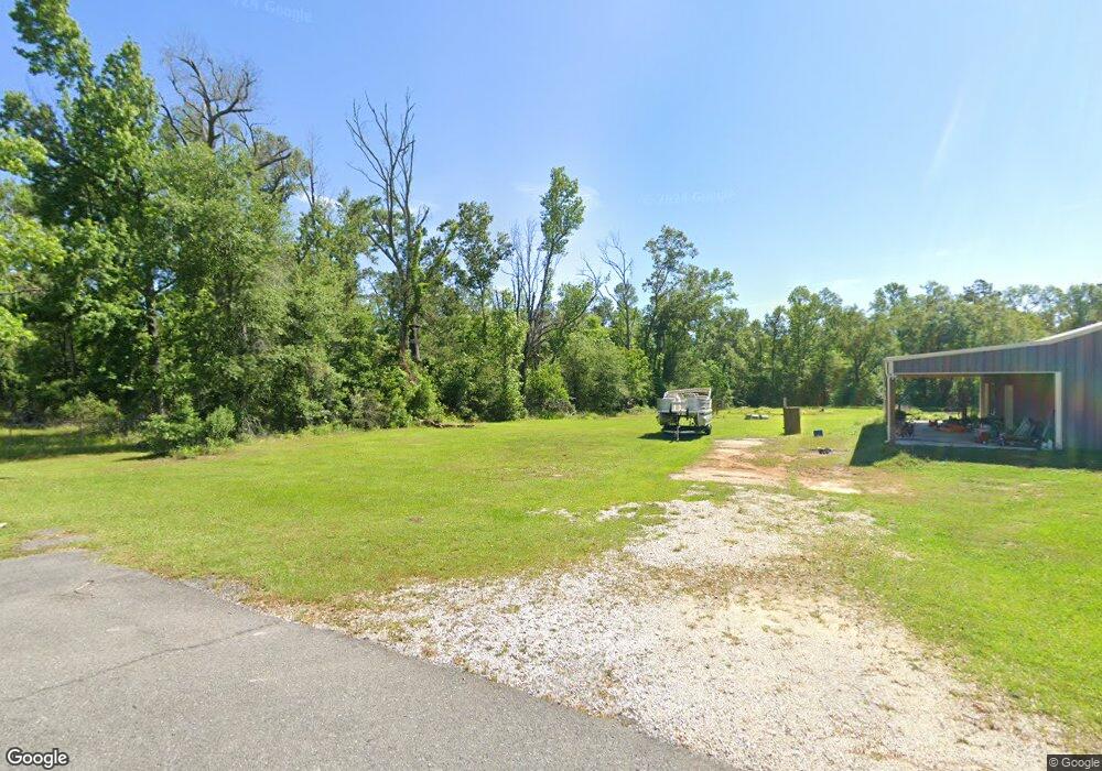
1242 Kellog Rd Unit Road Dequincy, LA 70633
Estimated Value: $97,000 - $178,109
4
Beds
1
Bath
2,533
Sq Ft
$54/Sq Ft
Est. Value
About This Home
This home is located at 1242 Kellog Rd Unit Road, Dequincy, LA 70633 and is currently estimated at $138,027, approximately $54 per square foot. 1242 Kellog Rd Unit Road is a home located in Calcasieu Parish with nearby schools including DeQuincy Primary School, DeQuincy Elementary School, and DeQuincy Middle School.
Ownership History
Date
Name
Owned For
Owner Type
Purchase Details
Closed on
Apr 29, 2015
Sold by
Dickerson Timothy G and Dickerson Whitney
Bought by
Red Michael Shane
Current Estimated Value
Home Financials for this Owner
Home Financials are based on the most recent Mortgage that was taken out on this home.
Original Mortgage
$71,047
Outstanding Balance
$54,851
Interest Rate
3.74%
Mortgage Type
New Conventional
Estimated Equity
$83,176
Purchase Details
Closed on
Jan 31, 2012
Sold by
Deutsche Bank National Trust Company
Bought by
Kellogg Chad Aaron and Kellogg Casie Leigh
Create a Home Valuation Report for This Property
The Home Valuation Report is an in-depth analysis detailing your home's value as well as a comparison with similar homes in the area
Home Values in the Area
Average Home Value in this Area
Purchase History
| Date | Buyer | Sale Price | Title Company |
|---|---|---|---|
| Red Michael Shane | $76,000 | None Available | |
| Kellogg Chad Aaron | $27,500 | United Title Of Louisiana In |
Source: Public Records
Mortgage History
| Date | Status | Borrower | Loan Amount |
|---|---|---|---|
| Open | Red Michael Shane | $71,047 |
Source: Public Records
Tax History Compared to Growth
Tax History
| Year | Tax Paid | Tax Assessment Tax Assessment Total Assessment is a certain percentage of the fair market value that is determined by local assessors to be the total taxable value of land and additions on the property. | Land | Improvement |
|---|---|---|---|---|
| 2024 | $487 | $11,810 | $510 | $11,300 |
| 2023 | $487 | $6,510 | $390 | $6,120 |
| 2022 | $731 | $6,510 | $390 | $6,120 |
| 2021 | $0 | $390 | $390 | $0 |
| 2020 | $43 | $370 | $370 | $0 |
| 2019 | $42 | $360 | $360 | $0 |
| 2018 | $595 | $5,120 | $360 | $4,760 |
| 2017 | $550 | $5,120 | $360 | $4,760 |
| 2016 | $595 | $5,120 | $360 | $4,760 |
| 2015 | $595 | $5,110 | $350 | $4,760 |
Source: Public Records
Map
Nearby Homes
- 1118 Pinder Ln
- 1114 Pinder Ln
- 1112 Pinder Ln
- 0 Louisiana 389
- 0 Barrow Rd
- 1411 Hargrove Loop
- 0 Hargrove Loop
- tbd Henry Robertson Rd
- 0 Henry Robertson Rd
- 1037 Temple Ln
- 409 Fields Hwy
- 107 Boise St
- 0 Hwy 389 and van Winkle Rd Unit 2-6103
- 1233 Capella Dr
- 128 N Doc Ln
- 104 Camelia Ave
- 600 N Overton St
- 0 Lois St Unit SWL25004000
- 800 W 4th St
- 206 Self St
- 1242 Kellogg Rd
- 1242 Kellog Rd
- 1242 Kellog Rd
- 1220 Kellog Rd
- 1286 Fields Hwy
- 1273 Fields Hwy
- 1300 Fields Hwy
- 1243 Alton Pierce Rd
- 1185 Hollie Ln
- 1265 Alton Pierce Rd
- 1320 Fields Hwy
- 1177 Hollie Ln
- 1238 Alton Pierce Rd
- 1231 Hollie Ln
- 1231 Hollie Ln
- 1159 Hollie Ln
- 1224 Fields Hwy
- 1331 Alton Pierce Rd
- 1313 Alton Pierce Rd
- 1133 Hollie Ln
