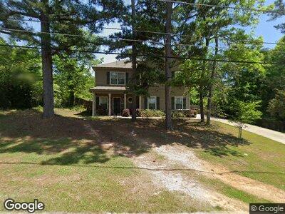
1242 Knight Dr Columbus, GA 31906
Lindsey Creek Park-Boxwood Estates NeighborhoodEstimated Value: $180,000 - $260,000
4
Beds
3
Baths
1,948
Sq Ft
$120/Sq Ft
Est. Value
About This Home
This home is located at 1242 Knight Dr, Columbus, GA 31906 and is currently estimated at $233,769, approximately $120 per square foot. 1242 Knight Dr is a home located in Muscogee County with nearby schools including Rigdon Road Elementary School, Richards Middle School, and Hardaway High School.
Ownership History
Date
Name
Owned For
Owner Type
Purchase Details
Closed on
Jun 28, 2019
Sold by
Hughes Russell
Bought by
Hughes Russell and Conyers Athena N
Current Estimated Value
Home Financials for this Owner
Home Financials are based on the most recent Mortgage that was taken out on this home.
Original Mortgage
$185,000
Interest Rate
3.9%
Purchase Details
Closed on
Jan 31, 2018
Sold by
Donald Bowles Inc
Bought by
Wright Alicia Alexandria
Home Financials for this Owner
Home Financials are based on the most recent Mortgage that was taken out on this home.
Original Mortgage
$169,640
Interest Rate
3.95%
Mortgage Type
VA
Purchase Details
Closed on
Oct 21, 2016
Sold by
Pauline
Bought by
Donald Bowles Inc
Create a Home Valuation Report for This Property
The Home Valuation Report is an in-depth analysis detailing your home's value as well as a comparison with similar homes in the area
Home Values in the Area
Average Home Value in this Area
Purchase History
| Date | Buyer | Sale Price | Title Company |
|---|---|---|---|
| Hughes Russell | -- | -- | |
| Hughes Russell | $185,000 | -- | |
| Wright Alicia Alexandria | $169,640 | -- | |
| Donald Bowles Inc | $12,650 | -- |
Source: Public Records
Mortgage History
| Date | Status | Borrower | Loan Amount |
|---|---|---|---|
| Open | Hughes Russell | $181,313 | |
| Closed | Hughes Russell | $185,000 | |
| Previous Owner | Wright Alicia Alexandria | $169,640 |
Source: Public Records
Tax History Compared to Growth
Tax History
| Year | Tax Paid | Tax Assessment Tax Assessment Total Assessment is a certain percentage of the fair market value that is determined by local assessors to be the total taxable value of land and additions on the property. | Land | Improvement |
|---|---|---|---|---|
| 2024 | -- | $81,796 | $5,844 | $75,952 |
| 2023 | $0 | $81,796 | $5,844 | $75,952 |
| 2022 | $0 | $62,368 | $5,844 | $56,524 |
| 2021 | $0 | $66,892 | $5,844 | $61,048 |
| 2020 | $0 | $66,892 | $5,844 | $61,048 |
| 2019 | $2,194 | $66,892 | $5,844 | $61,048 |
| 2018 | $1,980 | $48,336 | $5,844 | $42,492 |
| 2017 | $207 | $5,040 | $5,040 | $0 |
| 2016 | $209 | $5,062 | $5,062 | $0 |
| 2015 | $84 | $5,062 | $5,062 | $0 |
| 2014 | $84 | $5,062 | $5,062 | $0 |
| 2013 | -- | $5,062 | $5,062 | $0 |
Source: Public Records
Map
Nearby Homes
- 1310 Woodgren Ct
- 1365 Boxwood Blvd
- 1317 Glenwood Rd
- 3317 Morehouse St
- 1043 Quincy Dr
- 937 Diggs Ave
- 1006 34th Ave
- 3317 10th St
- 1750 Boxwood Place
- 1047 Fisk Ave
- 3415 Terminal St
- 3414 Terminal St
- 776 Terminal Ct
- 770 Terminal Ct
- 758 Terminal Ct
- 3011 Colorado St
- 2917 Hood St
- 2902 Gardenia St
- 4029 Kenesaw Ct
- 4327 Kenesaw Dr