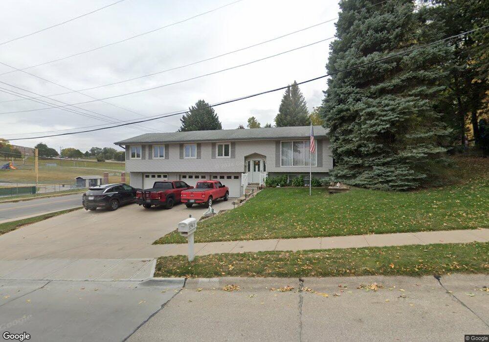
1242 Saint Andrews Rd Bellevue, NE 68005
Estimated Value: $293,000 - $330,828
3
Beds
2
Baths
2,011
Sq Ft
$156/Sq Ft
Est. Value
About This Home
This home is located at 1242 Saint Andrews Rd, Bellevue, NE 68005 and is currently estimated at $313,707, approximately $155 per square foot. 1242 Saint Andrews Rd is a home located in Sarpy County with nearby schools including Birchcrest Elementary School, Logan Fontenelle Middle School, and Bellevue East High School.
Ownership History
Date
Name
Owned For
Owner Type
Purchase Details
Closed on
Jul 15, 1999
Sold by
Bullard Patrick J
Bought by
Chamberlain Mark J and Chamberlain Judy M
Current Estimated Value
Home Financials for this Owner
Home Financials are based on the most recent Mortgage that was taken out on this home.
Original Mortgage
$60,000
Interest Rate
7.39%
Create a Home Valuation Report for This Property
The Home Valuation Report is an in-depth analysis detailing your home's value as well as a comparison with similar homes in the area
Home Values in the Area
Average Home Value in this Area
Purchase History
| Date | Buyer | Sale Price | Title Company |
|---|---|---|---|
| Chamberlain Mark J | $128,000 | -- |
Source: Public Records
Mortgage History
| Date | Status | Borrower | Loan Amount |
|---|---|---|---|
| Closed | Chamberlain Mark J | $60,000 |
Source: Public Records
Tax History Compared to Growth
Tax History
| Year | Tax Paid | Tax Assessment Tax Assessment Total Assessment is a certain percentage of the fair market value that is determined by local assessors to be the total taxable value of land and additions on the property. | Land | Improvement |
|---|---|---|---|---|
| 2025 | $4,927 | $279,014 | $40,000 | $239,014 |
| 2024 | $5,267 | $280,993 | $36,000 | $244,993 |
| 2023 | $5,267 | $249,445 | $32,000 | $217,445 |
| 2022 | $4,782 | $222,187 | $29,000 | $193,187 |
| 2021 | $4,629 | $212,791 | $29,000 | $183,791 |
| 2020 | $4,331 | $198,456 | $23,000 | $175,456 |
| 2019 | $4,010 | $184,907 | $23,000 | $161,907 |
| 2018 | $3,684 | $174,438 | $23,000 | $151,438 |
| 2017 | $3,531 | $166,071 | $23,000 | $143,071 |
| 2016 | $3,382 | $162,547 | $23,000 | $139,547 |
| 2015 | $3,335 | $161,224 | $23,000 | $138,224 |
| 2014 | $3,323 | $159,603 | $23,000 | $136,603 |
| 2012 | -- | $157,766 | $23,000 | $134,766 |
Source: Public Records
Map
Nearby Homes
- 1101 Potter Rd
- 20.74 Acres
- 1302 Wilroy Rd Unit 1
- 1101 Marian Ave
- 1212 W 16th Ave
- 910 Lemay Dr
- 1206 Skyview Dr
- Lot 13 Hidden Hills Dr
- 208 Sandi Ct
- 901 Brenton Ave
- 1509 Brenda Dr
- 1219 Robin Dr
- 1511 Lorraine Ave
- 2113 Twinridge Dr
- 1505 Mildred Ave
- 1322 Hancock St
- 2203 Lloyd St
- 2208 Greensboro Ave
- 2108 Randall Dr
- 706 W Mission Ave
- 1240 Saint Andrews Rd
- 1206 Lincoln Rd
- 1203 Kay Lynn Dr
- 1116 Lincoln Rd
- 1205 Kay Lynn Dr
- 1238 Saint Andrews Rd
- 1208 Lincoln Rd
- 1102 Potter Rd
- 1114 Lincoln Rd
- 1207 Kay Lynn Dr
- 1202 Kay Lynn Dr
- 1210 Lincoln Rd
- 1236 Saint Andrews Rd
- 1104 Potter Rd
- 1204 Kay Lynn Dr
- 1209 Kay Lynn Dr
- 1112 Lincoln Rd
- 1206 Kay Lynn Dr
- 1208 Kay Lynn Dr
- 1106 Potter Rd