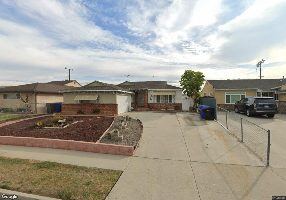
12426 Kayreid Dr Whittier, CA 90605
South Whittier NeighborhoodEstimated Value: $715,000 - $795,000
3
Beds
1
Bath
1,111
Sq Ft
$677/Sq Ft
Est. Value
About This Home
This home is located at 12426 Kayreid Dr, Whittier, CA 90605 and is currently estimated at $752,495, approximately $677 per square foot. 12426 Kayreid Dr is a home located in Los Angeles County with nearby schools including California High School, St. Paul Of The Cross Elementary School, and St. Gregory The Great.
Ownership History
Date
Name
Owned For
Owner Type
Purchase Details
Closed on
Aug 15, 2017
Sold by
Lovrien Patricia Ann
Bought by
Lovrien Patricia Ann
Current Estimated Value
Home Financials for this Owner
Home Financials are based on the most recent Mortgage that was taken out on this home.
Original Mortgage
$40,000
Interest Rate
3.96%
Mortgage Type
Commercial
Purchase Details
Closed on
Aug 19, 2002
Sold by
Lovrien Patricia Ann
Bought by
Lovrien Patricia Ann
Purchase Details
Closed on
Jan 5, 2002
Sold by
Stroik Richard J
Bought by
Lovrien Patricia
Home Financials for this Owner
Home Financials are based on the most recent Mortgage that was taken out on this home.
Original Mortgage
$100,000
Interest Rate
6.43%
Create a Home Valuation Report for This Property
The Home Valuation Report is an in-depth analysis detailing your home's value as well as a comparison with similar homes in the area
Home Values in the Area
Average Home Value in this Area
Purchase History
| Date | Buyer | Sale Price | Title Company |
|---|---|---|---|
| Lovrien Patricia Ann | -- | Ticor Title Company Of Ca | |
| Lovrien Patricia Ann | -- | Orange Coast Title | |
| Lovrien Patricia | -- | -- |
Source: Public Records
Mortgage History
| Date | Status | Borrower | Loan Amount |
|---|---|---|---|
| Closed | Lovrien Patricia Ann | $40,000 | |
| Closed | Lovrien Patricia | $100,000 |
Source: Public Records
Tax History Compared to Growth
Tax History
| Year | Tax Paid | Tax Assessment Tax Assessment Total Assessment is a certain percentage of the fair market value that is determined by local assessors to be the total taxable value of land and additions on the property. | Land | Improvement |
|---|---|---|---|---|
| 2025 | $1,456 | $76,518 | $37,669 | $38,849 |
| 2024 | $1,456 | $75,019 | $36,931 | $38,088 |
| 2023 | $1,422 | $73,549 | $36,207 | $37,342 |
| 2022 | $1,420 | $72,108 | $35,498 | $36,610 |
| 2021 | $1,390 | $70,695 | $34,802 | $35,893 |
| 2020 | $1,377 | $69,971 | $34,446 | $35,525 |
| 2019 | $1,366 | $68,600 | $33,771 | $34,829 |
| 2018 | $1,245 | $67,256 | $33,109 | $34,147 |
| 2016 | $1,175 | $64,646 | $31,824 | $32,822 |
| 2015 | $1,150 | $63,675 | $31,346 | $32,329 |
| 2014 | $1,146 | $62,428 | $30,732 | $31,696 |
Source: Public Records
Map
Nearby Homes
- 12309 Ramsey Dr
- 13703 Placid Dr
- 12818 Duffield Ave
- 13857 Leffingwell Rd
- 14000 Lake View Dr
- 14036 Lake View Dr Unit 143
- 13513 Leffingwell Rd
- 13854 Adoree St
- 13007 Duffield Ave
- 14020 Lake Crest Dr Unit 84
- 12726 Lake Forest Ave Unit 25
- 14034 Coteau Dr Unit 1103
- 14135 Chere Dr
- 13531 Utica St
- 13102 Sunnybrook Ln
- 13481 Meyer Rd
- 14216 Adoree St
- 13538 Lukay St
- 14243 Gagely Dr
- 11624 Starlight Ave
- 12432 Kayreid Dr
- 12420 Kayreid Dr
- 12436 Kayreid Dr
- 12414 Kayreid Dr
- 12429 Kayreid Dr
- 12410 Kayreid Dr
- 12442 Kayreid Dr
- 12435 Kayreid Dr
- 12417 Kayreid Dr
- 13741 Busby Dr
- 12402 Kayreid Dr
- 13740 Placid Dr
- 12409 Kayreid Dr
- 13743 Placid Dr
- 12409 Ramsey Dr
- 12415 Ramsey Dr
- 13748 Busby Dr
- 12358 Kayreid Dr
- 12403 Ramsey Dr
- 12419 Ramsey Dr