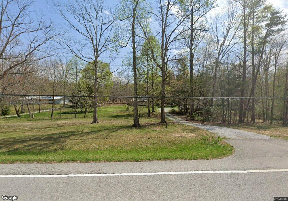
12429 Highway 127 S Unit 12395 Crossville, TN 38572
Estimated Value: $141,000 - $369,000
--
Bed
1
Bath
1,400
Sq Ft
$189/Sq Ft
Est. Value
About This Home
This home is located at 12429 Highway 127 S Unit 12395, Crossville, TN 38572 and is currently estimated at $264,375, approximately $188 per square foot. 12429 Highway 127 S Unit 12395 is a home located in Cumberland County with nearby schools including Frank P. Brown Elementary School and Cumberland County High School.
Ownership History
Date
Name
Owned For
Owner Type
Purchase Details
Closed on
Mar 25, 2022
Sold by
Brinson Janeil
Bought by
Fowler Greg Randall
Current Estimated Value
Purchase Details
Closed on
Jan 18, 1996
Sold by
Reeves Johnnie L
Bought by
Brinson Burl
Purchase Details
Closed on
Apr 19, 1995
Sold by
Obara Richard
Bought by
Reeves Johnnie L
Create a Home Valuation Report for This Property
The Home Valuation Report is an in-depth analysis detailing your home's value as well as a comparison with similar homes in the area
Home Values in the Area
Average Home Value in this Area
Purchase History
| Date | Buyer | Sale Price | Title Company |
|---|---|---|---|
| Fowler Greg Randall | -- | None Listed On Document | |
| Fowler Greg Randall | -- | None Listed On Document | |
| Brinson Burl | $46,000 | -- | |
| Reeves Johnnie L | $30,001 | -- |
Source: Public Records
Tax History Compared to Growth
Tax History
| Year | Tax Paid | Tax Assessment Tax Assessment Total Assessment is a certain percentage of the fair market value that is determined by local assessors to be the total taxable value of land and additions on the property. | Land | Improvement |
|---|---|---|---|---|
| 2024 | $505 | $44,450 | $8,300 | $36,150 |
| 2023 | $505 | $44,450 | $0 | $0 |
| 2022 | $505 | $44,450 | $8,300 | $36,150 |
| 2021 | $406 | $25,950 | $6,400 | $19,550 |
| 2020 | $406 | $25,950 | $6,400 | $19,550 |
| 2019 | $406 | $25,950 | $6,400 | $19,550 |
| 2018 | $570 | $36,425 | $7,250 | $29,175 |
| 2017 | $570 | $36,425 | $7,250 | $29,175 |
| 2016 | $645 | $42,200 | $7,250 | $34,950 |
| 2015 | $632 | $42,200 | $7,250 | $34,950 |
| 2014 | $632 | $42,185 | $0 | $0 |
Source: Public Records
Map
Nearby Homes
- Lot 16 Browns Gap Rd
- 82 Browns Gap Rd
- 221 Wind Song Trail
- 0 Browns Gap Rd Unit RTC2900043
- 0 Browns Gap Rd Unit 1303270
- 11981 Highway 127 S
- 12897 Highway 127 S
- 0 Old Highway 28 S Unit RTC2883659
- 8620 Vandever Rd
- 0 Fred Tollett Rd Unit 1297053
- 326 Breckenridge Dr
- 0 E Valley Rd Unit UPPR EAST 10557887
- 0 E Valley Rd Unit 1516089
- 103 Dublin Dr
- 00 Ashford Dr
- 821 Breckenridge Dr
- 188 Marion Agee Rd
- 22 Kelly Dr
- 123 Dunway Dr
- lot# 513 Connely Dr
- 17 Reed Rd
- Lot 4 Wind Song Dr
- 58 Reed Rd
- 144 Browns Gap Rd
- 12253 Highway 127 S
- 228 Browns Gap Rd
- 277 Buzzard Ln
- 12651 Highway 127 S
- 12189 Highway 127 S
- 190 Reed Rd
- 0 Windsong Unit 778314
- 12748 Highway 127 S
- 12105 Highway 127 S
- 277 Wind Song Trail
- 0 S 127 Hwy Unit 862808
- 501 Browns Gap Rd
- 12114 Highway 127 S
- 0 Browns Gap Rd Unit RTC2463889
- 0 Browns Gap Rd Unit 712034
- 0 Browns Gap Rd Unit 211360
