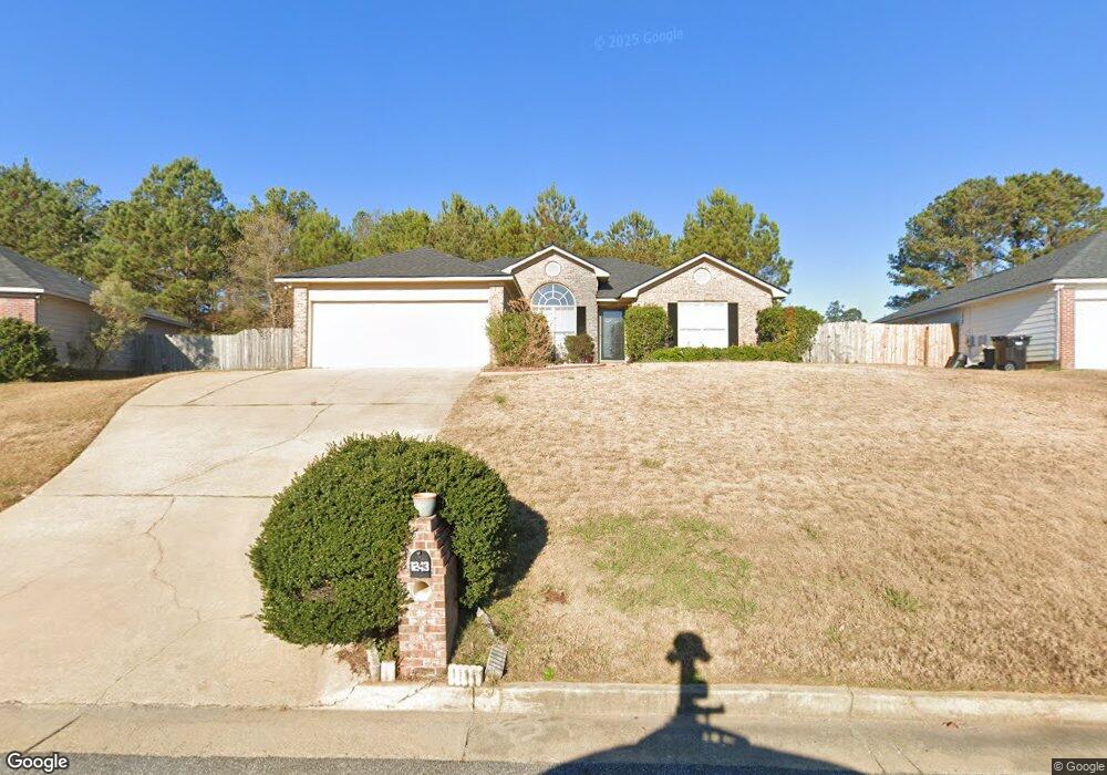
1243 Bunker Ridge Ln Columbus, GA 31907
Eastern Columbus NeighborhoodEstimated Value: $213,000 - $233,000
4
Beds
2
Baths
1,740
Sq Ft
$130/Sq Ft
Est. Value
About This Home
This home is located at 1243 Bunker Ridge Ln, Columbus, GA 31907 and is currently estimated at $225,707, approximately $129 per square foot. 1243 Bunker Ridge Ln is a home located in Muscogee County with nearby schools including Dawson Elementary School, East Columbus Magnet Academy, and Spencer High School.
Ownership History
Date
Name
Owned For
Owner Type
Purchase Details
Closed on
May 27, 2010
Sold by
Secretary Of Veterans Affairs
Bought by
Crawford Oren Lympat
Current Estimated Value
Home Financials for this Owner
Home Financials are based on the most recent Mortgage that was taken out on this home.
Original Mortgage
$112,475
Interest Rate
4.77%
Mortgage Type
FHA
Purchase Details
Closed on
Jan 5, 2010
Sold by
Gmac Mortgage Llc
Bought by
Secretary Of Veterans Affairs
Create a Home Valuation Report for This Property
The Home Valuation Report is an in-depth analysis detailing your home's value as well as a comparison with similar homes in the area
Home Values in the Area
Average Home Value in this Area
Purchase History
| Date | Buyer | Sale Price | Title Company |
|---|---|---|---|
| Crawford Oren Lympat | $116,945 | None Available | |
| Secretary Of Veterans Affairs | -- | None Available | |
| Gmac Mortgage Llc | $116,331 | None Available |
Source: Public Records
Mortgage History
| Date | Status | Borrower | Loan Amount |
|---|---|---|---|
| Previous Owner | Crawford Oren Lympat | $112,475 |
Source: Public Records
Tax History Compared to Growth
Tax History
| Year | Tax Paid | Tax Assessment Tax Assessment Total Assessment is a certain percentage of the fair market value that is determined by local assessors to be the total taxable value of land and additions on the property. | Land | Improvement |
|---|---|---|---|---|
| 2025 | $1,315 | $76,924 | $13,992 | $62,932 |
| 2024 | $1,314 | $76,924 | $13,992 | $62,932 |
| 2023 | $628 | $76,924 | $13,992 | $62,932 |
| 2022 | $1,370 | $55,540 | $13,992 | $41,548 |
| 2021 | $1,363 | $57,236 | $13,992 | $43,244 |
| 2020 | $1,364 | $57,236 | $13,992 | $43,244 |
| 2019 | $1,370 | $57,236 | $13,992 | $43,244 |
| 2018 | $1,370 | $57,236 | $13,992 | $43,244 |
| 2017 | $1,376 | $57,236 | $13,992 | $43,244 |
| 2016 | $1,382 | $52,200 | $8,800 | $43,400 |
| 2015 | $1,385 | $52,200 | $8,800 | $43,400 |
| 2014 | $1,387 | $52,200 | $8,800 | $43,400 |
| 2013 | -- | $65,618 | $8,800 | $56,818 |
Source: Public Records
Map
Nearby Homes
- 1238 Brandywine Dr
- 5310 Stoney Point Rd
- 5109 Lexington Ln
- 5090 Lexington Ln
- 1210 Bunker Hill Rd
- 5116 Magazine Ln
- 1340 Bunker Ridge Ln
- 5219 Argonne Dr
- 5336 Gettysburg Way
- 1513 Alamo Dr
- 5613 Quebec Dr
- 4462 Walking Stick Way
- 5644 Quebec Dr
- 5664 St Marys Rd
- 849 Bunker Hill Rd
- 1225 Rowell St
- 1025 Belmar St
- 4939 Aaron Dr
- 4408 Walking Stick Way
- 5728 Lexington Dr
- 1241 Bunker Ridge Ln
- 1245 Bunker Ridge Ln
- 1247 Bunker Ridge Ln
- 1499 Bunker Hill Rd
- 1244 Bunker Ridge Ln
- 1242 Bunker Ridge Ln
- 1489 Bunker Hill Rd
- 1246 Bunker Ridge Ln
- 1483 Bunker Hill Rd
- 1573 Bunker Hill Rd
- 1249 Bunker Ridge Ln
- 1248 Bunker Ridge Ln
- 1477 Bunker Hill Rd
- 1577 Bunker Hill Rd
- 2003 Bunker Way Dr
- 2007 Bunker Way Dr
- 1251 Bunker Ridge Ln
- 1272 Freedom Ridge Dr
- 1278 Freedom Ridge Dr
- 1252 Bunker Ridge Ln