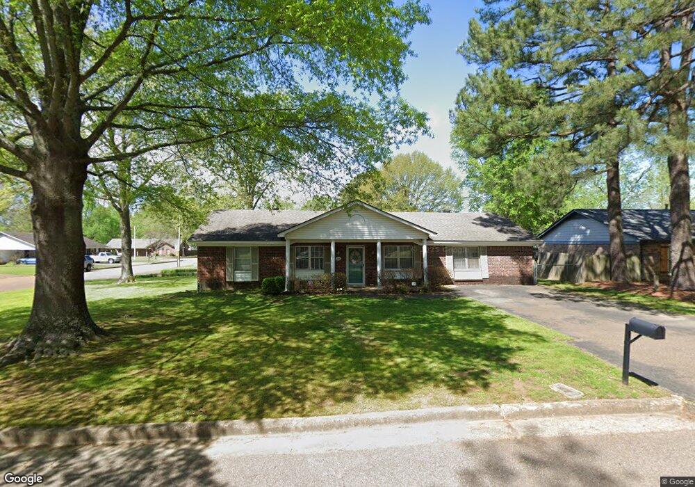
1243 Simmonsridge Dr Collierville, TN 38017
Estimated Value: $321,000 - $348,000
4
Beds
2
Baths
1,826
Sq Ft
$185/Sq Ft
Est. Value
About This Home
This home is located at 1243 Simmonsridge Dr, Collierville, TN 38017 and is currently estimated at $337,141, approximately $184 per square foot. 1243 Simmonsridge Dr is a home located in Shelby County with nearby schools including Collierville Elementary School, West Collierville Middle School, and Collierville High School.
Ownership History
Date
Name
Owned For
Owner Type
Purchase Details
Closed on
Apr 1, 2010
Sold by
Butler Michael Brent
Bought by
Butler Valarie L
Current Estimated Value
Purchase Details
Closed on
Sep 30, 1997
Sold by
Boone Julia Lanita Schoep
Bought by
Butler Michael B and Butler Valarie L
Home Financials for this Owner
Home Financials are based on the most recent Mortgage that was taken out on this home.
Original Mortgage
$104,013
Outstanding Balance
$16,725
Interest Rate
7.46%
Mortgage Type
FHA
Estimated Equity
$320,416
Create a Home Valuation Report for This Property
The Home Valuation Report is an in-depth analysis detailing your home's value as well as a comparison with similar homes in the area
Home Values in the Area
Average Home Value in this Area
Purchase History
| Date | Buyer | Sale Price | Title Company |
|---|---|---|---|
| Butler Valarie L | -- | None Available | |
| Butler Michael B | $103,900 | -- |
Source: Public Records
Mortgage History
| Date | Status | Borrower | Loan Amount |
|---|---|---|---|
| Open | Butler Michael B | $104,013 |
Source: Public Records
Tax History Compared to Growth
Tax History
| Year | Tax Paid | Tax Assessment Tax Assessment Total Assessment is a certain percentage of the fair market value that is determined by local assessors to be the total taxable value of land and additions on the property. | Land | Improvement |
|---|---|---|---|---|
| 2025 | $2,337 | $87,700 | $15,375 | $72,325 |
| 2024 | $2,337 | $68,925 | $7,700 | $61,225 |
| 2023 | $3,605 | $68,925 | $7,700 | $61,225 |
| 2022 | $3,522 | $68,925 | $7,700 | $61,225 |
| 2021 | $3,563 | $68,925 | $7,700 | $61,225 |
| 2020 | $2,966 | $50,450 | $7,700 | $42,750 |
| 2019 | $2,043 | $50,450 | $7,700 | $42,750 |
| 2018 | $2,043 | $50,450 | $7,700 | $42,750 |
| 2017 | $2,074 | $50,450 | $7,700 | $42,750 |
| 2016 | $1,764 | $40,375 | $0 | $0 |
| 2014 | $1,764 | $40,375 | $0 | $0 |
Source: Public Records
Map
Nearby Homes
- 379 Shelton Rd
- 292 Joel Cove
- 381 Bouldincrest Ave
- 368 Tararidge Cove
- 378 Easonwood Ave
- 1339 Riding Brook Dr
- 1335 Riding Brook Dr
- 237 Vista Ridge Dr
- 164 Danbrooke Dr
- 1445 Wolf Pack Dr
- 1082 Sugar Ln
- 1447 Howling Dr
- 1149 Abbeville St
- 1441 Milestone Dr
- 1482 Howling Dr
- 1479 Wolf Ridge Dr
- 121 Cottonwood Dr
- 1023 Greencliff Rd
- 978 Sugar Ln
- 626 Brookmere Dr
- 1251 Simmonsridge Dr
- 344 Laura Ann Dr
- 335 Laura Ann Dr
- 1244 Simmonsridge Dr
- 352 Laura Ann Dr
- 1236 Simmonsridge Dr
- 345 Laura Ann Dr
- 1263 Simmonsridge Dr
- 333 Shelton Rd
- 1252 Simmonsridge Dr
- 1228 Simmonsridge Dr
- 1219 Simmonsridge Dr
- 339 Shelton Rd
- 1264 Simmonsridge Dr
- 360 Laura Ann Dr
- 1218 Tararidge Dr
- 287 Hughes Cove
- 1218 Simmonsridge Dr
- 349 Shelton Rd
- 288 Hughes Cove