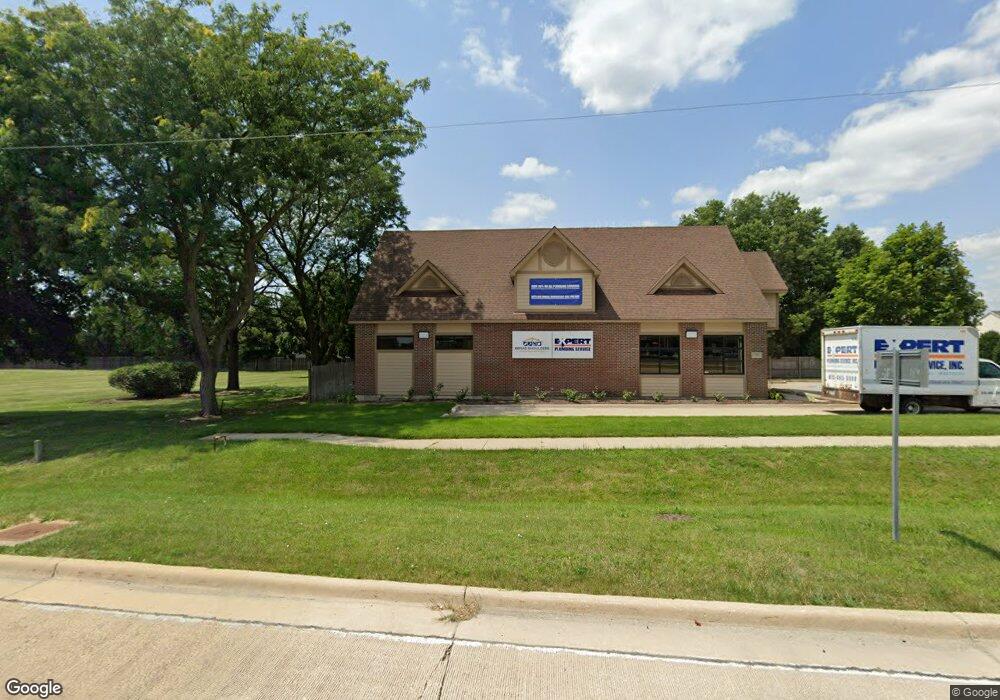
12438 S Route 59 Plainfield, IL 60585
North Plainfield NeighborhoodEstimated Value: $752,251
--
Bed
--
Bath
1,980
Sq Ft
$380/Sq Ft
Est. Value
About This Home
This home is located at 12438 S Route 59, Plainfield, IL 60585 and is currently estimated at $752,251, approximately $379 per square foot. 12438 S Route 59 is a home located in Will County with nearby schools including Eagle Pointe Elementary School, Heritage Grove Middle School, and Plainfield North High School.
Ownership History
Date
Name
Owned For
Owner Type
Purchase Details
Closed on
Aug 27, 2025
Sold by
Jackal Group Llc
Bought by
Gold Star Investment Llc
Current Estimated Value
Home Financials for this Owner
Home Financials are based on the most recent Mortgage that was taken out on this home.
Original Mortgage
$600,000
Outstanding Balance
$600,000
Interest Rate
6.72%
Mortgage Type
Credit Line Revolving
Estimated Equity
$242,904
Purchase Details
Closed on
Apr 11, 2023
Sold by
Witte Jeffrey G
Bought by
Jackal Group Llc
Home Financials for this Owner
Home Financials are based on the most recent Mortgage that was taken out on this home.
Original Mortgage
$550,000
Interest Rate
6%
Mortgage Type
Seller Take Back
Create a Home Valuation Report for This Property
The Home Valuation Report is an in-depth analysis detailing your home's value as well as a comparison with similar homes in the area
Home Values in the Area
Average Home Value in this Area
Purchase History
| Date | Buyer | Sale Price | Title Company |
|---|---|---|---|
| Gold Star Investment Llc | $750,000 | First American Title | |
| Jackal Group Llc | $690,000 | Fidelity National Title |
Source: Public Records
Mortgage History
| Date | Status | Borrower | Loan Amount |
|---|---|---|---|
| Open | Gold Star Investment Llc | $600,000 | |
| Previous Owner | Jackal Group Llc | $550,000 |
Source: Public Records
Tax History Compared to Growth
Tax History
| Year | Tax Paid | Tax Assessment Tax Assessment Total Assessment is a certain percentage of the fair market value that is determined by local assessors to be the total taxable value of land and additions on the property. | Land | Improvement |
|---|---|---|---|---|
| 2024 | $8,475 | $116,448 | $59,873 | $56,575 |
| 2023 | $8,475 | $116,448 | $59,873 | $56,575 |
| 2022 | $8,484 | $105,862 | $54,430 | $51,432 |
| 2021 | $8,601 | $105,862 | $54,430 | $51,432 |
| 2020 | $8,740 | $105,862 | $54,430 | $51,432 |
| 2019 | $8,871 | $105,862 | $54,430 | $51,432 |
| 2018 | $9,053 | $105,862 | $54,430 | $51,432 |
| 2017 | $9,259 | $105,862 | $54,430 | $51,432 |
| 2016 | $9,497 | $105,862 | $54,430 | $51,432 |
| 2015 | $9,857 | $105,862 | $54,430 | $51,432 |
| 2014 | $9,857 | $105,862 | $54,430 | $51,432 |
| 2013 | $9,857 | $105,862 | $54,430 | $51,432 |
Source: Public Records
Map
Nearby Homes
- 24181 Pear Tree Cir Unit 171206
- 24115 Pear Tree Cir Unit 170807
- 23540 W Bancroft Dr
- 24436 W Alexis Ln
- 24434 W Alexis Ln Unit 56400
- 24328 Whispering Trails Dr
- 24424 W Alexis Ln Unit 55405
- 24422 W Alexis Ln Unit 55406
- 24420 W Alexis Ln Unit 55407
- 24418 W Alexis Ln Unit 67416
- 23721 Greenfield Dr
- 24412 W Alexis Ln Unit 54429
- 24505 W Kroll Dr Unit 67416
- 12906 S Slate Ln
- 12929 S Platte Trail
- 23236 W Teton Ln
- 13028 Bradford Ln Unit 1
- 2711 Lawlor Ln
- 2739 Lawlor Ln
- 24333 Leski Ln
- 12435 Falcon Dr
- 12441 Falcon Dr
- 12445 Falcon Dr
- 12425 Falcon Dr
- 12421 Falcon Dr
- 12451 Falcon Dr
- 12415 Falcon Dr
- 12405 Falcon Dr
- 12453 Falcon Dr
- 12436 Falcon Dr
- 12440 Falcon Dr
- 12430 Falcon Dr
- 12443 S Route 59
- 12420 Falcon Dr
- 12401 Falcon Dr
- 12459 Falcon Dr
- 12416 Falcon Dr
- 12461 Falcon Dr
- 12410 Falcon Dr
- 12361 Falcon Dr