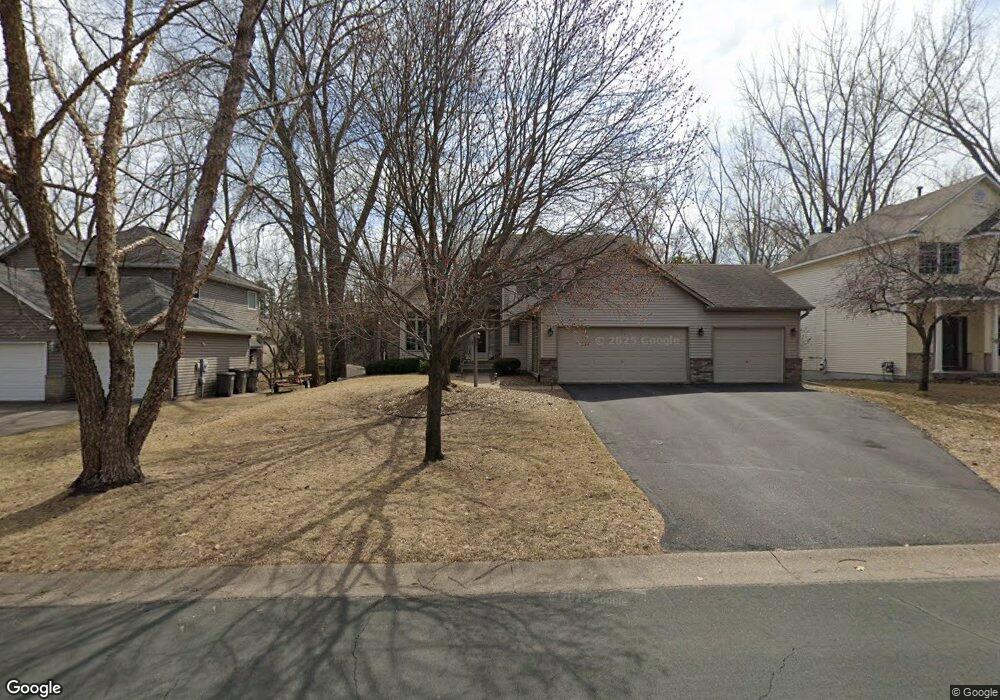
12439 Sandy Point Rd Eden Prairie, MN 55347
Estimated Value: $574,000 - $696,000
4
Beds
5
Baths
2,069
Sq Ft
$304/Sq Ft
Est. Value
About This Home
This home is located at 12439 Sandy Point Rd, Eden Prairie, MN 55347 and is currently estimated at $628,296, approximately $303 per square foot. 12439 Sandy Point Rd is a home located in Hennepin County with nearby schools including Eden Lake Elementary School, Central Middle School, and Eden Prairie High School.
Ownership History
Date
Name
Owned For
Owner Type
Purchase Details
Closed on
Jul 29, 2004
Sold by
Calice William and Calice Shannon
Bought by
Kaare Steven J and Kaare Sharon R
Current Estimated Value
Purchase Details
Closed on
Jul 18, 1999
Sold by
Tice Thomas M and Tice Kenny K
Bought by
Calice William and Calice Shannon
Purchase Details
Closed on
Apr 24, 1998
Sold by
First Residential Homes Inc
Bought by
Tice Thomas M and Tice Kerry K
Purchase Details
Closed on
Nov 7, 1997
Sold by
Laukka Jarvis Inc
Bought by
First Residential Homes Inc
Create a Home Valuation Report for This Property
The Home Valuation Report is an in-depth analysis detailing your home's value as well as a comparison with similar homes in the area
Home Values in the Area
Average Home Value in this Area
Purchase History
| Date | Buyer | Sale Price | Title Company |
|---|---|---|---|
| Kaare Steven J | $425,000 | -- | |
| Calice William | $269,900 | -- | |
| Tice Thomas M | $237,000 | -- | |
| First Residential Homes Inc | $59,000 | -- |
Source: Public Records
Tax History Compared to Growth
Tax History
| Year | Tax Paid | Tax Assessment Tax Assessment Total Assessment is a certain percentage of the fair market value that is determined by local assessors to be the total taxable value of land and additions on the property. | Land | Improvement |
|---|---|---|---|---|
| 2024 | $6,869 | $562,000 | $155,000 | $407,000 |
| 2023 | $6,263 | $545,200 | $153,900 | $391,300 |
| 2022 | $5,492 | $535,900 | $151,300 | $384,600 |
| 2021 | $5,295 | $446,200 | $126,100 | $320,100 |
| 2020 | $5,587 | $433,300 | $122,500 | $310,800 |
| 2019 | $5,492 | $442,100 | $125,000 | $317,100 |
| 2018 | $5,334 | $429,000 | $121,200 | $307,800 |
| 2017 | $5,259 | $400,700 | $113,300 | $287,400 |
| 2016 | $5,142 | $389,100 | $110,000 | $279,100 |
| 2015 | $5,355 | $389,100 | $110,000 | $279,100 |
| 2014 | -- | $351,300 | $109,300 | $242,000 |
Source: Public Records
Map
Nearby Homes
- 10237 Kiersten Place
- 10179 Englewood Dr
- 10035 Gristmill Ridge
- xxxx Riverview Rd
- 11068 Bell Oaks Estate Rd
- 11362 Hawk High Ct
- 11184 Johnson Ridge
- 12724 Surrey St
- 11332 Creekridge Dr
- 9549 Yorkshire Ln
- 10509 Purdey Rd
- 10675 Cavallo Ridge
- 11761 Welters Way
- 10529 Lee Dr
- 10520 Grant Dr
- 9535 Olympia Dr
- 10281 Arrowwood Dr
- 10246 Lee Dr
- 10382 Juniper Ln
- 10326 Balsam Ln
- 12447 Sandy Point Rd
- 12431 Sandy Point Rd
- 12455 Sandy Point Rd
- 12423 Sandy Point Rd
- 12412 Riverview Rd
- 12384 Riverview Rd
- 12438 Sandy Point Rd
- 12473 Sandy Point Rd
- 10300 Winter Place
- 12356 Riverview Rd
- 12440 Riverview Rd
- 12405 Sandy Point Rd
- 12420 Sandy Point Rd
- 10295 Winter Place
- 10340 Mooer Ln
- 12474 Sandy Point Rd
- 10294 Winter Place
- 10298 Mooer Ln
- 12328 Riverview Rd
- 12468 Riverview Rd