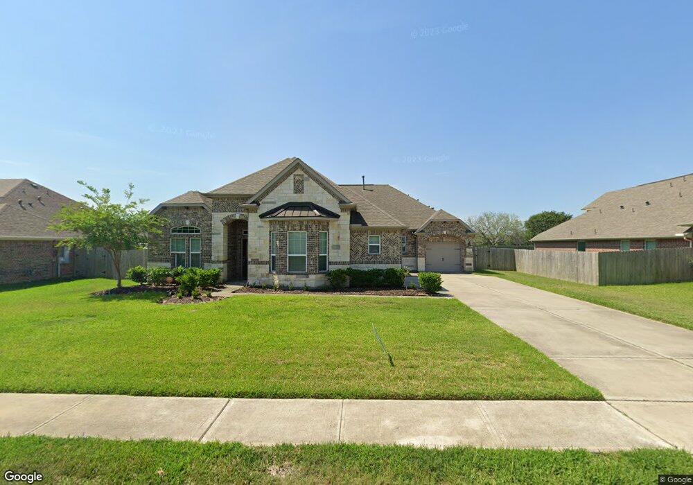
1244 Laurel Loop Angleton, TX 77515
Estimated Value: $390,731 - $502,000
Studio
--
Bath
2,598
Sq Ft
$169/Sq Ft
Est. Value
About This Home
This home is located at 1244 Laurel Loop, Angleton, TX 77515 and is currently estimated at $438,183, approximately $168 per square foot. 1244 Laurel Loop is a home with nearby schools including Westside Elementary School, Angleton Junior High School, and Angleton High School.
Ownership History
Date
Name
Owned For
Owner Type
Purchase Details
Closed on
Nov 16, 2021
Sold by
Davis Monique Evette
Bought by
Davis Eric Ray
Current Estimated Value
Home Financials for this Owner
Home Financials are based on the most recent Mortgage that was taken out on this home.
Original Mortgage
$276,000
Outstanding Balance
$250,998
Interest Rate
3.05%
Mortgage Type
Future Advance Clause Open End Mortgage
Estimated Equity
$187,185
Purchase Details
Closed on
Jun 22, 2016
Sold by
Anglja Homes
Bought by
Davis Monique E and Davis Eric R
Home Financials for this Owner
Home Financials are based on the most recent Mortgage that was taken out on this home.
Original Mortgage
$285,176
Interest Rate
3.57%
Mortgage Type
New Conventional
Create a Home Valuation Report for This Property
The Home Valuation Report is an in-depth analysis detailing your home's value as well as a comparison with similar homes in the area
Home Values in the Area
Average Home Value in this Area
Purchase History
| Date | Buyer | Sale Price | Title Company |
|---|---|---|---|
| Davis Eric Ray | -- | None Available | |
| Davis Monique E | -- | Red Oak Title Llc | |
| Davis Monique E | -- | Red Oak Title Llc |
Source: Public Records
Mortgage History
| Date | Status | Borrower | Loan Amount |
|---|---|---|---|
| Open | Davis Eric Ray | $276,000 | |
| Closed | Davis Monique E | $285,176 | |
| Closed | Davis Monique E | $286,480 |
Source: Public Records
Tax History
| Year | Tax Paid | Tax Assessment Tax Assessment Total Assessment is a certain percentage of the fair market value that is determined by local assessors to be the total taxable value of land and additions on the property. | Land | Improvement |
|---|---|---|---|---|
| 2025 | $5,885 | $401,140 | $85,390 | $315,750 |
| 2023 | $5,885 | $337,700 | $85,390 | $303,150 |
| 2022 | $7,538 | $307,000 | $51,980 | $255,020 |
| 2021 | $8,296 | $302,280 | $47,250 | $255,030 |
| 2020 | $8,725 | $299,740 | $47,250 | $252,490 |
| 2019 | $9,100 | $302,310 | $47,250 | $255,060 |
| 2018 | $9,181 | $299,680 | $47,250 | $252,430 |
| 2017 | $9,816 | $305,000 | $47,250 | $257,750 |
| 2016 | $1,141 | $35,440 | $35,440 | $0 |
| 2014 | $149 | $5,700 | $5,700 | $0 |
Source: Public Records
Map
Nearby Homes
- 0 Creekside Unit 13213123
- 00 Brahman Trail
- 000 Brahman Trail
- 00 Cahill
- 0 Hennessee Ln Unit 94643980
- 607 Longhorn Trail
- 000 Fm 521
- 00 Fm 523 Loop N
- 0 County Road 807 Unit 69526704
- 0 Creekside Unit 96763941
- TBD Sandy Trail
- 555 County Road 31
- 0 Marshall Ave Unit 36963003
- 1012 Enchanted Oaks Dr
- 1105 Oak Park Dr
- 900 Enchanted Oaks Dr
- 0 Anchor Rd Unit 22484698
- 1187 Thomas Dr
- 1140 Thomas Dr
- 619 Longhorn Trail
- 1248 Laurel Loop
- 1240 Laurel Loop
- 1252 Laurel Loop
- 1236 Laurel Loop
- 1252 Laurel Loop
- 1249 Laurel Loop
- 1245 Laurel Loop
- 1256 Laurel Loop
- 1256 Laurel Loop
- 1232 Laurel Loop
- 1108 Shady Oak Dr
- 1112 Shady Oak Dr
- 1275 Laurel Ln
- 1241 Laurel Loop
- 1104 Shady Oak Dr
- 1237 Laurel Loop
- 1260 Laurel Loop
- 1100 Shady Oak Dr
- 1260 Laurel Loop
- 1228 Laurel Loop
Your Personal Tour Guide
Ask me questions while you tour the home.