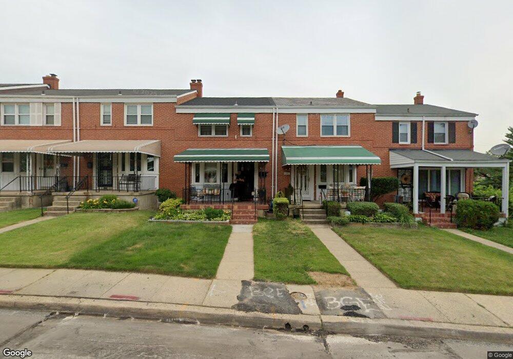
1244 Sheridan Ave Baltimore, MD 21239
New Northwood NeighborhoodEstimated Value: $174,956 - $203,000
--
Bed
1
Bath
1,216
Sq Ft
$155/Sq Ft
Est. Value
About This Home
This home is located at 1244 Sheridan Ave, Baltimore, MD 21239 and is currently estimated at $188,978, approximately $155 per square foot. 1244 Sheridan Ave is a home located in Baltimore City with nearby schools including Northwood Elementary School, Booker T. Washington Middle School, and Paul Laurence Dunbar High School.
Ownership History
Date
Name
Owned For
Owner Type
Purchase Details
Closed on
May 6, 2003
Sold by
Brown Dwayne L
Bought by
Brown Dwayne L and Brown Kimberly L
Current Estimated Value
Purchase Details
Closed on
Oct 5, 1994
Sold by
Davis Earnest
Bought by
Brown Dwayne L
Home Financials for this Owner
Home Financials are based on the most recent Mortgage that was taken out on this home.
Original Mortgage
$70,450
Interest Rate
8.55%
Create a Home Valuation Report for This Property
The Home Valuation Report is an in-depth analysis detailing your home's value as well as a comparison with similar homes in the area
Home Values in the Area
Average Home Value in this Area
Purchase History
| Date | Buyer | Sale Price | Title Company |
|---|---|---|---|
| Brown Dwayne L | $34,250 | -- | |
| Brown Dwayne L | $70,500 | -- |
Source: Public Records
Mortgage History
| Date | Status | Borrower | Loan Amount |
|---|---|---|---|
| Previous Owner | Brown Dwayne L | $70,450 | |
| Closed | Brown Dwayne L | $5,000 |
Source: Public Records
Tax History Compared to Growth
Tax History
| Year | Tax Paid | Tax Assessment Tax Assessment Total Assessment is a certain percentage of the fair market value that is determined by local assessors to be the total taxable value of land and additions on the property. | Land | Improvement |
|---|---|---|---|---|
| 2025 | $3,056 | $139,433 | -- | -- |
| 2024 | $3,056 | $130,100 | $36,000 | $94,100 |
| 2023 | $2,987 | $127,167 | $0 | $0 |
| 2022 | $2,932 | $124,233 | $0 | $0 |
| 2021 | $2,863 | $121,300 | $36,000 | $85,300 |
| 2020 | $2,613 | $120,933 | $0 | $0 |
| 2019 | $2,591 | $120,567 | $0 | $0 |
| 2018 | $2,626 | $120,200 | $36,000 | $84,200 |
| 2017 | $2,653 | $120,200 | $0 | $0 |
| 2016 | $2,290 | $120,200 | $0 | $0 |
| 2015 | $2,290 | $122,100 | $0 | $0 |
| 2014 | $2,290 | $122,100 | $0 | $0 |
Source: Public Records
Map
Nearby Homes
- 1231 Sheridan Ave
- 1205 Sheridan Ave
- 1324 Winston Ave
- 1062 Cameron Rd
- 1002 Beaumont Ave
- 1229 Winston Ave
- 1402 Woodbourne Ave
- 1346 Pentwood Rd
- 1014 Upnor Rd
- 1317 Pentwood Rd
- 5108 Saint Georges Ave
- 5106 Saint Georges Ave
- 4626 Marble Hall Rd
- 5107 Midwood Ave
- 5626 Midwood Ave
- 4603 Marble Hall Rd
- 4801 The Alameda
- 1322 E Cold Spring Ln
- 1027 Evesham Ave
- 1613 Winford Rd
- 1242 Sheridan Ave
- 1240 Sheridan Ave
- 1238 Sheridan Ave
- 1246 Sheridan Ave
- 1236 Sheridan Ave
- 1234 Sheridan Ave
- 1248 Sheridan Ave
- 1232 Sheridan Ave
- 1237 Woodbourne Ave
- 1235 Woodbourne Ave
- 1233 Woodbourne Ave
- 1230 Sheridan Ave
- 1231 Woodbourne Ave
- 1239 Woodbourne Ave
- 1229 Woodbourne Ave
- 1245 Sheridan Ave
- 1241 Woodbourne Ave
- 1243 Sheridan Ave
- 1228 Sheridan Ave
- 1241 Sheridan Ave