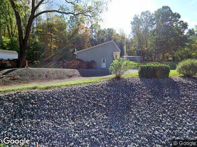
12446 Route 75 S Honey Grove, PA 17035
Estimated Value: $75,059 - $306,000
3
Beds
1
Bath
1,232
Sq Ft
$143/Sq Ft
Est. Value
About This Home
This home is located at 12446 Route 75 S, Honey Grove, PA 17035 and is currently estimated at $176,765, approximately $143 per square foot. 12446 Route 75 S is a home located in Juniata County with nearby schools including Juniata Elementary School, Tuscarora Middle School, and Juniata Senior High School.
Ownership History
Date
Name
Owned For
Owner Type
Purchase Details
Closed on
Apr 21, 2007
Sold by
Johnson Steve A
Bought by
Johnson Steve A
Current Estimated Value
Home Financials for this Owner
Home Financials are based on the most recent Mortgage that was taken out on this home.
Original Mortgage
$91,120
Interest Rate
6.17%
Mortgage Type
Unknown
Create a Home Valuation Report for This Property
The Home Valuation Report is an in-depth analysis detailing your home's value as well as a comparison with similar homes in the area
Home Values in the Area
Average Home Value in this Area
Purchase History
| Date | Buyer | Sale Price | Title Company |
|---|---|---|---|
| Johnson Steve A | -- | None Available |
Source: Public Records
Mortgage History
| Date | Status | Borrower | Loan Amount |
|---|---|---|---|
| Closed | Johnson Steve A | $20,000 | |
| Closed | Johnson Steve A | $83,053 | |
| Closed | Johnson Steve A | $100,000 | |
| Closed | Johnson Steve A | $10,000 | |
| Closed | Johnson Steve A | $92,500 | |
| Closed | Johnson Steve A | $91,120 |
Source: Public Records
Tax History Compared to Growth
Tax History
| Year | Tax Paid | Tax Assessment Tax Assessment Total Assessment is a certain percentage of the fair market value that is determined by local assessors to be the total taxable value of land and additions on the property. | Land | Improvement |
|---|---|---|---|---|
| 2025 | $1,400 | $12,820 | $2,370 | $10,450 |
| 2024 | $1,274 | $12,820 | $2,370 | $10,450 |
| 2023 | $1,229 | $12,820 | $2,370 | $10,450 |
| 2022 | $1,208 | $12,820 | $2,370 | $10,450 |
| 2021 | $1,179 | $12,820 | $2,370 | $10,450 |
| 2020 | $1,123 | $12,820 | $2,370 | $10,450 |
| 2019 | $1,121 | $12,820 | $2,370 | $10,450 |
| 2018 | $1,024 | $11,800 | $2,370 | $9,430 |
| 2017 | -- | $11,800 | $2,370 | $9,430 |
| 2016 | $980 | $11,800 | $2,370 | $9,430 |
| 2015 | -- | $11,800 | $2,370 | $9,430 |
| 2014 | -- | $11,800 | $2,370 | $9,430 |
Source: Public Records
Map
Nearby Homes
- 00 Rt 850 W Unit 2 PARCEL
- 00 Rt 850 W Unit 1 PARCEL
- 00 Rt 850 W
- 1420 Gloss Rd
- 729 Gloss Rd
- 10257 Fort Robinson Rd
- 9626 Route 75 S
- 1245 Thompson Hollow Ln
- 11 Blain Rd
- 250 Hostetter Ln Unit DRONEBER
- 56 Church Rd
- 6066 Shermans Valley Rd
- 190 Wolfgang Ln
- 1697 Campbell Hollow Rd
- 133 Black Bear Ln
- 2478 S Route 35
- 911 Robinson Rd
- 7810 Horse Valley Rd
- 674 Pine Glenn Rd
- 2279 State Route 103 N
- 12446 Route 75 S
- 12296 Route 75 S
- 12491 Route 75 S
- 12588 Route 75 S
- 0 Route 75 S
- 12656 Route 75 S
- 12156 Route 75 S
- 12685 Route 75 S
- 12791 Route 75 S
- 265 Sanderson Dr
- 2080 Burnt Church Rd
- 12802 Route 75 S
- 12811 Route 75 S
- 11948 Route 75 S
- 12895 Route 75 S
- 2426 Burnt Church Rd
- 192 Gilbow Hill Rd
- 12936 Route 75 S
- 154 Gilbow Hill Rd
- 12972 Route 75 S