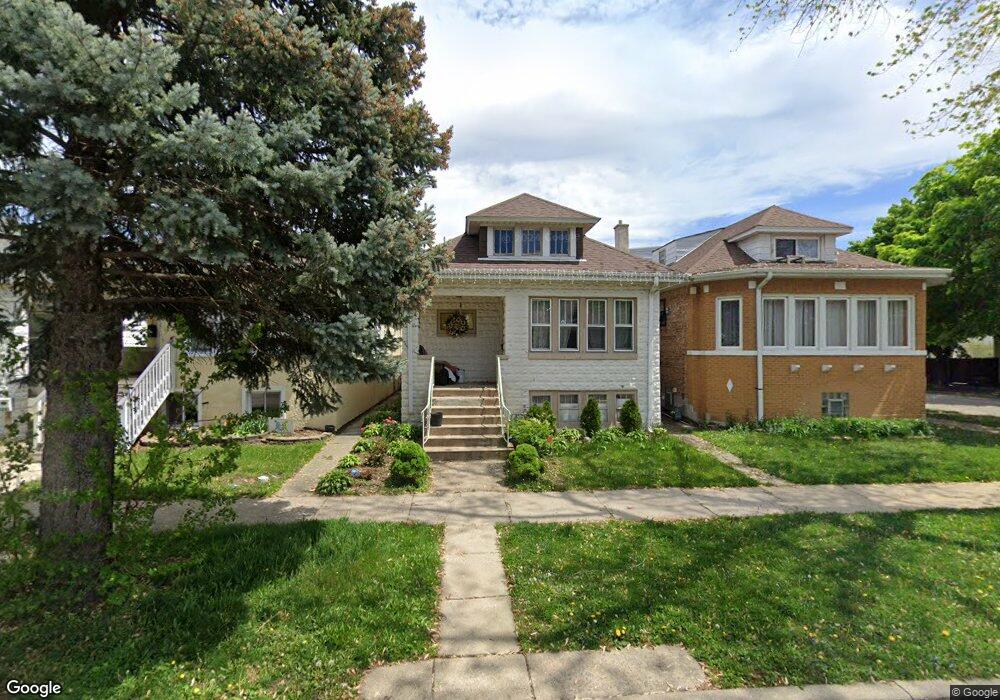
1245 Euclid Ave Berwyn, IL 60402
Estimated Value: $295,000 - $327,000
3
Beds
2
Baths
1,279
Sq Ft
$245/Sq Ft
Est. Value
About This Home
This home is located at 1245 Euclid Ave, Berwyn, IL 60402 and is currently estimated at $313,948, approximately $245 per square foot. 1245 Euclid Ave is a home located in Cook County with nearby schools including Prairie Oak School, Lincoln Middle School, and J. Sterling Morton High School West.
Ownership History
Date
Name
Owned For
Owner Type
Purchase Details
Closed on
Aug 9, 2007
Sold by
Zangrilli Thomas A and Zangrilli Johanna L
Bought by
Trigueros Juan Carlos and Barrera Faviola
Current Estimated Value
Home Financials for this Owner
Home Financials are based on the most recent Mortgage that was taken out on this home.
Original Mortgage
$218,500
Outstanding Balance
$138,555
Interest Rate
6.69%
Mortgage Type
New Conventional
Estimated Equity
$175,393
Create a Home Valuation Report for This Property
The Home Valuation Report is an in-depth analysis detailing your home's value as well as a comparison with similar homes in the area
Home Values in the Area
Average Home Value in this Area
Purchase History
| Date | Buyer | Sale Price | Title Company |
|---|---|---|---|
| Trigueros Juan Carlos | $230,000 | Multiple |
Source: Public Records
Mortgage History
| Date | Status | Borrower | Loan Amount |
|---|---|---|---|
| Open | Trigueros Juan Carlos | $218,500 |
Source: Public Records
Tax History Compared to Growth
Tax History
| Year | Tax Paid | Tax Assessment Tax Assessment Total Assessment is a certain percentage of the fair market value that is determined by local assessors to be the total taxable value of land and additions on the property. | Land | Improvement |
|---|---|---|---|---|
| 2024 | $6,818 | $25,001 | $4,019 | $20,982 |
| 2023 | $5,947 | $25,001 | $4,019 | $20,982 |
| 2022 | $5,947 | $18,261 | $3,483 | $14,778 |
| 2021 | $5,698 | $18,259 | $3,482 | $14,777 |
| 2020 | $5,634 | $18,259 | $3,482 | $14,777 |
| 2019 | $5,409 | $16,544 | $3,125 | $13,419 |
| 2018 | $5,194 | $16,544 | $3,125 | $13,419 |
| 2017 | $5,056 | $16,544 | $3,125 | $13,419 |
| 2016 | $4,426 | $12,961 | $2,589 | $10,372 |
| 2015 | $4,291 | $12,961 | $2,589 | $10,372 |
| 2014 | $4,193 | $12,961 | $2,589 | $10,372 |
| 2013 | $4,189 | $14,309 | $2,589 | $11,720 |
Source: Public Records
Map
Nearby Homes
- 1335 Wesley Ave
- 1156 Wesley Ave
- 1321 East Ave
- 1341 Kenilworth Ave
- 1183 S Scoville Ave
- 1135 S Oak Park Ave
- 1333 Clinton Ave
- 1442 Oak Park Ave
- 1324 Clinton Ave
- 1342 Clinton Ave
- 1143 Clinton Ave
- 1223 S Elmwood Ave Unit TWO
- 1243 Elmwood Ave
- 7011 Roosevelt Rd
- 1125 Gunderson Ave
- 1510 Scoville Ave
- 1435 Gunderson Ave
- 1216 Wenonah Ave
- 1101 S Oak Park Ave
- 1432 Home Ave
- 1243 Euclid Ave
- 1241 Euclid Ave
- 1237 Euclid Ave
- 1233 Euclid Ave
- 1240 Wesley Ave
- 1238 Wesley Ave
- 1231 Euclid Ave
- 1301 Euclid Ave
- 1246 Wesley Ave
- 1244 Wesley Ave
- 1303 Euclid Ave
- 1229 Euclid Ave
- 1244 Euclid Ave
- 1242 Euclid Ave
- 1240 Euclid Ave
- 1246 Euclid Ave
- 1227 Euclid Ave
- 1238 Euclid Ave
- 1302 Wesley Ave
- 1305 Euclid Ave