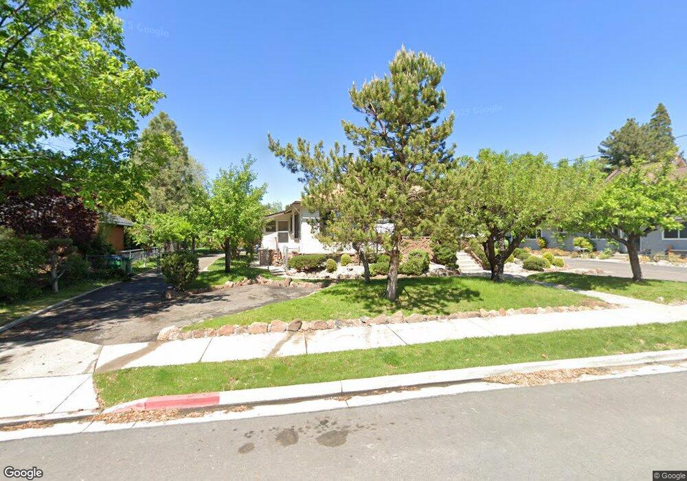
1245 Gordon Ave Reno, NV 89509
Hunter Lake NeighborhoodEstimated Value: $775,000 - $807,000
6
Beds
2
Baths
1,486
Sq Ft
$532/Sq Ft
Est. Value
About This Home
This home is located at 1245 Gordon Ave, Reno, NV 89509 and is currently estimated at $789,922, approximately $531 per square foot. 1245 Gordon Ave is a home located in Washoe County with nearby schools including Mount Rose K-8 School of Languages, Darrell C Swope Middle School, and Reno High School.
Ownership History
Date
Name
Owned For
Owner Type
Purchase Details
Closed on
Sep 13, 2023
Sold by
Jean Perez And Francisca Perez Family Tr
Bought by
Jean Perez Credit Shelter Trust and Prandi
Current Estimated Value
Purchase Details
Closed on
Jan 27, 2004
Sold by
Perez Francesca
Bought by
Perez Jean and Perez Francisca
Create a Home Valuation Report for This Property
The Home Valuation Report is an in-depth analysis detailing your home's value as well as a comparison with similar homes in the area
Home Values in the Area
Average Home Value in this Area
Purchase History
| Date | Buyer | Sale Price | Title Company |
|---|---|---|---|
| Jean Perez Credit Shelter Trust | -- | None Listed On Document | |
| Perez Jean | -- | -- |
Source: Public Records
Tax History
| Year | Tax Paid | Tax Assessment Tax Assessment Total Assessment is a certain percentage of the fair market value that is determined by local assessors to be the total taxable value of land and additions on the property. | Land | Improvement |
|---|---|---|---|---|
| 2026 | -- | $107,881 | $72,188 | $35,694 |
| 2025 | $1,754 | $107,357 | $72,188 | $35,169 |
| 2024 | $1,754 | $107,614 | $72,188 | $35,427 |
| 2023 | $1,702 | $103,123 | $72,188 | $30,935 |
| 2022 | $1,654 | $80,728 | $55,171 | $25,557 |
| 2021 | $1,532 | $68,227 | $43,043 | $25,184 |
| 2020 | $1,485 | $63,400 | $38,500 | $24,900 |
| 2019 | $1,414 | $62,164 | $38,038 | $24,126 |
| 2018 | $1,354 | $53,925 | $30,800 | $23,125 |
| 2017 | $1,299 | $53,437 | $30,800 | $22,637 |
| 2016 | $1,267 | $55,179 | $32,340 | $22,839 |
| 2015 | $1,264 | $36,762 | $13,860 | $22,902 |
| 2014 | $1,225 | $33,145 | $11,550 | $21,595 |
| 2013 | -- | $32,392 | $11,690 | $20,702 |
Source: Public Records
Map
Nearby Homes
- 1410 Patrick Ave
- 1295 Mark Twain Ave
- 1301 Wright St
- 1217 Lander St
- 1001 Lander St
- 255 Circle Dr
- 650 John Fremont Dr
- 1010 La Rue Ave
- 1418 Lander St
- 590 Saint Lawrence Ave
- 611 Nixon Ave
- 0 California Ave Unit 250054017
- 0 California Ave Unit 250053123
- 0 California Ave Unit 260001594
- 0 California Ave Unit 250053399
- 343 Mount Rose St
- 343 & 347 Mount Rose St St
- 222 W Arroyo St Unit 2
- 596 California Ave
- 745 California Ave
- 1275 Gordon Ave
- 1229 Gordon Ave
- 1225 Gordon Ave
- 1295 Gordon Ave
- 1224 Patrick Ave
- 1230 Patrick Ave
- 1209 Gordon Ave
- 1211 Gordon Ave
- 1240 Patrick Ave
- 1218 Patrick Ave
- 1325 Gordon Ave
- 1222 Gordon Ave
- 1250 Gordon Ave
- 1212 Patrick Ave
- 1218 Gordon Ave
- 1242 Patrick Ave
- 1270 Gordon Ave
- 1216 Gordon Ave
- 820 Monroe St
- 1290 Gordon Ave
Your Personal Tour Guide
Ask me questions while you tour the home.