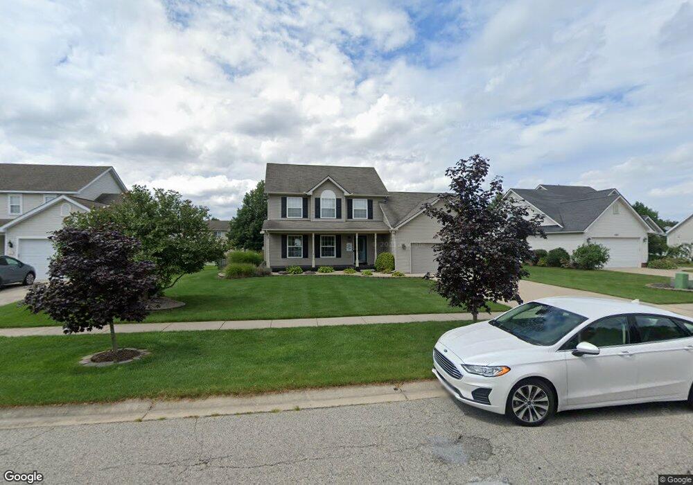
1245 Maple Leaf Ln Howell, MI 48843
Estimated Value: $368,859 - $399,000
4
Beds
3
Baths
1,858
Sq Ft
$209/Sq Ft
Est. Value
About This Home
This home is located at 1245 Maple Leaf Ln, Howell, MI 48843 and is currently estimated at $388,465, approximately $209 per square foot. 1245 Maple Leaf Ln is a home located in Livingston County with nearby schools including Northwest Elementary School, Highlander Way Middle School, and Howell High School.
Ownership History
Date
Name
Owned For
Owner Type
Purchase Details
Closed on
Feb 16, 2011
Sold by
Ketelaar David T and Ketelaar Amy L
Bought by
Ketelaar Amy L and Ketelaar David T
Current Estimated Value
Purchase Details
Closed on
May 15, 2001
Sold by
Hamway Homes Inc
Bought by
Ketelaar David T and Ketelaar Amy L
Create a Home Valuation Report for This Property
The Home Valuation Report is an in-depth analysis detailing your home's value as well as a comparison with similar homes in the area
Home Values in the Area
Average Home Value in this Area
Purchase History
| Date | Buyer | Sale Price | Title Company |
|---|---|---|---|
| Ketelaar Amy L | -- | -- | |
| Ketelaar David T | $208,000 | Select Title |
Source: Public Records
Tax History
| Year | Tax Paid | Tax Assessment Tax Assessment Total Assessment is a certain percentage of the fair market value that is determined by local assessors to be the total taxable value of land and additions on the property. | Land | Improvement |
|---|---|---|---|---|
| 2025 | $1,628 | $179,700 | $0 | $0 |
| 2024 | $1,582 | $172,200 | $0 | $0 |
| 2023 | $1,511 | $146,900 | $0 | $0 |
| 2022 | $701 | $122,700 | $0 | $0 |
| 2021 | $2,093 | $128,700 | $0 | $0 |
| 2020 | $2,117 | $122,700 | $0 | $0 |
| 2019 | $2,087 | $114,700 | $0 | $0 |
| 2018 | $2,066 | $102,100 | $0 | $0 |
| 2017 | $2,053 | $99,800 | $0 | $0 |
| 2016 | $2,023 | $96,800 | $0 | $0 |
| 2014 | $2,308 | $83,400 | $0 | $0 |
| 2012 | $2,308 | $78,900 | $0 | $0 |
Source: Public Records
Map
Nearby Homes
- 2830 Bonny Brook Dr Unit 3
- 1570 Princewood Blvd
- 2643 Kerria Dr Unit 65
- 2511 Kerria Dr Unit 42
- VACANT LOT Thompson Shore Dr
- 475 Cannonade Loop
- 571 Cannonade Loop
- 2430 Hickory Circle Dr Unit 103
- 487 Cannonade Loop
- 559 Cannonade Loop
- 499 Cannonade Loop
- 607 Cannonade Loop
- 1315 Central Ave
- TBD Cannonade Loop
- 0 Eager Unit 293099
- 409 Lake St
- 809 N Michigan Ave
- 325 Lake St
- 2160 E Grand River Ave
- 326 Victoria Park Dr Unit 38
- 1263 Maple Leaf Ln Unit 83
- 1227 Maple Leaf Ln Unit Bldg-Unit
- 1227 Maple Leaf Ln Unit 81
- 1248 Ashwood Ln
- 1281 Maple Leaf Ln
- 1266 Ashwood Ln
- 1232 Maple Leaf Ln Unit 74
- 1250 Maple Leaf Ln Unit 73
- 1284 Ashwood Ln
- 1268 Maple Leaf Ln
- 1299 Maple Leaf Ln Unit 85
- 1209 Maple Leaf Ln
- 2716 Bonny Brook Dr Unit 15
- 2773 Bonny Brook Dr Unit 75
- 1302 Ashwood Ln
- 2772 Autumn Creek Ln
- 2698 Bonny Brook Dr Unit 16
- 2758 Bonny Brook Dr Unit 7
- 1249 Ashwood Ln
- 1317 Maple Leaf Ln
Your Personal Tour Guide
Ask me questions while you tour the home.