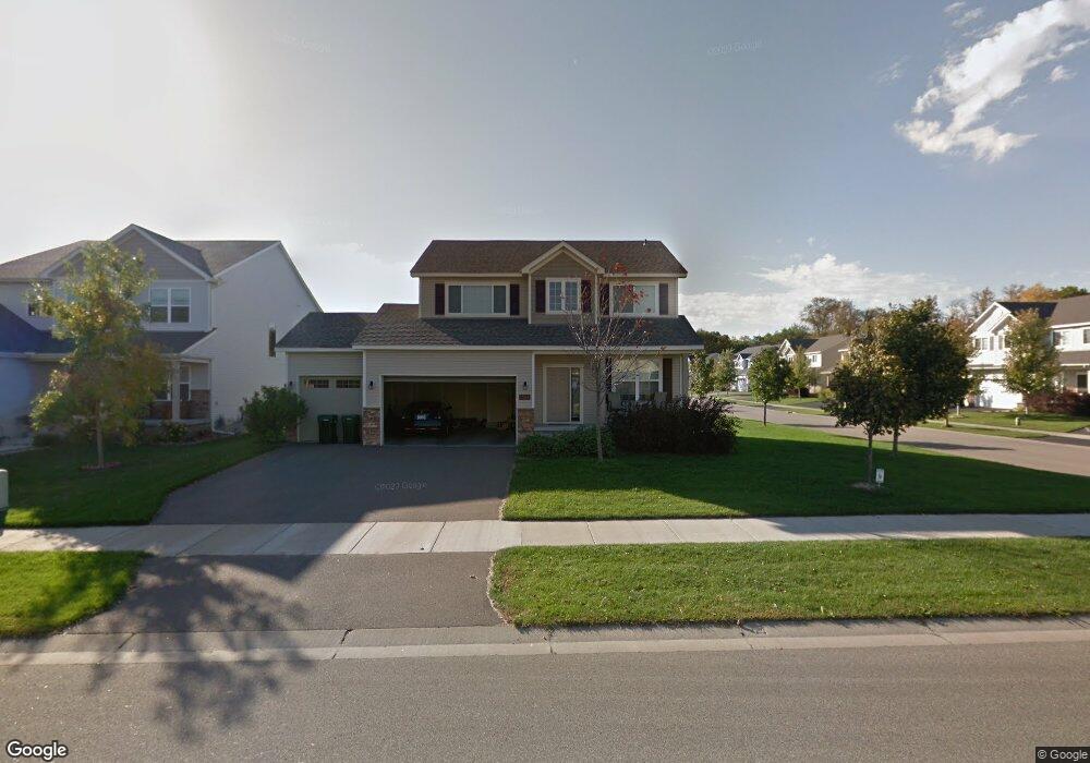
12454 Opal St NE Minneapolis, MN 55449
Estimated Value: $491,052 - $570,000
4
Beds
3
Baths
2,078
Sq Ft
$253/Sq Ft
Est. Value
About This Home
This home is located at 12454 Opal St NE, Minneapolis, MN 55449 and is currently estimated at $526,763, approximately $253 per square foot. 12454 Opal St NE is a home located in Anoka County with nearby schools including Sunrise Elementary School, Northdale Middle School, and Blaine Senior High School.
Ownership History
Date
Name
Owned For
Owner Type
Purchase Details
Closed on
Jul 22, 2020
Sold by
Ahmed Lina
Bought by
Ahmed Lina and Ahmed Adam Ali
Current Estimated Value
Purchase Details
Closed on
Jan 31, 2019
Sold by
Pieper Christine J and Pieper Jon
Bought by
Ahmed Lina
Home Financials for this Owner
Home Financials are based on the most recent Mortgage that was taken out on this home.
Original Mortgage
$308,748
Outstanding Balance
$271,993
Interest Rate
4.6%
Mortgage Type
New Conventional
Estimated Equity
$254,770
Purchase Details
Closed on
Sep 11, 2009
Sold by
Woodside Willowbrook Llc
Bought by
Williams Christine J and Pieper Jon
Home Financials for this Owner
Home Financials are based on the most recent Mortgage that was taken out on this home.
Original Mortgage
$257,254
Interest Rate
5%
Mortgage Type
FHA
Create a Home Valuation Report for This Property
The Home Valuation Report is an in-depth analysis detailing your home's value as well as a comparison with similar homes in the area
Home Values in the Area
Average Home Value in this Area
Purchase History
| Date | Buyer | Sale Price | Title Company |
|---|---|---|---|
| Ahmed Lina | -- | None Available | |
| Ahmed Lina | $346,200 | Trademark Title Services Inc | |
| Williams Christine J | $262,000 | -- |
Source: Public Records
Mortgage History
| Date | Status | Borrower | Loan Amount |
|---|---|---|---|
| Open | Ahmed Lina | $308,748 | |
| Previous Owner | Williams Christine J | $257,254 |
Source: Public Records
Tax History Compared to Growth
Tax History
| Year | Tax Paid | Tax Assessment Tax Assessment Total Assessment is a certain percentage of the fair market value that is determined by local assessors to be the total taxable value of land and additions on the property. | Land | Improvement |
|---|---|---|---|---|
| 2025 | $4,702 | $458,600 | $110,000 | $348,600 |
| 2024 | $4,702 | $446,200 | $108,200 | $338,000 |
| 2023 | $4,234 | $444,800 | $103,000 | $341,800 |
| 2022 | $4,146 | $439,800 | $90,000 | $349,800 |
| 2021 | $4,028 | $378,900 | $75,000 | $303,900 |
| 2020 | $3,905 | $362,200 | $75,000 | $287,200 |
| 2019 | $3,693 | $339,200 | $67,000 | $272,200 |
| 2018 | $3,743 | $315,400 | $0 | $0 |
| 2017 | $3,304 | $309,900 | $0 | $0 |
| 2016 | $3,431 | $280,700 | $0 | $0 |
| 2015 | -- | $280,700 | $69,700 | $211,000 |
| 2014 | -- | $243,800 | $62,400 | $181,400 |
Source: Public Records
Map
Nearby Homes
- 12469 National St NE
- 12202 Opal St NE
- 4873 127th Cir NE
- 4883 127th Cir NE
- 4890 127th Ln NE
- 4903 127th Cir NE
- 2183 120th Ln NE
- 2150 120th Ln NE
- 2140 120th Ln NE
- 12745 Stutz Ct NE
- 4891 127th Ln NE
- 4881 127th Ln NE
- 4872 128th Cir NE
- Aspen Plan at Oakwood Ponds
- Middleton Plan at Oakwood Ponds
- Kenton Plan at Oakwood Ponds
- Sutherland Plan at Oakwood Ponds
- Victoria Plan at Oakwood Ponds
- Riley Plan at Oakwood Ponds
- Alder Plan at Oakwood Ponds
- 12448 Opal St NE
- 12440 Opal St NE
- 12469 National St NE
- 12469 12469 National-Street-ne
- 12453 Opal St NE
- 4865 124th Ln NE
- 12463 National St NE
- 12463 12463 National-Street-ne
- 12463 National St NE
- 12459 Opal St NE
- 17621 National St NE
- 17715 National St NE
- 13161 National St NE
- 4857 124th Ln NE
- 12465 Opal St NE
- 12447 Opal St NE
- 12432 Opal St NE
- 12465 12465 Ne Opal-Street-ne
- 4851 124th Ln NE
- 12457 National St NE