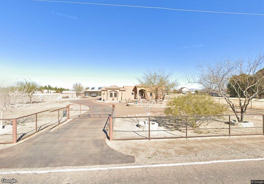
1246 Borderland Rd Anthony, NM 88021
Estimated Value: $387,000 - $499,653
3
Beds
3
Baths
2,289
Sq Ft
$194/Sq Ft
Est. Value
About This Home
This home is located at 1246 Borderland Rd, Anthony, NM 88021 and is currently estimated at $443,327, approximately $193 per square foot. 1246 Borderland Rd is a home with nearby schools including La Union Elementary School, Santa Teresa Middle School, and Santa Teresa High School.
Ownership History
Date
Name
Owned For
Owner Type
Purchase Details
Closed on
Oct 10, 2006
Sold by
Read Edward N
Bought by
Gutierrez Ralph C and Guitierrez Anna D
Current Estimated Value
Home Financials for this Owner
Home Financials are based on the most recent Mortgage that was taken out on this home.
Original Mortgage
$33,500
Outstanding Balance
$19,761
Interest Rate
6.44%
Mortgage Type
Seller Take Back
Estimated Equity
$423,566
Create a Home Valuation Report for This Property
The Home Valuation Report is an in-depth analysis detailing your home's value as well as a comparison with similar homes in the area
Purchase History
| Date | Buyer | Sale Price | Title Company |
|---|---|---|---|
| Gutierrez Ralph C | -- | Dona Ana Title Company |
Source: Public Records
Mortgage History
| Date | Status | Borrower | Loan Amount |
|---|---|---|---|
| Open | Gutierrez Ralph C | $33,500 |
Source: Public Records
Tax History
| Year | Tax Paid | Tax Assessment Tax Assessment Total Assessment is a certain percentage of the fair market value that is determined by local assessors to be the total taxable value of land and additions on the property. | Land | Improvement |
|---|---|---|---|---|
| 2025 | $3,592 | $124,252 | $25,000 | $99,252 |
| 2024 | $3,592 | $124,252 | $25,000 | $99,252 |
| 2023 | $3,505 | $120,633 | $25,000 | $95,633 |
| 2022 | $3,497 | $120,633 | $25,000 | $95,633 |
| 2021 | $3,478 | $120,633 | $25,000 | $95,633 |
| 2020 | $3,501 | $120,633 | $25,000 | $95,633 |
| 2019 | $3,501 | $120,633 | $25,000 | $95,633 |
| 2018 | $3,493 | $120,633 | $25,000 | $95,633 |
| 2017 | $3,427 | $120,633 | $23,800 | $96,833 |
| 2016 | $3,332 | $120,633 | $23,800 | $96,833 |
| 2015 | $1,744 | $361,900 | $71,400 | $290,500 |
| 2014 | $3 | $16,700 | $1,000 | $15,700 |
Source: Public Records
Map
Nearby Homes
- 1069 Hoppas Ct
- 6337 Camino Nogal Dr
- 6433 Toivoa Place
- 6541 Toivoa Place
- 6328 Camino Pinon Place
- 980 Pecos River Dr
- 6461 Villaggio Dr
- 996 Willow River Dr
- 972 Pellegrino Ave
- 980 Willow River Dr
- 6643 Westside Dr
- 964 Willow River Dr
- 5905 Windermore Ct
- 940 Abe Goldberg Dr
- 1064 Miss Bev Ave
- 932 Crooked River Dr
- 837 Bronze Hill Ave
- 1067 Gardner Rd
- 5973 Cartagena Cir
- 953 Aqueduct Ave
- 1250 Borderland Rd
- 1210 Borderland Rd
- 1270 Borderland Rd
- 1220 Borderland Rd
- 6340 Gato Rd
- 0000 Borderland Rd
- 6360 Gato Rd
- 0000 Gato Rd
- 1230 Borderland Rd
- 1290 Borderland Rd
- 6370 Gato Rd
- 1300 Borderland Rd
- 6380 Gato Rd
- 6390 Gato Rd
- 6390 Gato Rd
- 1240 Borderland Rd
- 6403 Gato Rd
- 6400 Gato Rd
- 6400 Gato Rd
- 6405 Gato Rd
Your Personal Tour Guide
Ask me questions while you tour the home.