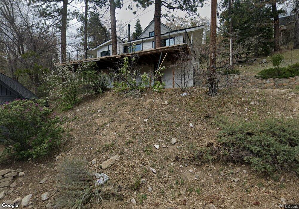
1247 Crags Ln Fawnskin, CA 92333
Estimated Value: $475,388 - $721,000
1
Bed
1
Bath
1,684
Sq Ft
$344/Sq Ft
Est. Value
About This Home
This home is located at 1247 Crags Ln, Fawnskin, CA 92333 and is currently estimated at $580,097, approximately $344 per square foot. 1247 Crags Ln is a home with nearby schools including North Shore Elementary School, Big Bear Middle School, and Big Bear High School.
Ownership History
Date
Name
Owned For
Owner Type
Purchase Details
Closed on
Apr 23, 2020
Sold by
Evans Leigh Ann
Bought by
Evans Edwin J
Current Estimated Value
Purchase Details
Closed on
Apr 22, 2020
Sold by
Evans Edwin J
Bought by
Evans Edwin J
Purchase Details
Closed on
Apr 21, 2020
Sold by
Edwin J Evans Family Limited Partnership
Bought by
Evans Edwin J
Purchase Details
Closed on
Apr 20, 2020
Sold by
Evans Edwin J
Bought by
Rasmussen Richard and Rasmussen Heather Anne
Purchase Details
Closed on
Jan 3, 1996
Sold by
The Edwin J Evans Jr 1995 Living Trut
Bought by
The Evans Family Ltd Partnership
Create a Home Valuation Report for This Property
The Home Valuation Report is an in-depth analysis detailing your home's value as well as a comparison with similar homes in the area
Home Values in the Area
Average Home Value in this Area
Purchase History
| Date | Buyer | Sale Price | Title Company |
|---|---|---|---|
| Evans Edwin J | -- | Lawyers Title | |
| Evans Edwin J | -- | Lawyers Title | |
| Evans Edwin J | -- | Lawyers Title | |
| Rasmussen Richard | $160,000 | Lawyers Title | |
| The Evans Family Ltd Partnership | -- | -- | |
| The Edwin J Evans Jr 1995 Living Trust | -- | -- |
Source: Public Records
Tax History Compared to Growth
Tax History
| Year | Tax Paid | Tax Assessment Tax Assessment Total Assessment is a certain percentage of the fair market value that is determined by local assessors to be the total taxable value of land and additions on the property. | Land | Improvement |
|---|---|---|---|---|
| 2025 | $3,844 | $273,411 | $71,087 | $202,324 |
| 2024 | $3,844 | $268,050 | $69,693 | $198,357 |
| 2023 | $3,758 | $262,794 | $68,326 | $194,468 |
| 2022 | $3,580 | $257,641 | $66,986 | $190,655 |
| 2021 | $2,974 | $252,590 | $65,673 | $186,917 |
| 2020 | $1,026 | $66,776 | $15,637 | $51,139 |
| 2019 | $1,053 | $65,466 | $15,330 | $50,136 |
| 2018 | $1,224 | $64,182 | $15,029 | $49,153 |
| 2017 | $811 | $62,923 | $14,734 | $48,189 |
| 2016 | $796 | $61,689 | $14,445 | $47,244 |
| 2015 | $1,818 | $60,762 | $14,228 | $46,534 |
| 2014 | $1,741 | $59,571 | $13,949 | $45,622 |
Source: Public Records
Map
Nearby Homes
- 39342 Mohawk Dr
- 39326 Cedar Dell Rd
- 0 Raccoon Dr Unit 32501518
- 1247 Piney Ridge Place
- 1127 Crags Ln
- 0 Bruin Trail Unit 32300136
- 0 Cedar Dell Rd Unit 32202725
- 1118 Bruin Trail
- 39239 Mohawk Dr
- 1137 Ridge Rd
- 39325 Lodge Rd
- 1106 Comanche Dr
- 39177 Arapahoe Rd
- 39337 Garden Place
- 39178 Sioux Dr
- 0 N Shore Dr Unit IG25012446
- 0 N Shore Dr Unit 32405685
- 39576 Oakglen Rd
- 39210 N Shore Dr
- 39226 N Shore Dr
- 1265 Brookside Ln
- 1277-1285 Brookside Ln
- 1231 Crags Ln
- 1234 Bruin Trail
- 1245 Brookside Ln
- 1272 Bruin Trail
- 1221 Crags Ln
- 1220 Bruin Trail
- 39367 Cedar Dell Rd
- 1239 Brookside Ln
- 1277 Bruin Trail
- 1231 Brookside Ln
- 1297 Brookside Ln
- 1292 Bruin Trail
- 1188 Bruin Trail
- 1198 Bruin Trail
- 39372 Cedar Dell
- 1245 Bruin Trail
- 1208 Bruin Trail
- 1275 Bruin Trail