Estimated Value: $456,000 - $517,000
3
Beds
3
Baths
2,585
Sq Ft
$187/Sq Ft
Est. Value
About This Home
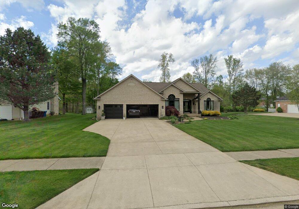
This home is located at 1247 Maxfli Dr, Akron, OH 44312 and is currently estimated at $484,623, approximately $187 per square foot. 1247 Maxfli Dr is a home located in Summit County with nearby schools including Springfield High School, Chapel Hill Christian School-Green Campus, and Academy of the Immaculate Heart of Mary.
Ownership History
Date
Name
Owned For
Owner Type
Purchase Details
Closed on
Jan 8, 2014
Sold by
Porter Edwin D and Porter Kim A
Bought by
Porter Living Trust
Current Estimated Value
Purchase Details
Closed on
May 3, 2000
Sold by
Brown Gregory S and Brown Pamela A
Bought by
Porter Edwin D and Porter Kim A
Home Financials for this Owner
Home Financials are based on the most recent Mortgage that was taken out on this home.
Original Mortgage
$203,400
Outstanding Balance
$68,606
Interest Rate
5.87%
Estimated Equity
$416,017
Purchase Details
Closed on
Dec 8, 1997
Sold by
Wayne Breitenstine Build
Bought by
Brown Gregory S and Brown Pamela A
Create a Home Valuation Report for This Property
The Home Valuation Report is an in-depth analysis detailing your home's value as well as a comparison with similar homes in the area
Purchase History
| Date | Buyer | Sale Price | Title Company |
|---|---|---|---|
| Porter Living Trust | -- | None Available | |
| Porter Edwin D | $44,900 | Midland Commerce Group | |
| Brown Gregory S | $41,500 | -- |
Source: Public Records
Mortgage History
| Date | Status | Borrower | Loan Amount |
|---|---|---|---|
| Open | Porter Edwin D | $203,400 |
Source: Public Records
Tax History
| Year | Tax Paid | Tax Assessment Tax Assessment Total Assessment is a certain percentage of the fair market value that is determined by local assessors to be the total taxable value of land and additions on the property. | Land | Improvement |
|---|---|---|---|---|
| 2024 | $6,745 | $128,965 | $26,625 | $102,340 |
| 2023 | $6,745 | $128,965 | $26,625 | $102,340 |
| 2022 | $6,111 | $102,501 | $21,133 | $81,368 |
| 2021 | $5,969 | $102,501 | $21,133 | $81,368 |
| 2020 | $5,885 | $102,500 | $21,130 | $81,370 |
| 2019 | $5,916 | $96,150 | $20,710 | $75,440 |
| 2018 | $5,685 | $96,150 | $20,710 | $75,440 |
| 2017 | $4,837 | $96,150 | $20,710 | $75,440 |
| 2016 | $4,828 | $79,840 | $20,710 | $59,130 |
| 2015 | $4,837 | $79,840 | $20,710 | $59,130 |
| 2014 | $4,779 | $79,840 | $20,710 | $59,130 |
| 2013 | $4,798 | $80,640 | $20,710 | $59,930 |
Source: Public Records
Map
Nearby Homes
- 1254 Maxfli Dr
- 1238 Maxfli Dr
- 2872 Ironwood Dr
- 2729 Ariels Way
- 1086 Saint Andrew's Ct
- 2837 Stratford Cir
- 2828 Steelwood Cir
- 1088 Buena Vista Dr
- 0 Fortuna Dr Unit 5005346
- S/L 43 Park Ave
- 3108 Vermont Place
- 1457 5th Ave
- 1702 Far View Rd
- 1031 Archmere Dr
- 3218 Pickle Rd
- 2690 Mayfair Rd
- 1134 E Turkeyfoot Lake Rd
- 619 Moore Rd
- 3374 Buckeye Trail
- 3375 Buckeye Trail
- 1239 Maxfli Dr
- 1255 Maxfli Dr
- 1221 Maxfli Dr
- 1246 Maxfli Dr
- 1263 Maxfli Dr
- 1203 Maxfli Dr
- 1220 Maxfli Dr
- 1262 Maxfli Dr
- 1195 Maxfli Dr
- 1202 Maxfli Dr
- 1289 Titleist Dr
- 1271 Maxfli Dr
- 1194 Maxfli Dr
- 1270 Maxfli Dr
- 1187 Maxfli Dr
- 2692 Ultra Cir
- 1186 Maxfli Dr
- 1288 Maxfli Dr
- 2693 Ultra Cir
- 1293 Maxfli Dr
Your Personal Tour Guide
Ask me questions while you tour the home.