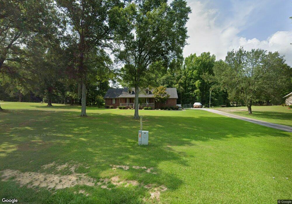
1247 Suttle Rd Lancaster, SC 29720
Estimated Value: $251,551 - $364,000
Studio
2
Baths
1,891
Sq Ft
$159/Sq Ft
Est. Value
About This Home
This home is located at 1247 Suttle Rd, Lancaster, SC 29720 and is currently estimated at $301,138, approximately $159 per square foot. 1247 Suttle Rd is a home located in Lancaster County with nearby schools including McDonald Green Elementary School, South Middle School, and Lancaster High School.
Ownership History
Date
Name
Owned For
Owner Type
Purchase Details
Closed on
May 15, 2018
Sold by
Mothershed Ronald E and Mothershed Michelle W
Bought by
Mothershed Ronald E and Mothershed Michelle W
Current Estimated Value
Home Financials for this Owner
Home Financials are based on the most recent Mortgage that was taken out on this home.
Original Mortgage
$111,000
Interest Rate
4.4%
Mortgage Type
New Conventional
Purchase Details
Closed on
Jan 8, 2015
Sold by
Nelson Sandra D
Bought by
Sepcic Adrian
Purchase Details
Closed on
Dec 28, 2009
Sold by
Mothershed Ronald E and Mothershed Michelle W
Bought by
Mothershed Ronald E and Mothershed Michelle W
Home Financials for this Owner
Home Financials are based on the most recent Mortgage that was taken out on this home.
Original Mortgage
$125,000
Interest Rate
4.82%
Mortgage Type
New Conventional
Create a Home Valuation Report for This Property
The Home Valuation Report is an in-depth analysis detailing your home's value as well as a comparison with similar homes in the area
Home Values in the Area
Average Home Value in this Area
Purchase History
| Date | Buyer | Sale Price | Title Company |
|---|---|---|---|
| Mothershed Ronald E | -- | None Available | |
| Sepcic Adrian | -- | -- | |
| Mothershed Ronald E | -- | -- |
Source: Public Records
Mortgage History
| Date | Status | Borrower | Loan Amount |
|---|---|---|---|
| Closed | Mothershed Ronald E | $111,000 | |
| Closed | Mothershed Ronald E | $125,000 |
Source: Public Records
Tax History
| Year | Tax Paid | Tax Assessment Tax Assessment Total Assessment is a certain percentage of the fair market value that is determined by local assessors to be the total taxable value of land and additions on the property. | Land | Improvement |
|---|---|---|---|---|
| 2024 | $1,076 | $7,008 | $688 | $6,320 |
| 2023 | $1,072 | $7,008 | $688 | $6,320 |
| 2022 | $1,068 | $7,008 | $688 | $6,320 |
| 2021 | $1,045 | $7,008 | $688 | $6,320 |
| 2020 | $1,004 | $6,552 | $688 | $5,864 |
| 2019 | $2,215 | $6,552 | $688 | $5,864 |
| 2018 | $2,131 | $6,552 | $688 | $5,864 |
| 2017 | $981 | $0 | $0 | $0 |
| 2016 | $957 | $0 | $0 | $0 |
| 2015 | $789 | $0 | $0 | $0 |
| 2014 | $789 | $0 | $0 | $0 |
| 2013 | $789 | $0 | $0 | $0 |
Source: Public Records
Map
Nearby Homes
- 2908 Woodland Way
- 1186 Merribrook Ln
- 1182 Merribrook Ln
- 2895 Courtside Dr
- 1139 Merribrook Ln
- 1411 Foxbrook Cir
- 5114 Sedgefield Dr
- 5142 Sedgefield Dr
- 2599 State Road S-29-503
- 1976 McIlwain Rd
- 2131 Robert H Kirk Rd
- 2375 Ellison Cir
- TBD Sunnyside Dr Unit 14 & 15
- 2417 Lynwood Dr
- 2526 Country Club Dr
- 2470 Country Club Dr
- 2644 Downey Dr
- 2166 Reeves Rd
- 4008 Cypress Cir
- Lot 24 Avalon Ln Unit 24
- 1273 Suttle Rd
- 1241 Suttle Rd
- 1272 Foxfire Dr
- 1272 Suttle Rd
- 1276 Suttle Rd
- 1264 Foxfire Dr
- 2553 Linseed Ln
- 1314 Foxfire Dr
- 1255 Foxfire Dr
- 1275 Suttle Rd
- 1297 Foxfire Dr
- 1217 Suttle Rd
- 1305 Suttle Rd
- 1328 Foxfire Dr
- 1244 Foxfire Dr
- 1239 Foxfire Dr
- 1269 Blair Ct
- 1306 Suttle Rd
- 1236 Blairwood Ct
- 1329 Foxfire Dr
Your Personal Tour Guide
Ask me questions while you tour the home.