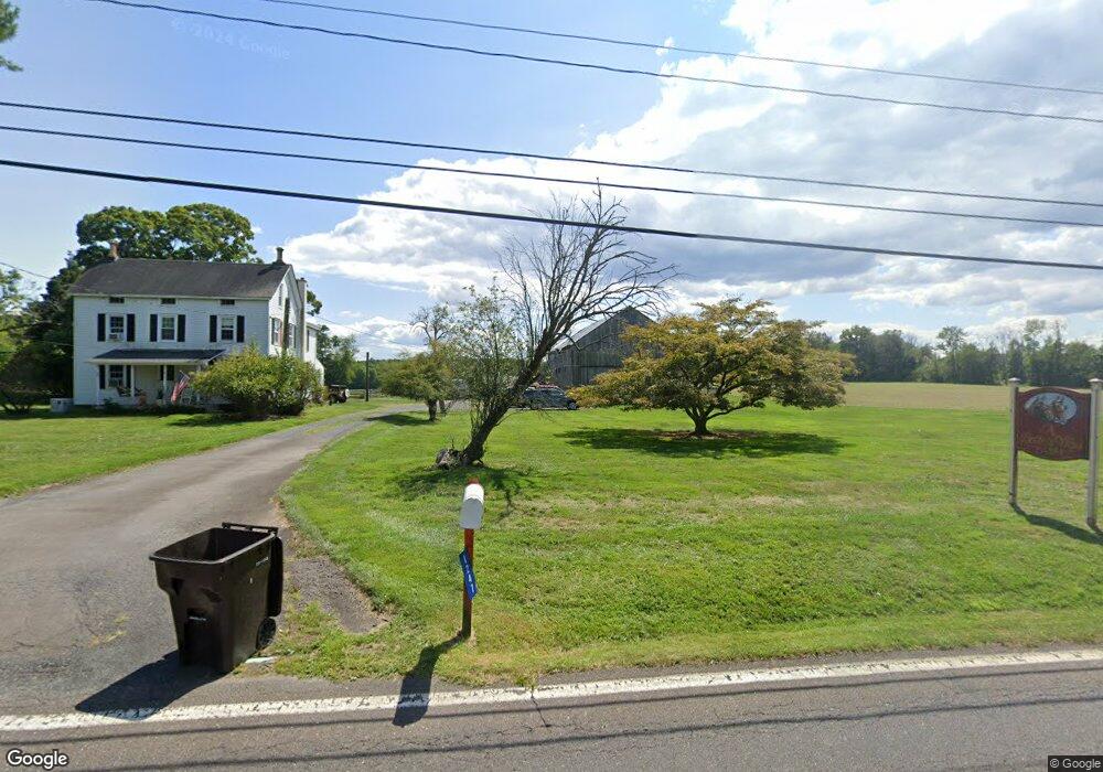
1247 Wrightstown Rd Newtown, PA 18940
Estimated Value: $301,000 - $773,265
3
Beds
1
Bath
1,802
Sq Ft
$338/Sq Ft
Est. Value
About This Home
This home is located at 1247 Wrightstown Rd, Newtown, PA 18940 and is currently estimated at $609,088, approximately $338 per square foot. 1247 Wrightstown Rd is a home located in Bucks County with nearby schools including Wrightstown Elementary School, Newtown Middle School, and Council Rock High School North.
Ownership History
Date
Name
Owned For
Owner Type
Purchase Details
Closed on
Jan 4, 2005
Sold by
Hamilton Harry W and Hamilton Linda L
Bought by
Hamilton Harry W and Hamilton Linda L
Current Estimated Value
Home Financials for this Owner
Home Financials are based on the most recent Mortgage that was taken out on this home.
Original Mortgage
$245,000
Outstanding Balance
$72,323
Interest Rate
6.25%
Mortgage Type
Adjustable Rate Mortgage/ARM
Estimated Equity
$536,765
Purchase Details
Closed on
Dec 20, 2004
Sold by
Fisher Della Cramer and Fisher Shirley
Bought by
Hamilton Harry W and Hamilton Linda L
Home Financials for this Owner
Home Financials are based on the most recent Mortgage that was taken out on this home.
Original Mortgage
$245,000
Outstanding Balance
$72,323
Interest Rate
6.25%
Mortgage Type
Adjustable Rate Mortgage/ARM
Estimated Equity
$536,765
Create a Home Valuation Report for This Property
The Home Valuation Report is an in-depth analysis detailing your home's value as well as a comparison with similar homes in the area
Home Values in the Area
Average Home Value in this Area
Purchase History
| Date | Buyer | Sale Price | Title Company |
|---|---|---|---|
| Hamilton Harry W | -- | -- | |
| Hamilton Harry W | $98,000 | -- | |
| Hamilton Harry W | $147,000 | -- |
Source: Public Records
Mortgage History
| Date | Status | Borrower | Loan Amount |
|---|---|---|---|
| Open | Hamilton Harry W | $245,000 |
Source: Public Records
Tax History Compared to Growth
Tax History
| Year | Tax Paid | Tax Assessment Tax Assessment Total Assessment is a certain percentage of the fair market value that is determined by local assessors to be the total taxable value of land and additions on the property. | Land | Improvement |
|---|---|---|---|---|
| 2025 | $6,711 | $38,000 | $21,150 | $16,850 |
| 2024 | $6,711 | $38,000 | $21,150 | $16,850 |
| 2023 | $6,428 | $38,000 | $21,150 | $16,850 |
| 2022 | $6,365 | $38,000 | $21,150 | $16,850 |
| 2021 | $6,266 | $38,000 | $21,150 | $16,850 |
| 2020 | $6,117 | $38,000 | $21,150 | $16,850 |
| 2019 | $5,977 | $38,000 | $21,150 | $16,850 |
| 2018 | $5,867 | $38,000 | $21,150 | $16,850 |
| 2017 | $5,635 | $38,000 | $21,150 | $16,850 |
| 2016 | $5,635 | $38,000 | $21,150 | $16,850 |
| 2015 | -- | $38,000 | $21,150 | $16,850 |
| 2014 | -- | $38,000 | $21,150 | $16,850 |
Source: Public Records
Map
Nearby Homes
- 288 Jane Chapman Dr E Unit E
- 309 Matthews Ln
- 101 Laurel Cir
- 401 Society Place Unit A1
- 2212 Society Place Unit D2
- 702 Society Place Unit A2
- 0 Augusta Dr Unit KINGSWOOD
- 0 Augusta Dr Unit MAYWEATHER
- 0 Augusta Dr Unit RAINTREE
- 0 Augusta Dr Unit CLOVERFIELD
- 0 Augusta Dr Unit ROLLINS
- 0 Augusta Dr Unit LANEY
- Raintree Plan at Lyondale Meadows
- Kingswood Plan at Lyondale Meadows
- Cloverfield Plan at Lyondale Meadows
- Laney Plan at Lyondale Meadows
- Mayweather Plan at Lyondale Meadows
- Rollins Plan at Lyondale Meadows
- 316 Monterey Place
- 95 Rittenhouse Cir Unit 92
- 1280 Wrightstown Rd
- 1238 Wrightstown Rd
- 1300 Wrightstown Rd
- 204 Jane Chapman Dr E
- 208 Jane Chapman Dr E
- 212 Jane Chapman Dr E
- 200 Jane Chapman Dr E
- 1285 Wrightstown Rd
- 216 Jane Chapman Dr E
- 1321 Wrightstown Rd
- 209 Jane Chapman Dr E
- 1320 Wrightstown Rd
- 205 Jane Chapman Dr E
- 213 Jane Chapman Dr E
- 201 Jane Chapman Dr E
- 201 Jane Chapman Dr E Unit 24
- 220 Jane Chapman Dr E
- 8 Penn Oak Trail
- 100 Joseph Dr
- 224 Jane Chapman Dr E