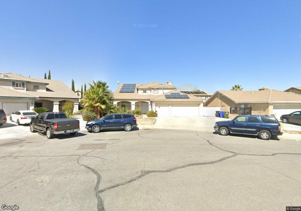
12474 Redrock Ct Victorville, CA 92392
Mesa Linda NeighborhoodEstimated Value: $511,000 - $535,698
5
Beds
3
Baths
2,746
Sq Ft
$189/Sq Ft
Est. Value
About This Home
This home is located at 12474 Redrock Ct, Victorville, CA 92392 and is currently estimated at $518,675, approximately $188 per square foot. 12474 Redrock Ct is a home located in San Bernardino County with nearby schools including Eagle Ranch Elementary School, Silverado High School, and Mojave River Academy - Oro Grande.
Ownership History
Date
Name
Owned For
Owner Type
Purchase Details
Closed on
Feb 7, 1995
Sold by
Federal National Mortgage Association
Bought by
Buchanan James E and Buchanan Bonita
Current Estimated Value
Home Financials for this Owner
Home Financials are based on the most recent Mortgage that was taken out on this home.
Original Mortgage
$166,800
Interest Rate
9.23%
Mortgage Type
Seller Take Back
Purchase Details
Closed on
Oct 3, 1994
Sold by
Carletello Johnny and Carletello Connie S
Bought by
Federal National Mortgage Association
Purchase Details
Closed on
Sep 11, 1993
Sold by
Carletello Johnny
Bought by
Carranza John David and Carranza Frances R
Home Financials for this Owner
Home Financials are based on the most recent Mortgage that was taken out on this home.
Original Mortgage
$168,250
Interest Rate
8.52%
Mortgage Type
Seller Take Back
Create a Home Valuation Report for This Property
The Home Valuation Report is an in-depth analysis detailing your home's value as well as a comparison with similar homes in the area
Home Values in the Area
Average Home Value in this Area
Purchase History
| Date | Buyer | Sale Price | Title Company |
|---|---|---|---|
| Buchanan James E | $172,000 | First American Title Company | |
| Federal National Mortgage Association | $150,000 | Northern Counties Title Ins | |
| Carranza John David | $168,500 | -- |
Source: Public Records
Mortgage History
| Date | Status | Borrower | Loan Amount |
|---|---|---|---|
| Closed | Buchanan James E | $166,800 | |
| Previous Owner | Carranza John David | $168,250 |
Source: Public Records
Tax History Compared to Growth
Tax History
| Year | Tax Paid | Tax Assessment Tax Assessment Total Assessment is a certain percentage of the fair market value that is determined by local assessors to be the total taxable value of land and additions on the property. | Land | Improvement |
|---|---|---|---|---|
| 2025 | $2,633 | $227,318 | $31,353 | $195,965 |
| 2024 | $2,633 | $222,861 | $30,738 | $192,123 |
| 2023 | $2,605 | $218,491 | $30,135 | $188,356 |
| 2022 | $2,557 | $214,207 | $29,544 | $184,663 |
| 2021 | $2,694 | $210,007 | $28,965 | $181,042 |
| 2020 | $2,645 | $207,854 | $28,668 | $179,186 |
| 2019 | $2,627 | $203,779 | $28,106 | $175,673 |
| 2018 | $2,652 | $199,783 | $27,555 | $172,228 |
| 2017 | $2,579 | $195,866 | $27,015 | $168,851 |
| 2016 | $2,383 | $192,025 | $26,485 | $165,540 |
| 2015 | $2,446 | $189,140 | $26,087 | $163,053 |
| 2014 | $2,410 | $185,435 | $25,576 | $159,859 |
Source: Public Records
Map
Nearby Homes
- 12477 Redrock Ct
- 12413 Redrock Rd
- 0 Eagle Ranch Pkwy
- 12530 Loma Verde Dr
- 12533 Loma Verde Dr
- 12591 Loma Verde Dr
- 12544 Sunbird Ln
- 12312 Atoka Ln
- 12213 Nugget Ave
- 12451 Antelope Dr
- 12342 Southwind St
- 0 El Dorado St Unit SR25115583
- 12776 Berrydale St
- 12766 Brookdale St
- 12709 Gaines St
- 12658 Shorewood Way
- 12866 Albright Ct
- 12884 Caesar Ln
- 0 Highway 395 Unit CV24228214
- 0 Highway 395 Unit HD25120289
- 12492 Redrock Ct
- 12487 Kokomo Dr
- 12470 Redrock Ct
- 12495 Kokomo Dr
- 12479 Kokomo Dr
- 12500 Redrock Ct
- 12468 Redrock Ct
- 12505 Kokomo Dr
- 12467 Kokomo Dr
- 12487 Redrock Ct
- 12510 Redrock Ct
- 12469 Redrock Ct
- 12513 Kokomo Dr
- 12457 Kokomo Dr
- 12495 Redrock Ct
- 12490 Kokomo Way
- 12484 Kokomo Way
- 12496 Kokomo Dr
- 12498 Kokomo Way
- 12482 Kokomo Dr