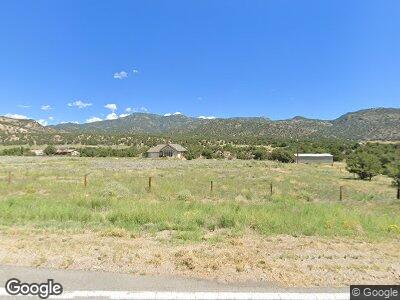
12477 Us Highway 50 Howard, CO 81233
Estimated Value: $530,000 - $703,000
2
Beds
2
Baths
1,494
Sq Ft
$438/Sq Ft
Est. Value
About This Home
This home is located at 12477 Us Highway 50, Howard, CO 81233 and is currently estimated at $653,833, approximately $437 per square foot. 12477 Us Highway 50 is a home located in Fremont County with nearby schools including Cotopaxi Elementary School and Cotopaxi Junior/Senior High School.
Ownership History
Date
Name
Owned For
Owner Type
Purchase Details
Closed on
Apr 8, 2022
Sold by
Kayser James N
Bought by
Kayser James N and Kayser Yvonne E
Current Estimated Value
Purchase Details
Closed on
Mar 18, 2016
Sold by
Peanut Holdings Llc
Bought by
Kayser James N
Purchase Details
Closed on
May 28, 2015
Sold by
Wortham Gene M and Zettlemoyer Lois A
Bought by
Peanut Holdings Llc
Purchase Details
Closed on
Oct 30, 2008
Sold by
Wortham Gene M
Bought by
Wortham Gene M and Zettlemoyer Lois
Home Financials for this Owner
Home Financials are based on the most recent Mortgage that was taken out on this home.
Original Mortgage
$15,000
Interest Rate
6.5%
Mortgage Type
Credit Line Revolving
Create a Home Valuation Report for This Property
The Home Valuation Report is an in-depth analysis detailing your home's value as well as a comparison with similar homes in the area
Home Values in the Area
Average Home Value in this Area
Purchase History
| Date | Buyer | Sale Price | Title Company |
|---|---|---|---|
| Kayser James N | -- | None Listed On Document | |
| Kayser James N | $375,000 | None Available | |
| Peanut Holdings Llc | -- | None Available | |
| Wortham Gene M | -- | None Available |
Source: Public Records
Mortgage History
| Date | Status | Borrower | Loan Amount |
|---|---|---|---|
| Previous Owner | Zettlemoyer Lois | $174,000 | |
| Previous Owner | Wortham Gene M | $15,000 | |
| Previous Owner | Wortham Gene M | $307,000 | |
| Previous Owner | Wortham Gene M | $142,500 |
Source: Public Records
Tax History Compared to Growth
Tax History
| Year | Tax Paid | Tax Assessment Tax Assessment Total Assessment is a certain percentage of the fair market value that is determined by local assessors to be the total taxable value of land and additions on the property. | Land | Improvement |
|---|---|---|---|---|
| 2024 | $1,874 | $50,829 | $0 | $0 |
| 2023 | $1,874 | $37,723 | $0 | $0 |
| 2022 | $1,664 | $34,697 | $0 | $0 |
| 2021 | $1,693 | $35,695 | $0 | $0 |
| 2020 | $1,527 | $32,583 | $0 | $0 |
| 2019 | $1,522 | $32,583 | $0 | $0 |
| 2018 | $1,279 | $27,246 | $0 | $0 |
| 2017 | $1,086 | $27,246 | $0 | $0 |
| 2016 | $1,109 | $27,820 | $0 | $0 |
| 2015 | $1,104 | $27,820 | $0 | $0 |
| 2012 | $1,012 | $25,310 | $7,960 | $17,350 |
Source: Public Records
Map
Nearby Homes
- 1135 Ogden Loop
- 10240 U S 50
- 10817 U S 50
- 35 Shillelagh Place
- 9825 Us Highway 50
- 9564 Us Highway 50
- 14527 U S 50
- 716 W Blarney Stone Rd
- 110 Triple j Ct
- 8180 Us Highway 50
- 0 Tbd County Road 45
- 42 Holiday Hills Blvd
- 163 Holiday Hills Blvd
- 790 Holiday Hills Blvd
- 838 Ridge Way Dr
- 7816 Us Hwy 50
- 13440 County Road 45
- 830 High Peaks Ranch Rd
- 16193 U S 50
- 160 Nuthatch Dr