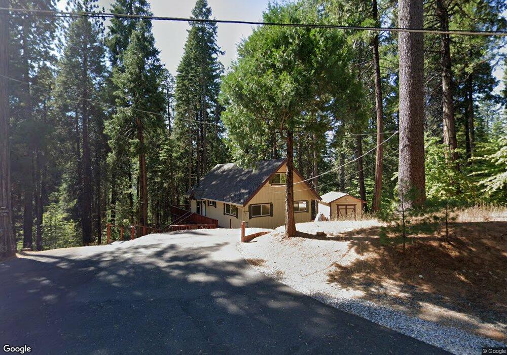
1248 Cypress Point Dr Arnold, CA 95223
Estimated Value: $366,025 - $524,000
2
Beds
2
Baths
1,296
Sq Ft
$325/Sq Ft
Est. Value
About This Home
This home is located at 1248 Cypress Point Dr, Arnold, CA 95223 and is currently estimated at $421,506, approximately $325 per square foot. 1248 Cypress Point Dr is a home with nearby schools including Bret Harte Union High School.
Ownership History
Date
Name
Owned For
Owner Type
Purchase Details
Closed on
Jan 9, 2020
Sold by
Mathews Timothy Blake and Mathews Monica Marie
Bought by
Mathews Timothy B and Mathews Monica M
Current Estimated Value
Purchase Details
Closed on
Oct 18, 2019
Sold by
Scott Derrick and Mathews Timothy Blake
Bought by
Mathews Timothy Blake and Mathews Monixca Marie
Purchase Details
Closed on
Aug 20, 2008
Sold by
Smith Richard C
Bought by
Mathews Alan R and Mathews Derrick Scott
Home Financials for this Owner
Home Financials are based on the most recent Mortgage that was taken out on this home.
Original Mortgage
$123,217
Outstanding Balance
$80,196
Interest Rate
6.59%
Mortgage Type
Purchase Money Mortgage
Estimated Equity
$341,310
Create a Home Valuation Report for This Property
The Home Valuation Report is an in-depth analysis detailing your home's value as well as a comparison with similar homes in the area
Home Values in the Area
Average Home Value in this Area
Purchase History
| Date | Buyer | Sale Price | Title Company |
|---|---|---|---|
| Mathews Timothy B | -- | None Available | |
| Mathews Timothy Blake | -- | None Available | |
| Mathews Alan R | $315,000 | Placer Title Company | |
| Mathews Alan R | -- | Placer Title Company | |
| Mathews Derrick Scott | -- | Placer Title Company | |
| Mathews Timothy Blake | -- | Placer Title Company | |
| Smith Richard C | -- | Placer Title Company |
Source: Public Records
Mortgage History
| Date | Status | Borrower | Loan Amount |
|---|---|---|---|
| Open | Mathews Alan R | $123,217 |
Source: Public Records
Tax History
| Year | Tax Paid | Tax Assessment Tax Assessment Total Assessment is a certain percentage of the fair market value that is determined by local assessors to be the total taxable value of land and additions on the property. | Land | Improvement |
|---|---|---|---|---|
| 2025 | $4,323 | $350,449 | $74,348 | $276,101 |
| 2023 | $4,210 | $336,843 | $71,462 | $265,381 |
| 2022 | $4,004 | $330,239 | $70,061 | $260,178 |
| 2021 | $3,548 | $284,000 | $30,000 | $254,000 |
| 2020 | $3,189 | $252,000 | $30,000 | $222,000 |
| 2019 | $3,062 | $239,000 | $30,000 | $209,000 |
| 2018 | $2,843 | $233,000 | $30,000 | $203,000 |
| 2017 | $2,550 | $208,000 | $30,000 | $178,000 |
| 2016 | $2,521 | $202,000 | $30,000 | $172,000 |
| 2015 | -- | $202,000 | $30,000 | $172,000 |
| 2014 | -- | $195,000 | $30,000 | $165,000 |
Source: Public Records
Map
Nearby Homes
- 1376 Meadow Dr
- 729 Dawyn Dr
- 2245 Castlewood Ln
- 485 Moran Rd
- 2119 Silverado Way
- 1955 Seminole Way
- 1800 Medina Dr
- 588 Blue Lake Springs Dr
- 2041 Baywood View
- 459 Dean Way
- 2418 Meadow Dr
- 1578 Gloria Dr
- 1206 Greensboro Way
- 923 Bear Run Way
- 1964 Belmont Way
- 1051 Greensboro Way
- 1262 Pebble Beach Way
- 1856 Anna Lee Way
- 845 Honey Ct
- 210 David Lee Rd
- 1264 Cypress Point Dr
- 1234 Cypress Point Dr
- 1897 Meadow Dr
- 1253 Cypress Point Dr
- 1253 Cypress Point Rd
- 1879 Meadow Dr
- 1915 Meadow Dr
- 1304 Cypress Point Dr
- 1869 Meadow Dr
- 1212 Cypress Point Dr
- 1176 Wawona Way
- 1229 Cypress Point Dr
- 1158 Wawona Way
- 1601 Meadow Dr
- 2078 Meadow Dr
- 1332 Meadow Dr
- 858 Meadow Dr
- 883 Meadow Dr
- 907 Meadow Dr
- 1488 Meadow Dr
Your Personal Tour Guide
Ask me questions while you tour the home.