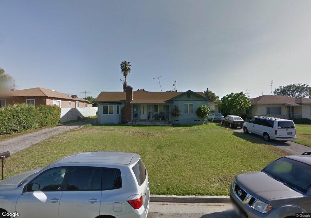
1248 E Mcwood St West Covina, CA 91790
Estimated Value: $1,014,000 - $1,057,000
3
Beds
1
Bath
2,339
Sq Ft
$441/Sq Ft
Est. Value
About This Home
This home is located at 1248 E Mcwood St, West Covina, CA 91790 and is currently estimated at $1,032,226, approximately $441 per square foot. 1248 E Mcwood St is a home located in Los Angeles County with nearby schools including Merced Elementary School, Hollencrest Middle School, and West Covina High School.
Ownership History
Date
Name
Owned For
Owner Type
Purchase Details
Closed on
May 29, 2002
Sold by
Pitts Dale Patrick and Pitts Patricia Louise
Bought by
Saldamando Ricardo
Current Estimated Value
Home Financials for this Owner
Home Financials are based on the most recent Mortgage that was taken out on this home.
Original Mortgage
$279,900
Outstanding Balance
$118,766
Interest Rate
6.86%
Estimated Equity
$913,460
Purchase Details
Closed on
Nov 18, 1998
Sold by
Family Trust Pitts Dale P And Patricia L Trs
Bought by
Pitts Dale Patrick
Home Financials for this Owner
Home Financials are based on the most recent Mortgage that was taken out on this home.
Original Mortgage
$208,000
Interest Rate
6.84%
Purchase Details
Closed on
Oct 21, 1993
Sold by
Pitts Dale P
Bought by
Pitts Dale Patrick and Pitts Patricia Louise
Create a Home Valuation Report for This Property
The Home Valuation Report is an in-depth analysis detailing your home's value as well as a comparison with similar homes in the area
Home Values in the Area
Average Home Value in this Area
Purchase History
| Date | Buyer | Sale Price | Title Company |
|---|---|---|---|
| Saldamando Ricardo | $350,000 | Ticor Title | |
| Pitts Dale Patrick | -- | First American Title Co | |
| Pitts Dale Patrick | -- | -- |
Source: Public Records
Mortgage History
| Date | Status | Borrower | Loan Amount |
|---|---|---|---|
| Open | Saldamando Ricardo | $279,900 | |
| Previous Owner | Pitts Dale Patrick | $208,000 |
Source: Public Records
Tax History Compared to Growth
Tax History
| Year | Tax Paid | Tax Assessment Tax Assessment Total Assessment is a certain percentage of the fair market value that is determined by local assessors to be the total taxable value of land and additions on the property. | Land | Improvement |
|---|---|---|---|---|
| 2025 | $6,361 | $506,749 | $242,873 | $263,876 |
| 2024 | $6,361 | $496,813 | $238,111 | $258,702 |
| 2023 | $6,048 | $487,073 | $233,443 | $253,630 |
| 2022 | $6,096 | $477,523 | $228,866 | $248,657 |
| 2021 | $5,921 | $468,161 | $224,379 | $243,782 |
| 2019 | $5,764 | $454,277 | $217,725 | $236,552 |
| 2018 | $5,447 | $445,370 | $213,456 | $231,914 |
| 2016 | $4,975 | $428,077 | $205,168 | $222,909 |
| 2015 | $4,873 | $421,648 | $202,087 | $219,561 |
| 2014 | $4,844 | $413,390 | $198,129 | $215,261 |
Source: Public Records
Map
Nearby Homes
- 1850 Neff Ave
- 17040 E Holton St
- 16422 Francisquito Ave
- 1834 Valinda Ave
- 1623 E Francisquito Ave
- 1450 Westcastle
- 1517 Mccabe Way
- 1495 Mccabe Way
- 1704 Pass And Covina Rd
- 1300 S Fleetwell Ave
- 1408 Millcreek
- 1038 E Herring Ave
- 1516 Wimbledon Ct
- 0 E Harvest Moon St
- 920 E Herring Ave
- 1681 Aspen Village Way
- 1635 Park Vista Way
- 1306 S Cajon Ave
- 1257 N Harvest Walk Dr Unit 42
- 1433 Kauai St
- 1300 E Mcwood St
- 1240 E Mcwood St
- 1824 Shale Ave
- 1236 E Mcwood St
- 1308 E Mcwood St
- 1820 Shale Ave
- 1821 Shale Ave
- 1232 E Mcwood St
- 1249 E Mcwood St
- 1816 Shale Ave
- 1241 E Mcwood St
- 1301 E Mcwood St
- 1817 N Avington Ave
- 1817 Shale Ave
- 1316 E Mcwood St
- 1818 Wren Ave
- 1237 E Mcwood St
- 1307 E Mcwood St
- 1224 E Mcwood St
- 1811 N Avington Ave