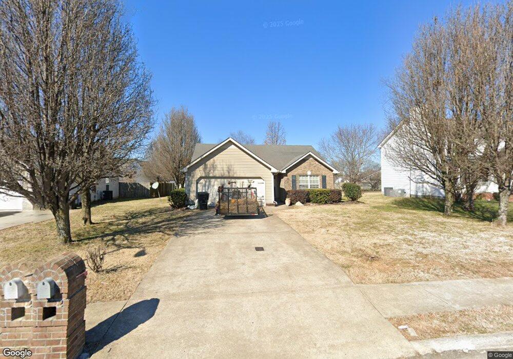
1248 Saint Andrews Dr Murfreesboro, TN 37128
Estimated Value: $307,211 - $356,000
--
Bed
2
Baths
1,270
Sq Ft
$265/Sq Ft
Est. Value
About This Home
This home is located at 1248 Saint Andrews Dr, Murfreesboro, TN 37128 and is currently estimated at $336,303, approximately $264 per square foot. 1248 Saint Andrews Dr is a home located in Rutherford County with nearby schools including Scales Elementary School, Rockvale Middle School, and Rockvale High School.
Ownership History
Date
Name
Owned For
Owner Type
Purchase Details
Closed on
Sep 17, 2012
Sold by
Bailey Michael
Bought by
Bailey Michael
Current Estimated Value
Purchase Details
Closed on
Nov 5, 2010
Sold by
Leblanc Tonya Renee
Bought by
Bailey Michael
Home Financials for this Owner
Home Financials are based on the most recent Mortgage that was taken out on this home.
Original Mortgage
$88,000
Interest Rate
4.33%
Purchase Details
Closed on
Jan 22, 2003
Sold by
Mcewen Joe T
Bought by
Renee Leblanc Tonya
Purchase Details
Closed on
Jan 16, 2002
Sold by
Leblanc Brian S
Bought by
Renee Leblanc Tonya
Purchase Details
Closed on
Oct 17, 2000
Sold by
Cason Lane Development
Bought by
Leblanc Tonya R
Create a Home Valuation Report for This Property
The Home Valuation Report is an in-depth analysis detailing your home's value as well as a comparison with similar homes in the area
Home Values in the Area
Average Home Value in this Area
Purchase History
| Date | Buyer | Sale Price | Title Company |
|---|---|---|---|
| Bailey Michael | -- | -- | |
| Bailey Michael | $110,000 | -- | |
| Renee Leblanc Tonya | -- | -- | |
| Renee Leblanc Tonya | -- | -- | |
| Leblanc Tonya R | $102,900 | -- |
Source: Public Records
Mortgage History
| Date | Status | Borrower | Loan Amount |
|---|---|---|---|
| Previous Owner | Leblanc Tonya R | $88,000 |
Source: Public Records
Tax History Compared to Growth
Tax History
| Year | Tax Paid | Tax Assessment Tax Assessment Total Assessment is a certain percentage of the fair market value that is determined by local assessors to be the total taxable value of land and additions on the property. | Land | Improvement |
|---|---|---|---|---|
| 2025 | -- | $63,925 | $13,750 | $50,175 |
| 2024 | -- | $63,925 | $13,750 | $50,175 |
| 2023 | $1,199 | $63,925 | $13,750 | $50,175 |
| 2022 | $1,033 | $63,925 | $13,750 | $50,175 |
| 2021 | $972 | $43,775 | $9,375 | $34,400 |
| 2020 | $972 | $43,775 | $9,375 | $34,400 |
| 2019 | $972 | $43,775 | $9,375 | $34,400 |
| 2018 | $1,335 | $43,775 | $0 | $0 |
| 2017 | $1,230 | $31,625 | $0 | $0 |
| 2016 | $1,230 | $31,625 | $0 | $0 |
| 2015 | $1,230 | $31,625 | $0 | $0 |
| 2014 | $786 | $31,625 | $0 | $0 |
| 2013 | -- | $32,425 | $0 | $0 |
Source: Public Records
Map
Nearby Homes
- 2940 Waywood Dr
- 1518 Saint Andrews Dr
- 1421 Rebecca Johns Dr
- 1442 Rebecca Johns Dr Unit V20
- 3331 Alta Ln
- 3315 Alta Ln
- 725 Stonetrace Dr
- 2905 Stonehedge Dr
- 627 Tidesridge Ct
- 647 Stonetrace Dr
- 1710 Locerbie Dr
- 412 Conhocken Ct
- 1541 Teresa Ln
- 2307 Katie Ct
- 1725 Satterfield Ct
- 1417 Ovaldale Dr
- 1712 Odessa Ave
- 1823 Joben Dr
- 1419 Cason Trail
- 1736 Bellamy Ln
- 1252 Saint Andrews Dr
- 1244 Saint Andrews Dr
- 1195 Portree Ct
- 1191 Portree Ct
- 1256 Saint Andrews Dr
- 1240 Saint Andrews Dr
- 1198 Portree Ct
- 1186 Everton Dr
- 1253 Saint Andrews Dr
- 1257 Saint Andrews Dr
- 1187 Portree Ct
- 1182 Everton Dr
- 1260 Saint Andrews Dr
- 1261 Saint Andrews Dr
- 1194 Portree Ct
- 1249 St Andrews Dr
- 1249 Saint Andrews Dr
- 1183 Portree Ct
- 1178 Everton Dr
- 1190 Portree Ct