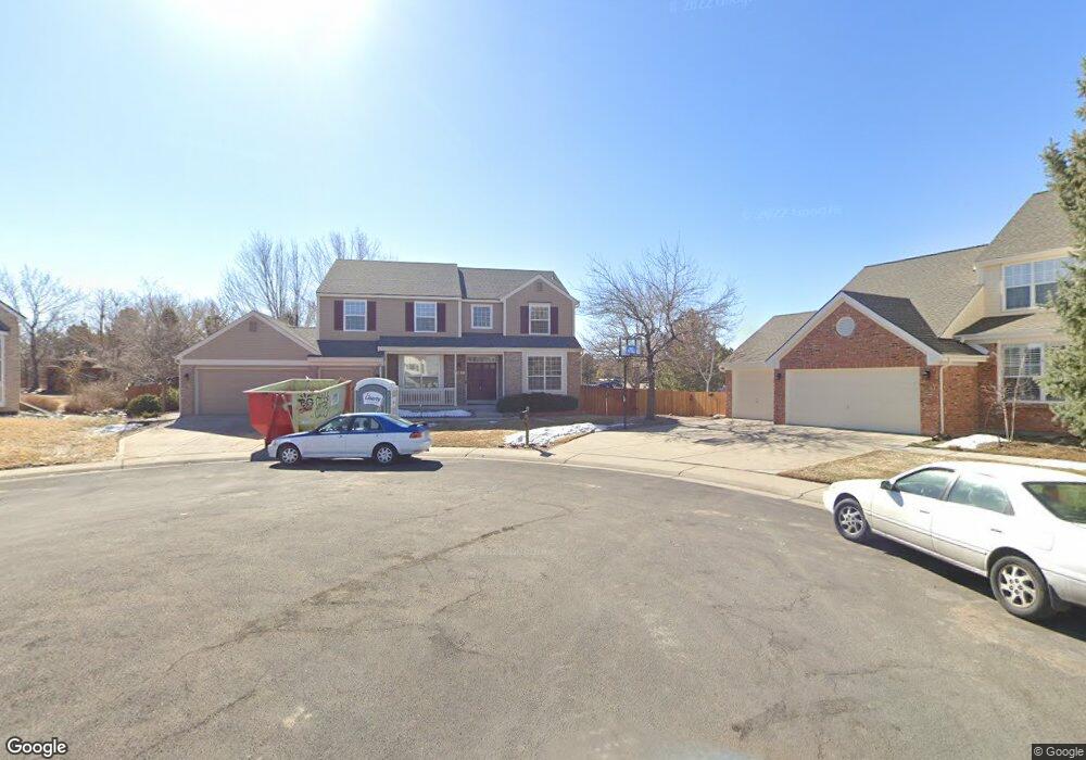
12480 Navajo Ct Denver, CO 80234
Home Farm NeighborhoodEstimated Value: $822,000 - $964,000
4
Beds
3
Baths
2,856
Sq Ft
$306/Sq Ft
Est. Value
About This Home
This home is located at 12480 Navajo Ct, Denver, CO 80234 and is currently estimated at $874,632, approximately $306 per square foot. 12480 Navajo Ct is a home located in Adams County with nearby schools including Arapahoe Ridge Elementary School, Silver Hills Middle School, and Mountain Range High School.
Ownership History
Date
Name
Owned For
Owner Type
Purchase Details
Closed on
Nov 30, 2021
Sold by
Bergstrom James W and Bergstrom Linda A
Bought by
Brusate Peter C and Brusate Karyn M
Current Estimated Value
Home Financials for this Owner
Home Financials are based on the most recent Mortgage that was taken out on this home.
Original Mortgage
$626,400
Outstanding Balance
$575,969
Interest Rate
3.09%
Mortgage Type
New Conventional
Estimated Equity
$298,663
Purchase Details
Closed on
May 14, 1997
Sold by
Colorado North Company Llc
Bought by
Bergstrom James W and Bergstrom Linda A
Home Financials for this Owner
Home Financials are based on the most recent Mortgage that was taken out on this home.
Original Mortgage
$195,800
Interest Rate
8.16%
Purchase Details
Closed on
Jan 31, 1997
Sold by
Home Farm Company Llc
Bought by
Colorado North Company Llc
Create a Home Valuation Report for This Property
The Home Valuation Report is an in-depth analysis detailing your home's value as well as a comparison with similar homes in the area
Home Values in the Area
Average Home Value in this Area
Purchase History
| Date | Buyer | Sale Price | Title Company |
|---|---|---|---|
| Brusate Peter C | $783,000 | Land Title | |
| Bergstrom James W | $251,386 | Land Title | |
| Colorado North Company Llc | $161,130 | Land Title |
Source: Public Records
Mortgage History
| Date | Status | Borrower | Loan Amount |
|---|---|---|---|
| Open | Brusate Peter C | $626,400 | |
| Previous Owner | Bergstrom James W | $195,800 |
Source: Public Records
Tax History Compared to Growth
Tax History
| Year | Tax Paid | Tax Assessment Tax Assessment Total Assessment is a certain percentage of the fair market value that is determined by local assessors to be the total taxable value of land and additions on the property. | Land | Improvement |
|---|---|---|---|---|
| 2024 | $5,687 | $55,060 | $9,000 | $46,060 |
| 2023 | $5,626 | $61,490 | $9,740 | $51,750 |
| 2022 | $3,851 | $42,430 | $10,010 | $32,420 |
| 2021 | $3,851 | $42,430 | $10,010 | $32,420 |
| 2020 | $3,454 | $39,600 | $10,300 | $29,300 |
| 2019 | $4,223 | $39,600 | $10,300 | $29,300 |
| 2018 | $3,915 | $35,510 | $7,200 | $28,310 |
| 2017 | $3,532 | $35,510 | $7,200 | $28,310 |
| 2016 | $3,332 | $32,470 | $6,770 | $25,700 |
| 2015 | $3,327 | $32,470 | $6,770 | $25,700 |
| 2014 | -- | $30,420 | $5,890 | $24,530 |
Source: Public Records
Map
Nearby Homes
- 12671 Home Farm Ln
- 12705 Kalamath Ct
- 12705 Home Farm Dr
- 930 W 128th Place
- 920 W 128th Place
- 975 W 128th Place
- 935 W 128th Place
- 931 W 128th Place
- 834 W 128th Place
- 851 W 128th Place
- 811 W 128th Place
- 12173 Melody Dr Unit 303
- 12151 Melody Dr Unit 202
- 12902 Harmony Pkwy
- 12141 Melody Dr Unit 302
- 12901 Galapago St
- 12166 Melody Dr Unit 202
- 12172 Melody Dr Unit 302
- 12186 Melody Dr Unit 104
- 1872 W 130th Dr
- 12490 Navajo Ct
- 12481 Navajo Ct
- 12469 Mariposa Ct
- 1134 W 124th Ct
- 12491 Navajo Ct
- 12479 Mariposa Ct
- 12458 Mariposa Ct
- 12489 Mariposa Ct
- 1144 W 124th Ct
- 1153 W 124th Ct
- 12468 Mariposa Ct
- 1114 W 124th Ct
- 12478 Mariposa Ct
- 1194 W 125th Dr
- 1154 W 124th Ct
- 12499 Mariposa Ct
- 12488 Mariposa Ct
- 1501 W 124th Ave Unit 100
- 1133 W 124th Ct
- 1104 W 124th Ct