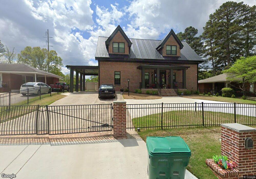
1249 Sanders Way Unit 3 Morrow, GA 30260
Estimated Value: $323,655 - $366,000
3
Beds
3
Baths
2,970
Sq Ft
$117/Sq Ft
Est. Value
About This Home
This home is located at 1249 Sanders Way Unit 3, Morrow, GA 30260 and is currently estimated at $348,885, approximately $117 per square foot. 1249 Sanders Way Unit 3 is a home located in Clayton County with nearby schools including Lake City Elementary School, Babb Middle School, and Forest Park High School.
Ownership History
Date
Name
Owned For
Owner Type
Purchase Details
Closed on
May 31, 2002
Sold by
Meeks Antoine
Bought by
Bernard Seve
Current Estimated Value
Home Financials for this Owner
Home Financials are based on the most recent Mortgage that was taken out on this home.
Original Mortgage
$117,500
Interest Rate
6.67%
Purchase Details
Closed on
May 10, 2002
Sold by
Walker John D and Walker Rhonda
Bought by
Meeks Antoine
Home Financials for this Owner
Home Financials are based on the most recent Mortgage that was taken out on this home.
Original Mortgage
$117,500
Interest Rate
6.67%
Purchase Details
Closed on
Sep 11, 2000
Sold by
Bowen Steven L and Bowen Lisa L
Bought by
Walker John D and Walker Rhonda
Home Financials for this Owner
Home Financials are based on the most recent Mortgage that was taken out on this home.
Original Mortgage
$86,900
Interest Rate
7.92%
Mortgage Type
New Conventional
Create a Home Valuation Report for This Property
The Home Valuation Report is an in-depth analysis detailing your home's value as well as a comparison with similar homes in the area
Home Values in the Area
Average Home Value in this Area
Purchase History
| Date | Buyer | Sale Price | Title Company |
|---|---|---|---|
| Bernard Seve | $5,000 | -- | |
| Meeks Antoine | $110,000 | -- | |
| Walker John D | $91,500 | -- |
Source: Public Records
Mortgage History
| Date | Status | Borrower | Loan Amount |
|---|---|---|---|
| Previous Owner | Bernard Seve | $117,500 | |
| Previous Owner | Meeks Antoine | $104,500 | |
| Previous Owner | Walker John D | $86,900 |
Source: Public Records
Tax History Compared to Growth
Tax History
| Year | Tax Paid | Tax Assessment Tax Assessment Total Assessment is a certain percentage of the fair market value that is determined by local assessors to be the total taxable value of land and additions on the property. | Land | Improvement |
|---|---|---|---|---|
| 2025 | $7,665 | $211,680 | $6,400 | $205,280 |
| 2024 | $8,278 | $222,200 | $6,400 | $215,800 |
| 2023 | $2,383 | $94,000 | $6,580 | $87,420 |
| 2022 | $3,297 | $94,000 | $6,580 | $87,420 |
| 2021 | $1,210 | $96,720 | $6,400 | $90,320 |
| 2020 | $1,225 | $40,637 | $6,400 | $34,237 |
| 2019 | $1,281 | $41,562 | $5,200 | $36,362 |
| 2018 | $1,291 | $41,793 | $5,200 | $36,593 |
| 2017 | $899 | $32,102 | $5,200 | $26,902 |
| 2016 | $628 | $27,584 | $5,200 | $22,384 |
| 2015 | $628 | $0 | $0 | $0 |
| 2014 | $717 | $30,607 | $5,200 | $25,407 |
Source: Public Records
Map
Nearby Homes
- 1167 Sanders Dr
- 1112 Reynolds Ct Unit 4
- 5489 Ahyoka Dr
- 1615 Dellwood Cir
- 98 Werner Brook Way SW
- 5068 Lorraine Place
- 1638 Dellwood Cir
- 843 White Oak Dr
- 0 Ash St Unit 10563129
- 1639 Burks Dr
- 5344 Sharon St
- 1063 Pine Mountain Dr
- 5570 Ash St
- 804 Linda Way
- 5355 Sharon St
- 5012 East St
- 1343 Burbank Trail
- 791 Alice St
- 965 Cone Rd
- 5690 Cypress Dr
- 1249 Sanders
- 1257 Sanders Way
- 1241 Sanders Way
- 1265 Sanders Way
- 1252 Sanders Way
- 1233 Sanders Way Unit 2
- 1262 Sanders Way
- 1240 Sanders Way
- 1273 Sanders Way
- 1225 Sanders Way
- 1232 Sanders Way Unit 2
- 1279 Sanders Way
- 1217 Sanders Way
- 1297 Sanders Dr
- 1224 Sanders Way Unit 2
- 1283 Sanders Dr Unit 3
- 1277 Sanders Dr
- 1263 Sanders Dr
- 1211 Sanders Way
- 1216 Sanders Way