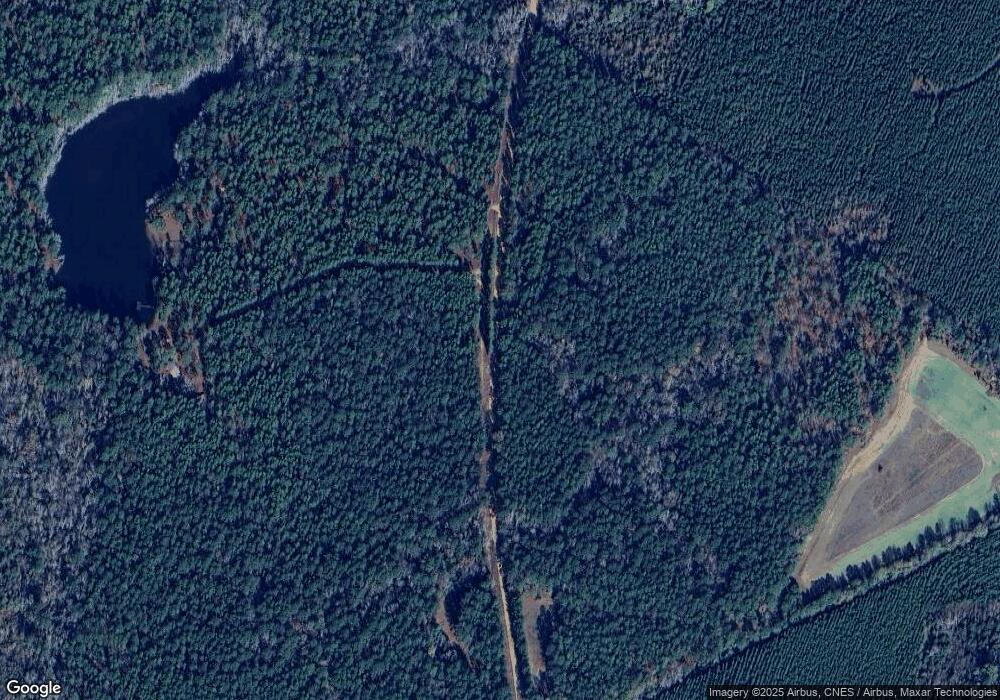
1249 Shepard Rd Bartow, GA 30413
Estimated Value: $228,000 - $497,000
Studio
--
Bath
1,194
Sq Ft
$307/Sq Ft
Est. Value
About This Home
This home is located at 1249 Shepard Rd, Bartow, GA 30413 and is currently estimated at $366,816, approximately $307 per square foot. 1249 Shepard Rd is a home with nearby schools including Johnson County Elementary School, Johnson County Middle School, and Johnson County High School.
Ownership History
Date
Name
Owned For
Owner Type
Purchase Details
Closed on
Apr 11, 2022
Sold by
Harrison Samuel Hughel
Bought by
Davis Family Tree Farms Llc
Current Estimated Value
Home Financials for this Owner
Home Financials are based on the most recent Mortgage that was taken out on this home.
Original Mortgage
$356,000
Outstanding Balance
$325,242
Interest Rate
4.42%
Mortgage Type
New Conventional
Estimated Equity
$41,574
Purchase Details
Closed on
Sep 29, 1994
Sold by
Powell Floyd B
Bought by
Harrison Samuel
Create a Home Valuation Report for This Property
The Home Valuation Report is an in-depth analysis detailing your home's value as well as a comparison with similar homes in the area
Purchase History
| Date | Buyer | Sale Price | Title Company |
|---|---|---|---|
| Davis Family Tree Farms Llc | $445,000 | -- | |
| Harrison Samuel | -- | -- |
Source: Public Records
Mortgage History
| Date | Status | Borrower | Loan Amount |
|---|---|---|---|
| Open | Davis Family Tree Farms Llc | $356,000 |
Source: Public Records
Tax History
| Year | Tax Paid | Tax Assessment Tax Assessment Total Assessment is a certain percentage of the fair market value that is determined by local assessors to be the total taxable value of land and additions on the property. | Land | Improvement |
|---|---|---|---|---|
| 2024 | $1,172 | $68,778 | $62,332 | $6,446 |
| 2023 | $1,053 | $68,778 | $62,332 | $6,446 |
| 2022 | $1,961 | $68,778 | $62,332 | $6,446 |
| 2021 | $1,132 | $38,605 | $33,277 | $5,328 |
| 2020 | $1,177 | $38,605 | $33,277 | $5,328 |
| 2019 | $1,210 | $39,688 | $33,277 | $6,411 |
| 2018 | $1,164 | $39,688 | $33,277 | $6,411 |
| 2017 | $1,208 | $39,688 | $33,277 | $6,411 |
| 2016 | $1,164 | $39,688 | $33,277 | $6,411 |
| 2015 | -- | $40,357 | $33,277 | $7,080 |
| 2014 | -- | $40,357 | $33,277 | $7,080 |
| 2013 | -- | $40,357 | $33,276 | $7,080 |
Source: Public Records
Map
Nearby Homes
- 22 Jl Price Rd
- 0 Smith Rd
- 2195 Montgomery St
- 55 Hatcher St
- 53 Averett St
- 7782 Church St
- 151 Brantley Midas Rd
- 1055 Scruggs Cir
- 2829 Baldee Rd
- 7170 Church St
- 426 Wadley Coleman Lake Rd
- 69 S Main St
- 0 Bartow-Dublin Rd Unit 24028627
- 0 Bartow-Dublin Rd Unit 10559571
- 35 Cheatham St
- 65 W Calhoun St
- 209 S Main St
- 65 E Calhoun St
- 1274 Georgia 171
- 0 Newman Smith Rd Unit 10573699
- 1141 Shepard Rd
- 1487 Shepard Rd
- 221 Ga Hwy
- 117 Mixon St
- 108 Mixon Rd
- 5509 Us Highway 221 Hwy N
- 470 Pollett Rd
- 117 Mixon Rd
- Tract 26 Pollett Rd
- Tract 25 Pollett Rd
- 115 Ozie Mason Rd
- Tract 27 Pollett Rd
- Tract 28 Pollett Rd
- Tract 20 Pollett Rd
- Tract 32 Pollett Rd
- Tract 33 Pollett Rd
- Tract 30 Pollett Rd
- Tract 19 Pollett Rd
