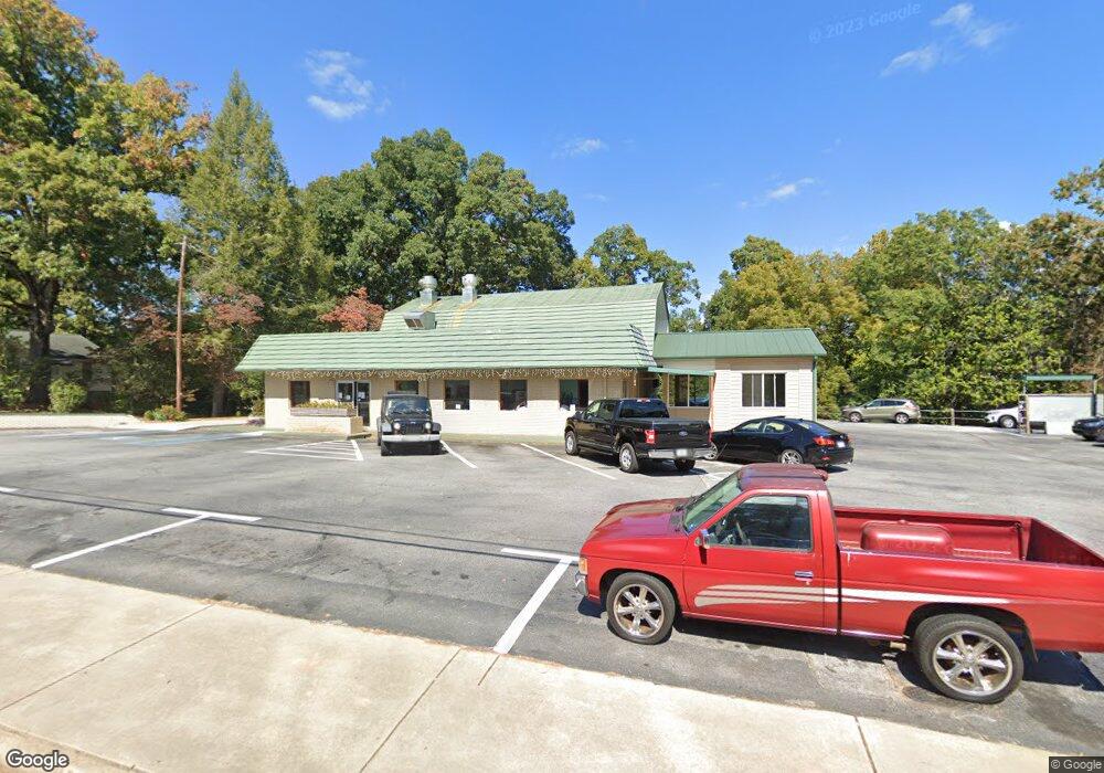
1249 W Main St West Union, SC 29696
--
Bed
--
Bath
3,149
Sq Ft
0.7
Acres
About This Home
This home is located at 1249 W Main St, West Union, SC 29696. 1249 W Main St is a home located in Oconee County with nearby schools including Walhalla Elementary School, Walhalla Middle School, and Walhalla High School.
Ownership History
Date
Name
Owned For
Owner Type
Purchase Details
Closed on
Oct 10, 2019
Sold by
Blue Ridge Bank
Bought by
Bugg Bobby Lee
Home Financials for this Owner
Home Financials are based on the most recent Mortgage that was taken out on this home.
Original Mortgage
$144,690
Outstanding Balance
$94,953
Interest Rate
3.5%
Mortgage Type
Commercial
Purchase Details
Closed on
Nov 20, 2014
Sold by
Moore Keevin E
Bought by
Cooper Ii Curtis T and Cooper Curtis T
Purchase Details
Closed on
Sep 30, 2011
Sold by
Cooper Rachel Lee
Bought by
Rabun County Bank
Create a Home Valuation Report for This Property
The Home Valuation Report is an in-depth analysis detailing your home's value as well as a comparison with similar homes in the area
Home Values in the Area
Average Home Value in this Area
Purchase History
| Date | Buyer | Sale Price | Title Company |
|---|---|---|---|
| Bugg Bobby Lee | $168,290 | None Available | |
| Cooper Ii Curtis T | -- | -- | |
| Rabun County Bank | $200,000 | -- |
Source: Public Records
Mortgage History
| Date | Status | Borrower | Loan Amount |
|---|---|---|---|
| Open | Bugg Bobby Lee | $144,690 |
Source: Public Records
Tax History Compared to Growth
Tax History
| Year | Tax Paid | Tax Assessment Tax Assessment Total Assessment is a certain percentage of the fair market value that is determined by local assessors to be the total taxable value of land and additions on the property. | Land | Improvement |
|---|---|---|---|---|
| 2025 | $2,989 | $8,075 | $1,585 | $6,490 |
| 2024 | $2,989 | $8,075 | $1,585 | $6,490 |
| 2023 | $2,927 | $8,075 | $1,585 | $6,490 |
| 2022 | $2,932 | $8,075 | $1,585 | $6,490 |
| 2021 | $1,980 | $8,075 | $1,585 | $6,490 |
| 2020 | $2,436 | $0 | $0 | $0 |
| 2019 | $2,436 | $0 | $0 | $0 |
| 2018 | $2,372 | $0 | $0 | $0 |
| 2017 | $1,980 | $0 | $0 | $0 |
| 2016 | $1,980 | $0 | $0 | $0 |
| 2015 | -- | $0 | $0 | $0 |
| 2014 | -- | $12,120 | $2,695 | $9,426 |
| 2013 | -- | $0 | $0 | $0 |
Source: Public Records
Map
Nearby Homes
- 204 Friendship Dr
- 209 Moore Ave
- 00 Keowee St
- 00 Branch St
- 208 Branch St
- 2539 Blue Ridge Blvd
- 000 Anderson St
- 412 N Spring St
- 320 Jaynes St
- 115 Burns Mill Rd
- 00 S Spring St
- 203 Tulip Dr
- 117 Edney Dr
- 301 Shadybrook Dr Unit B
- 00 N Church St
- 2423 Westminster Hwy
- 00 Fox Run Rd
- Lot 57 Fox Run Rd
- 221 Cub Cove Dr
- 1198 Anderson St
- 1250 W Main St
- 1221 W Main St
- 101 Elizabeth St
- 00 W Main St
- 1107 E Main St
- 1320 W Main St
- 107 Elizabeth St
- 1204 W Main St
- 1105 E Main St
- 1103 E Main St
- 1340 W Main St
- 02 Moore Ave
- 00 Moore Ave
- 1100 E Main St
- 104 Moore Ave
- 1101 E Main St
- 1394 W Main St
- 108 Moore Ave
- 202 Friendship Dr
- 206 Friendship Dr