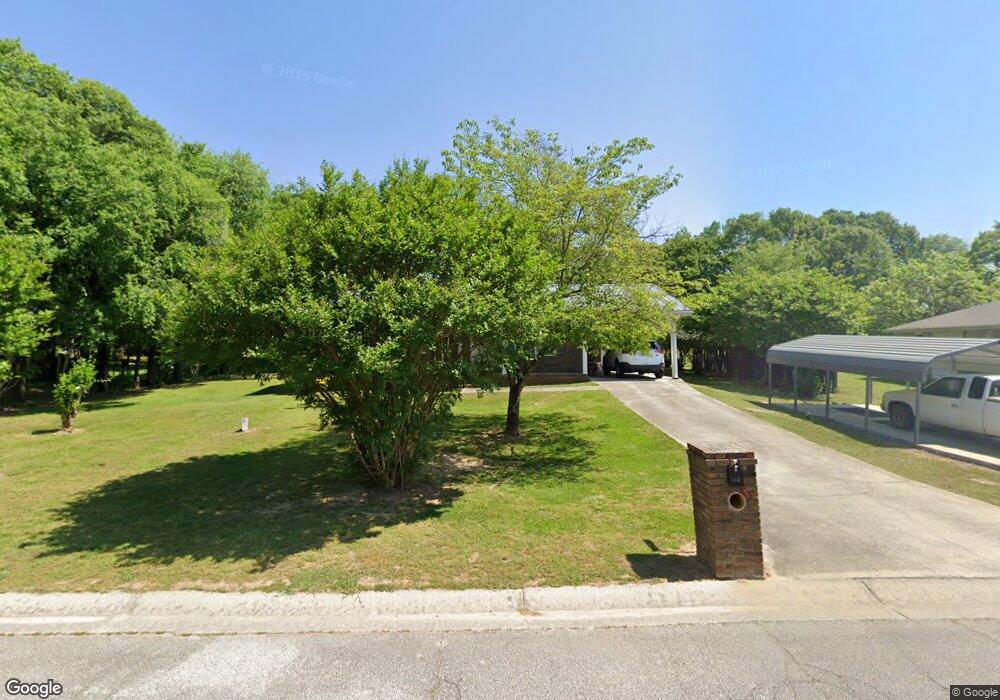
125 Ashwood Way Winder, GA 30680
Estimated Value: $253,295 - $292,000
3
Beds
2
Baths
1,000
Sq Ft
$277/Sq Ft
Est. Value
About This Home
This home is located at 125 Ashwood Way, Winder, GA 30680 and is currently estimated at $276,824, approximately $276 per square foot. 125 Ashwood Way is a home located in Barrow County with nearby schools including County Line Elementary School, Russell Middle School, and Winder-Barrow High School.
Ownership History
Date
Name
Owned For
Owner Type
Purchase Details
Closed on
Jun 9, 2004
Sold by
Aycock Betty
Bought by
Richter Melanie
Current Estimated Value
Home Financials for this Owner
Home Financials are based on the most recent Mortgage that was taken out on this home.
Original Mortgage
$86,250
Interest Rate
5.98%
Mortgage Type
New Conventional
Purchase Details
Closed on
Apr 7, 1993
Sold by
Reynolds James E and Wade Don L
Bought by
Flanagan Charles W and Flanagan Eloise B
Home Financials for this Owner
Home Financials are based on the most recent Mortgage that was taken out on this home.
Original Mortgage
$59,400
Interest Rate
7.75%
Mortgage Type
FHA
Create a Home Valuation Report for This Property
The Home Valuation Report is an in-depth analysis detailing your home's value as well as a comparison with similar homes in the area
Home Values in the Area
Average Home Value in this Area
Purchase History
| Date | Buyer | Sale Price | Title Company |
|---|---|---|---|
| Richter Melanie | $75,000 | -- | |
| Flanagan Charles W | $59,400 | -- |
Source: Public Records
Mortgage History
| Date | Status | Borrower | Loan Amount |
|---|---|---|---|
| Closed | Richter Melanie | $86,250 | |
| Previous Owner | Flanagan Charles W | $59,400 |
Source: Public Records
Tax History Compared to Growth
Tax History
| Year | Tax Paid | Tax Assessment Tax Assessment Total Assessment is a certain percentage of the fair market value that is determined by local assessors to be the total taxable value of land and additions on the property. | Land | Improvement |
|---|---|---|---|---|
| 2024 | $600 | $80,372 | $20,800 | $59,572 |
| 2023 | $447 | $80,372 | $20,800 | $59,572 |
| 2022 | $604 | $58,179 | $17,200 | $40,979 |
| 2021 | $447 | $50,667 | $12,000 | $38,667 |
| 2020 | $426 | $44,887 | $12,000 | $32,887 |
| 2019 | $395 | $37,107 | $10,000 | $27,107 |
| 2018 | $380 | $37,107 | $10,000 | $27,107 |
| 2017 | $856 | $28,676 | $8,800 | $19,876 |
| 2016 | $794 | $27,142 | $8,800 | $18,342 |
| 2015 | $803 | $27,368 | $8,800 | $18,568 |
| 2014 | $674 | $24,282 | $5,488 | $18,794 |
| 2013 | -- | $23,422 | $5,488 | $17,934 |
Source: Public Records
Map
Nearby Homes
- 932 Century Oak Dr
- 926 Live Oak Ct Unit 2
- 469 Plantation Dr
- 0 E Northcrest Dr Unit 10648147
- 615 Wellington Dr
- 746 Baskins Cir
- 412 Regan Dr
- 27 Creekside Dr
- 401 N 5th Ave
- 436 Northcrest Dr
- 623 Teal Dr
- 381 W Candler St
- 713 Mallard Dr
- 300 Hyde Park
- 290 Hyde Park
- 172 Settle St
- The Paisley Plan at Rockwell Farms
- The Rockwell Plan at Rockwell Farms
- 127 Ashwood Way
- 123 Ashwood Way Unit 3
- 129 Ashwood Way
- 124 Ashwood Way
- 121 Ashwood Way Unit 3
- 121 Ashwood Way
- 121 Ashwood Way Unit 3
- 126 Ashwood Way
- 120 Ashwood Way Unit 3
- 120 Ashwood Way
- 131 Ashwood Way
- 131 Ashwood Way Unit 6
- 127 Ashwood Dr Unit 3
- 127 Ashwood Dr
- 134 Ashwood Ct
- 0 Ashwood Way Unit 8870709
- 0 Ashwood Way Unit 7337603
- 0 Ashwood Way Unit 7347034
- 0 Ashwood Way Unit 7349929
- 119 Ashwood Dr