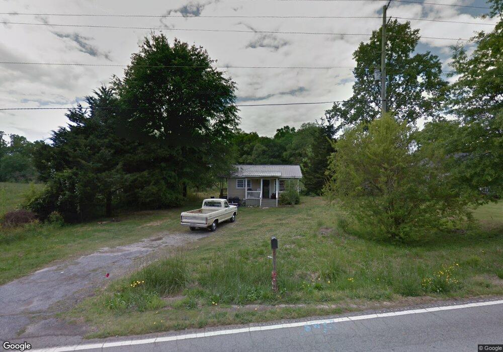
125 Burnt Tanyard Rd West Union, SC 29696
Estimated Value: $74,000 - $213,000
2
Beds
1
Bath
768
Sq Ft
$183/Sq Ft
Est. Value
About This Home
This home is located at 125 Burnt Tanyard Rd, West Union, SC 29696 and is currently estimated at $140,871, approximately $183 per square foot. 125 Burnt Tanyard Rd is a home with nearby schools including Keowee Elementary School, Walhalla Middle School, and Walhalla High School.
Ownership History
Date
Name
Owned For
Owner Type
Purchase Details
Closed on
Jul 15, 2021
Sold by
Powell Keith Julian
Bought by
Calle Company Of The Upstate Llc
Current Estimated Value
Purchase Details
Closed on
Apr 21, 2021
Sold by
Powell John Michael and Powell Keith Julian
Bought by
Powell Keith Julian
Purchase Details
Closed on
Dec 15, 2016
Sold by
Powell Keith Julian
Bought by
Callie Company Of The Upstate Llc
Purchase Details
Closed on
Nov 18, 2015
Sold by
Estate Of Grace Louise Nichols
Bought by
Powell John Michael and Powell Keith Julian
Purchase Details
Closed on
May 27, 2008
Sold by
Powell Grace N
Bought by
Powell Keith J and Powell Deborah F
Create a Home Valuation Report for This Property
The Home Valuation Report is an in-depth analysis detailing your home's value as well as a comparison with similar homes in the area
Home Values in the Area
Average Home Value in this Area
Purchase History
| Date | Buyer | Sale Price | Title Company |
|---|---|---|---|
| Calle Company Of The Upstate Llc | -- | None Available | |
| Powell Keith Julian | -- | None Available | |
| Powell John Michael | -- | None Listed On Document | |
| Powell Keith Julian | -- | None Available | |
| Callie Company Of The Upstate Llc | -- | None Available | |
| Powell Keith Julian | -- | None Available | |
| Powell John Michael | -- | None Available | |
| Powell Keith J | -- | -- |
Source: Public Records
Tax History Compared to Growth
Tax History
| Year | Tax Paid | Tax Assessment Tax Assessment Total Assessment is a certain percentage of the fair market value that is determined by local assessors to be the total taxable value of land and additions on the property. | Land | Improvement |
|---|---|---|---|---|
| 2025 | $449 | $1,395 | $197 | $1,198 |
| 2024 | $449 | $1,395 | $197 | $1,198 |
| 2023 | $449 | $1,395 | $197 | $1,198 |
| 2022 | $455 | $1,395 | $197 | $1,198 |
| 2021 | $460 | $1,343 | $211 | $1,132 |
| 2020 | $460 | $0 | $0 | $0 |
| 2019 | $460 | $0 | $0 | $0 |
| 2018 | $448 | $0 | $0 | $0 |
| 2017 | $421 | $0 | $0 | $0 |
| 2016 | $421 | $0 | $0 | $0 |
| 2015 | -- | $0 | $0 | $0 |
| 2014 | -- | $1,965 | $476 | $1,490 |
| 2013 | -- | $0 | $0 | $0 |
Source: Public Records
Map
Nearby Homes
- 2357 Pickens Hwy
- 665 Brc Dr
- 108 Cranes Crossing Dr
- 270 Colony Ln
- 00 Colony Ln
- TBD Colony Ln
- 00 Wolf Stake Church Rd
- 000 Wolf Stake Church Rd
- 595 Morris Ln
- 00 (Corner) Hwy 183 Keowee School Rd
- 150 Cedar Hill Dr
- TBD Colony Ln
- 1817 Hastehill Dr
- 507 Lariat Loop
- 1907 Queen Dr
- Lot 44 Glassy Water Way
- 310 Falcons Nest Rd
- 130 Quail Haven Dr
- Hudson Plan at Windsor Estates
- Bramante Ranch Plan at Windsor Estates
- 129 Burnt Tanyard Rd
- 138 Burnt Tanyard Rd
- 119 Burnt Tanyard Rd
- 115 Burnt Tanyard Rd
- 141 Burnt Tanyard Rd
- 140 Burnt Tanyard Rd
- 2313 Pickens Hwy
- 143 Burnt Tanyard Rd
- 152 Burnt Tanyard Rd
- 107 Burnt Tanyard Rd
- 108 Burnt Tanyard Rd
- 161 Burnt Tanyard Rd
- 160 Burnt Tanyard Rd
- 376 Owens Dr
- 509 Lynn Dr
- 164 Burnt Tanyard Rd
- 165 Burnt Tanyard Rd
- 505 Lynn Dr
- 403 Welborn Rd
- 411 Welborn Rd