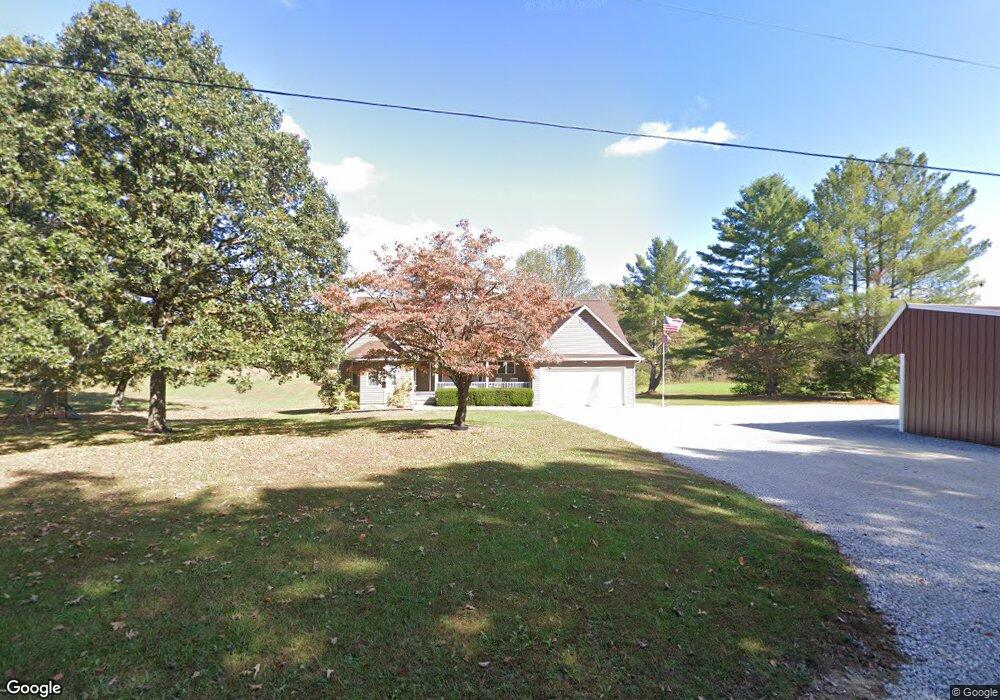
125 Cave Branch Rd Allardt, TN 38504
Estimated Value: $225,000 - $648,000
--
Bed
2
Baths
1,904
Sq Ft
$225/Sq Ft
Est. Value
About This Home
This home is located at 125 Cave Branch Rd, Allardt, TN 38504 and is currently estimated at $428,722, approximately $225 per square foot. 125 Cave Branch Rd is a home located in Fentress County.
Ownership History
Date
Name
Owned For
Owner Type
Purchase Details
Closed on
Aug 8, 2005
Sold by
Not Provided
Bought by
Hancock Ken
Current Estimated Value
Purchase Details
Closed on
Nov 19, 1987
Bought by
Hancock Jeffrey E
Create a Home Valuation Report for This Property
The Home Valuation Report is an in-depth analysis detailing your home's value as well as a comparison with similar homes in the area
Home Values in the Area
Average Home Value in this Area
Purchase History
| Date | Buyer | Sale Price | Title Company |
|---|---|---|---|
| Hancock Ken | -- | -- | |
| Hancock Jeffrey E | $2,500 | -- |
Source: Public Records
Tax History Compared to Growth
Tax History
| Year | Tax Paid | Tax Assessment Tax Assessment Total Assessment is a certain percentage of the fair market value that is determined by local assessors to be the total taxable value of land and additions on the property. | Land | Improvement |
|---|---|---|---|---|
| 2025 | $954 | $70,700 | $0 | $0 |
| 2024 | $954 | $70,700 | $5,550 | $65,150 |
| 2023 | $954 | $70,700 | $5,550 | $65,150 |
| 2022 | $833 | $43,625 | $4,750 | $38,875 |
| 2021 | $833 | $43,625 | $4,750 | $38,875 |
| 2020 | $833 | $43,625 | $4,750 | $38,875 |
| 2019 | $833 | $43,625 | $4,750 | $38,875 |
| 2018 | $833 | $43,625 | $4,750 | $38,875 |
| 2017 | $833 | $42,000 | $3,975 | $38,025 |
| 2016 | $833 | $42,000 | $3,975 | $38,025 |
| 2015 | $833 | $41,993 | $0 | $0 |
| 2014 | $833 | $41,993 | $0 | $0 |
Source: Public Records
Map
Nearby Homes
- 18.6 Acres Cave Branch Rd
- 18.6 Acres Cave Branch Rd
- 186 Cave Branch Rd
- 4676 Rugby Pike
- 3305 Rugby Pike
- 0 Sam Smith Rd Unit 236295
- 0 Sam Smith Rd Unit LotWP001 23395947
- 0 Sam Smith Rd Unit RTC2865905
- 0 Stockton Rd
- 3136 Rugby Pike
- 40 acres Rugby Pike
- 0 Peter Ford Rd Unit 1319904
- 40 Rugby Pike
- 1010 Smallwood Rd
- 305 Griffin Ln
- 925 Unity Church Rd
- 54 E Ridge Rd
- 997 Unity Church Rd
- 1223 Sheppard Rd
- 831 Fritzsche Loop
- 115 Cave Branch Rd
- 116 Cave Branch Rd
- 155 Cave Branch Rd
- 140 Don Conatser Rd
- 265 Bud Brown Loop Rd
- 199 Don Conatser Rd
- 135 Don Conatser Rd
- 240 Bud Brown Loop Rd
- 215 Bud Brown Loop Rd
- 3848 Rugby Pike
- 700 Levi Hull Rd
- 640 Levi Hull Rd
- 1235 Shirley Rd
- 3914 Rugby Pike
- 0 Shirley Rd Unit 733137
- 0 Shirley Rd Unit 772918
- 0 Shirley Rd Unit 773784
- 0 Shirley Rd Unit 773783
- 0 Shirley Rd Unit 773909
- 0 Shirley Rd Unit 817941