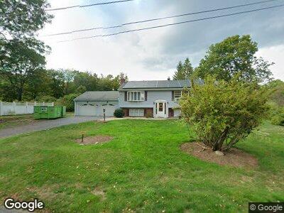
125 Chestnut St Lunenburg, MA 01462
Estimated Value: $430,000 - $490,000
3
Beds
2
Baths
1,248
Sq Ft
$366/Sq Ft
Est. Value
About This Home
This home is located at 125 Chestnut St, Lunenburg, MA 01462 and is currently estimated at $457,343, approximately $366 per square foot. 125 Chestnut St is a home located in Worcester County with nearby schools including Lunenburg Primary School, Lunenburg High School, and St Bernards Elementary School.
Ownership History
Date
Name
Owned For
Owner Type
Purchase Details
Closed on
Mar 3, 2023
Sold by
Hays James A and Hays Elizabeth M
Bought by
Hays Lt
Current Estimated Value
Purchase Details
Closed on
Jul 26, 1972
Bought by
Hays James A and Hays Elizabeth M
Create a Home Valuation Report for This Property
The Home Valuation Report is an in-depth analysis detailing your home's value as well as a comparison with similar homes in the area
Home Values in the Area
Average Home Value in this Area
Purchase History
| Date | Buyer | Sale Price | Title Company |
|---|---|---|---|
| Hays Lt | -- | None Available | |
| Hays James A | $3,500 | -- |
Source: Public Records
Mortgage History
| Date | Status | Borrower | Loan Amount |
|---|---|---|---|
| Previous Owner | Hays James A | $50,000 | |
| Previous Owner | Hays James A | $50,000 |
Source: Public Records
Tax History Compared to Growth
Tax History
| Year | Tax Paid | Tax Assessment Tax Assessment Total Assessment is a certain percentage of the fair market value that is determined by local assessors to be the total taxable value of land and additions on the property. | Land | Improvement |
|---|---|---|---|---|
| 2025 | $5,975 | $416,100 | $131,000 | $285,100 |
| 2024 | $5,608 | $397,700 | $123,600 | $274,100 |
| 2023 | $5,325 | $364,200 | $112,400 | $251,800 |
| 2022 | $5,014 | $291,700 | $93,700 | $198,000 |
| 2020 | $4,974 | $274,500 | $93,900 | $180,600 |
| 2019 | $4,917 | $263,200 | $88,400 | $174,800 |
| 2018 | $4,643 | $235,700 | $88,400 | $147,300 |
| 2017 | $4,482 | $224,300 | $81,600 | $142,700 |
| 2016 | $4,171 | $212,700 | $77,600 | $135,100 |
| 2015 | $3,768 | $205,700 | $73,700 | $132,000 |
Source: Public Records
Map
Nearby Homes
- 63 Holman St
- 319 Highland St
- 830 Massachusetts Ave
- 733 Massachusetts Ave
- 5 Chestnut St
- 711 Massachusetts Ave Unit 2
- 711 Massachusetts Ave Unit 4
- 711 Massachusetts Ave Unit 3
- 711 Massachusetts Ave Unit 1
- 711.8 Massachusetts Ave Unit 8
- 711.7 Massachusetts Ave Unit 7
- 31 School St
- 6 Riley Rd Unit 6
- 35 Leominster Rd
- 95 Royal Fern Dr Unit 95
- 759 Northfield Rd
- 293 West St
- 439 Sunnyhill Rd
- 150 Townsend Harbor Rd
- 77 Electric Ave
- 125 Chestnut St
- 119 Chestnut St
- 120 Chestnut St
- 126 Chestnut St
- 114 Chestnut St
- 111 Highland St
- 105 Chestnut St
- 71 Highland St
- 98 Highland St
- 82 Highland St
- 115 Highland St
- 108 Highland St
- 72 Highland St
- 53 Highland St
- 93 Chestnut St
- 58 Highland St
- 127 Highland St
- 120 Highland St
- 47 Highland St
- 77 Chestnut St