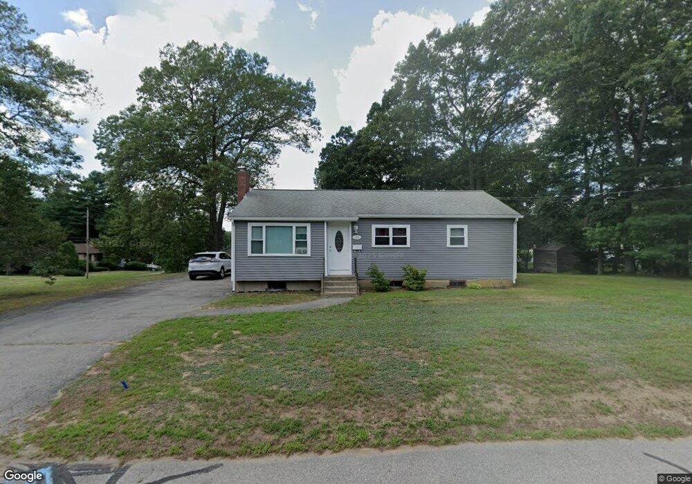
125 Donahue Way Stoughton, MA 02072
Estimated Value: $468,000 - $601,000
3
Beds
1
Bath
1,664
Sq Ft
$317/Sq Ft
Est. Value
About This Home
This home is located at 125 Donahue Way, Stoughton, MA 02072 and is currently estimated at $527,682, approximately $317 per square foot. 125 Donahue Way is a home located in Norfolk County with nearby schools including Wilkins Elementary School, Dr. Robert G. O'Donnell Middle School, and Stoughton High School.
Ownership History
Date
Name
Owned For
Owner Type
Purchase Details
Closed on
Jun 29, 2015
Sold by
Donahue Way Irt and Harback
Bought by
Tankerley Sheri
Current Estimated Value
Purchase Details
Closed on
Aug 10, 2004
Sold by
Harback Peter D and Harback Roberta
Bought by
Donahue Way Rt and Harback
Purchase Details
Closed on
Mar 2, 2004
Sold by
Mansfield Carol A
Bought by
Harback Peter D and Harback Roberta
Create a Home Valuation Report for This Property
The Home Valuation Report is an in-depth analysis detailing your home's value as well as a comparison with similar homes in the area
Home Values in the Area
Average Home Value in this Area
Purchase History
| Date | Buyer | Sale Price | Title Company |
|---|---|---|---|
| Tankerley Sheri | $250,000 | -- | |
| Tankerley Sheri | $250,000 | -- | |
| Donahue Way Rt | -- | -- | |
| Donahue Way Rt | -- | -- | |
| Harback Peter D | $245,000 | -- | |
| Harback Peter D | $245,000 | -- |
Source: Public Records
Tax History Compared to Growth
Tax History
| Year | Tax Paid | Tax Assessment Tax Assessment Total Assessment is a certain percentage of the fair market value that is determined by local assessors to be the total taxable value of land and additions on the property. | Land | Improvement |
|---|---|---|---|---|
| 2025 | $5,113 | $413,000 | $223,300 | $189,700 |
| 2024 | $4,981 | $391,300 | $203,900 | $187,400 |
| 2023 | $4,798 | $354,100 | $186,400 | $167,700 |
| 2022 | $4,714 | $327,100 | $179,300 | $147,800 |
| 2021 | $4,495 | $297,700 | $158,200 | $139,500 |
| 2020 | $4,433 | $297,700 | $158,200 | $139,500 |
| 2019 | $4,392 | $286,300 | $158,200 | $128,100 |
| 2018 | $3,901 | $263,400 | $151,200 | $112,200 |
| 2017 | $3,743 | $258,300 | $149,400 | $108,900 |
| 2016 | $3,823 | $255,400 | $135,400 | $120,000 |
| 2015 | $3,757 | $248,300 | $128,300 | $120,000 |
| 2014 | $3,505 | $222,700 | $117,800 | $104,900 |
Source: Public Records
Map
Nearby Homes
- 178 Carey Cir
- 42 Amherst Rd
- 229 Stoughton St
- 32 Marys Way
- 32 Doty Dr
- 163 Pearl St
- 43 Elderwood Dr Unit 43
- 109 Greenbrook Dr Unit 109
- 103 Kim Terrace Unit A
- 50 Claire Dr Unit C-2-50
- 28 Faxon St Unit 4
- 26 Faxon St Unit 2
- 82 Bailey St
- 64 Laurelwood Dr
- 175 Greenbrook Dr
- 59 Rosewood Dr
- 230 Greenbrook Dr Unit 6-06
- 84 Pearl St
- 11 Springwood Ave
- 435 School St