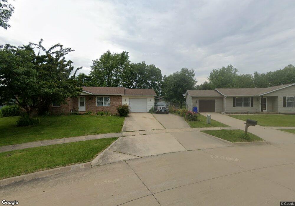
125 Elm Ridge Ct North Liberty, IA 52317
Estimated Value: $222,000 - $245,663
3
Beds
1
Bath
1,088
Sq Ft
$218/Sq Ft
Est. Value
About This Home
This home is located at 125 Elm Ridge Ct, North Liberty, IA 52317 and is currently estimated at $236,666, approximately $217 per square foot. 125 Elm Ridge Ct is a home located in Johnson County with nearby schools including Buford Garner Elementary School, North Central Junior High School, and Liberty High School.
Ownership History
Date
Name
Owned For
Owner Type
Purchase Details
Closed on
Apr 29, 2014
Sold by
Eakes Wade and Eakes Wade Eldon
Bought by
Eakes Carolyn and Eakes Carolyn Ruth
Current Estimated Value
Home Financials for this Owner
Home Financials are based on the most recent Mortgage that was taken out on this home.
Original Mortgage
$112,910
Interest Rate
5.87%
Mortgage Type
Adjustable Rate Mortgage/ARM
Create a Home Valuation Report for This Property
The Home Valuation Report is an in-depth analysis detailing your home's value as well as a comparison with similar homes in the area
Home Values in the Area
Average Home Value in this Area
Purchase History
| Date | Buyer | Sale Price | Title Company |
|---|---|---|---|
| Eakes Carolyn | -- | None Available |
Source: Public Records
Mortgage History
| Date | Status | Borrower | Loan Amount |
|---|---|---|---|
| Closed | Eakes Carolyn | $112,910 |
Source: Public Records
Tax History Compared to Growth
Tax History
| Year | Tax Paid | Tax Assessment Tax Assessment Total Assessment is a certain percentage of the fair market value that is determined by local assessors to be the total taxable value of land and additions on the property. | Land | Improvement |
|---|---|---|---|---|
| 2024 | $3,270 | $204,800 | $57,400 | $147,400 |
| 2023 | $3,050 | $204,800 | $57,400 | $147,400 |
| 2022 | $2,890 | $166,100 | $32,300 | $133,800 |
| 2021 | $2,814 | $166,100 | $32,300 | $133,800 |
| 2020 | $2,814 | $154,500 | $32,300 | $122,200 |
| 2019 | $2,702 | $154,500 | $32,300 | $122,200 |
| 2018 | $2,646 | $148,600 | $32,300 | $116,300 |
| 2017 | $2,646 | $148,600 | $32,300 | $116,300 |
| 2016 | $2,460 | $141,700 | $32,300 | $109,400 |
| 2015 | $2,460 | $141,700 | $32,300 | $109,400 |
| 2014 | $2,276 | $122,800 | $32,300 | $90,500 |
Source: Public Records
Map
Nearby Homes
- 1190 Berkshire Ln
- 142 Elm Ridge Dr
- 115 N Colton Dr
- 470 N Colton Dr
- 1035 Liberty Way
- 100 Cherry Ct Unit 2
- 455 Heritage Place
- 445 Heritage Place
- 425 Heritage Place
- 415 Heritage Place Unit 417
- 825 Kiowa Dr
- 513 Sugar Creek Ln
- 540 Augusta Cir Unit 5
- 400 W Penn St
- 555 Country Ln
- 427 Watts Ct
- 437 Watts Ct
- 1500 Harvest St
- 120 Shannon Dr Unit 4
- 478 Cambria Dr
- 105 Elm Ridge Ct
- 135 Elm Ridge Ct
- 190 Brookfield Ave
- 200 Brookfield Ave
- 75 Elm Ridge Ct
- 145 Elm Ridge Ct
- 100 Elm Ridge Ct
- 180 Brookfield Ave
- 210 Brookfield Ave
- 70 Elm Ridge Ct
- 155 Elm Ridge Ct
- 55 Hawthorne Place
- 160 Elm Ridge Ct
- 65 Elm Ridge Ct
- 65 Hawthorne Place
- 220 Brookfield Ave
- 30 Elm Ridge Ct
- 170 Brookfield Ave
- 45 Hawthorne Place
- 165 Elm Ridge Ct