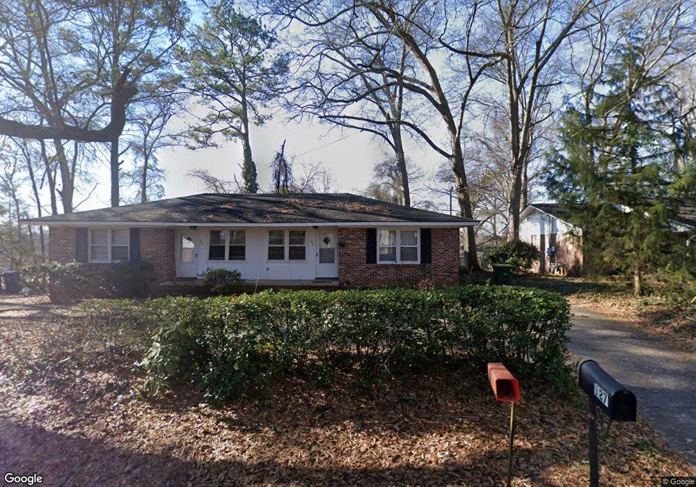
125 Hart Ave Athens, GA 30606
Normaltown NeighborhoodEstimated Value: $377,000 - $504,000
--
Bed
2
Baths
1,604
Sq Ft
$283/Sq Ft
Est. Value
About This Home
This home is located at 125 Hart Ave, Athens, GA 30606 and is currently estimated at $453,998, approximately $283 per square foot. 125 Hart Ave is a home located in Clarke County with nearby schools including Johnnie Lay Burks Elementary School, Clarke Middle School, and Clarke Central High School.
Ownership History
Date
Name
Owned For
Owner Type
Purchase Details
Closed on
Mar 24, 2008
Sold by
Hammond Philip E
Bought by
Athens Best Rentals Llc
Current Estimated Value
Purchase Details
Closed on
Mar 13, 2000
Sold by
Hammond Philip E
Bought by
Athens Best Rentals Llc
Purchase Details
Closed on
Aug 2, 1996
Sold by
Pitts Betty W
Bought by
Hammond Philip E
Create a Home Valuation Report for This Property
The Home Valuation Report is an in-depth analysis detailing your home's value as well as a comparison with similar homes in the area
Home Values in the Area
Average Home Value in this Area
Purchase History
| Date | Buyer | Sale Price | Title Company |
|---|---|---|---|
| Athens Best Rentals Llc | -- | -- | |
| Hammond Philip E | -- | -- | |
| Athens Best Rentals Llc | -- | -- | |
| Hammond Philip E | $76,000 | -- |
Source: Public Records
Mortgage History
| Date | Status | Borrower | Loan Amount |
|---|---|---|---|
| Closed | Hammond Philip E | $0 |
Source: Public Records
Tax History Compared to Growth
Tax History
| Year | Tax Paid | Tax Assessment Tax Assessment Total Assessment is a certain percentage of the fair market value that is determined by local assessors to be the total taxable value of land and additions on the property. | Land | Improvement |
|---|---|---|---|---|
| 2025 | $5,074 | $163,411 | $44,000 | $119,411 |
| 2024 | $5,074 | $155,643 | $44,000 | $111,643 |
| 2023 | $4,864 | $145,943 | $40,000 | $105,943 |
| 2022 | $4,412 | $138,312 | $40,000 | $98,312 |
| 2021 | $2,929 | $86,922 | $40,000 | $46,922 |
| 2020 | $2,794 | $82,922 | $36,000 | $46,922 |
| 2019 | $2,612 | $76,922 | $30,000 | $46,922 |
| 2018 | $2,468 | $72,693 | $30,000 | $42,693 |
| 2017 | $2,092 | $61,617 | $30,000 | $31,617 |
| 2016 | $2,044 | $60,207 | $30,000 | $30,207 |
| 2015 | $1,911 | $56,207 | $26,000 | $30,207 |
| 2014 | $1,778 | $52,207 | $22,000 | $30,207 |
Source: Public Records
Map
Nearby Homes
- 525 King Ave
- 1398 W Hancock Ave
- 145 Sunset Dr
- 215 Holman Ave
- 105 Magnolia Terrace
- 283 King Ave
- 100 Crestview Cir
- 1226 W Broad St
- 1198 W West Hancock Ave W
- 1196 W Hancock Ave Unit 1
- 480 N Billups St
- 206 Fortson Dr
- 1055 Baxter St Unit 504
- 224 Fortson Dr
- 597 Dearing St
- 390 Best Dr
- 552 Cobb St
- 338 Springdale St
- 169 Fortson Cir
- 500 Dearing St Unit 6
- 135 Hart Ave
- 145 Hart Ave
- 36 Holman Ave
- 0 Hart Ave Unit 7636019
- 0 Hart Ave Unit 7609248
- 0 Hart Ave
- 100 Hart Ave
- 215 Hodgson Dr
- 38 Holman Ave
- 147 Hart Ave
- 44 Holman Ave
- 140 Hart Ave
- 225 Hodgson Dr
- W W Broad St Unit 409
- W W Broad St Unit 108
- W W Broad St Unit 335
- W W Broad St Unit 921
- W W Broad St Unit 715
- W W Broad St Unit 332
- W W Broad St Unit 607