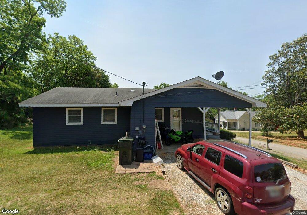
125 Mitchell St Toccoa, GA 30577
Estimated Value: $172,059 - $205,000
3
Beds
2
Baths
1,040
Sq Ft
$179/Sq Ft
Est. Value
About This Home
This home is located at 125 Mitchell St, Toccoa, GA 30577 and is currently estimated at $186,515, approximately $179 per square foot. 125 Mitchell St is a home located in Stephens County with nearby schools including Stephens County High School.
Ownership History
Date
Name
Owned For
Owner Type
Purchase Details
Closed on
May 23, 2019
Sold by
Powell Joshua Kevin
Bought by
Hilton Kayla D
Current Estimated Value
Home Financials for this Owner
Home Financials are based on the most recent Mortgage that was taken out on this home.
Original Mortgage
$89,898
Outstanding Balance
$78,712
Interest Rate
4.2%
Mortgage Type
New Conventional
Estimated Equity
$107,803
Purchase Details
Closed on
Dec 16, 2011
Sold by
Blackwelder Donald Wayne
Bought by
Powell Joshua Kevin
Home Financials for this Owner
Home Financials are based on the most recent Mortgage that was taken out on this home.
Original Mortgage
$52,959
Interest Rate
4.06%
Mortgage Type
New Conventional
Create a Home Valuation Report for This Property
The Home Valuation Report is an in-depth analysis detailing your home's value as well as a comparison with similar homes in the area
Purchase History
| Date | Buyer | Sale Price | Title Company |
|---|---|---|---|
| Hilton Kayla D | $87,000 | -- | |
| Powell Joshua Kevin | $45,000 | -- |
Source: Public Records
Mortgage History
| Date | Status | Borrower | Loan Amount |
|---|---|---|---|
| Open | Hilton Kayla D | $89,898 | |
| Previous Owner | Powell Joshua Kevin | $52,959 |
Source: Public Records
Tax History
| Year | Tax Paid | Tax Assessment Tax Assessment Total Assessment is a certain percentage of the fair market value that is determined by local assessors to be the total taxable value of land and additions on the property. | Land | Improvement |
|---|---|---|---|---|
| 2025 | $2,132 | $61,107 | $2,039 | $59,068 |
| 2024 | $1,428 | $40,042 | $2,039 | $38,003 |
| 2023 | $1,314 | $37,143 | $2,039 | $35,104 |
| 2022 | $1,038 | $34,880 | $2,039 | $32,841 |
| 2021 | $1,006 | $32,183 | $2,039 | $30,144 |
| 2020 | $1,000 | $31,668 | $2,039 | $29,629 |
| 2019 | $881 | $29,797 | $2,039 | $27,758 |
| 2018 | $770 | $26,283 | $2,268 | $24,015 |
| 2017 | $782 | $26,283 | $2,268 | $24,015 |
| 2016 | $770 | $26,283 | $2,268 | $24,015 |
| 2015 | $804 | $26,216 | $2,268 | $23,948 |
| 2014 | $848 | $27,108 | $2,268 | $24,840 |
| 2013 | -- | $27,108 | $2,268 | $24,840 |
Source: Public Records
Map
Nearby Homes
- 239 E Doyle St
- 100 Forest Ave
- 109 Schaefer Ct
- 22 Green Hill Place
- 84 Oak Creek Cir
- 345 Prather Bridge Rd
- 30 Moore Ave
- 1168 Rosedale St
- 259 E Currahee St
- 288 Davis Ave
- 157 Taylor St
- 45 Hayes St
- 0 Hwy 17 Alt Unit 10577119
- 899 E Doyle St
- 53 Cole Manor Dr
- 320 S Pond St
- 614 616 S Pond St
- 128 Branch St
- 59 Sunset Ln
- 43 Mountain View Dr
Your Personal Tour Guide
Ask me questions while you tour the home.