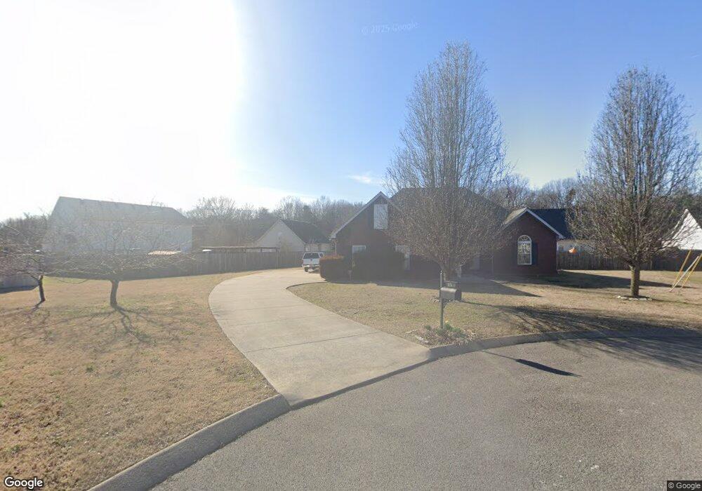
125 Nick Price Dr Murfreesboro, TN 37129
Estimated Value: $394,690 - $437,000
--
Bed
--
Bath
1,610
Sq Ft
$263/Sq Ft
Est. Value
About This Home
This home is located at 125 Nick Price Dr, Murfreesboro, TN 37129 and is currently estimated at $423,673, approximately $263 per square foot. 125 Nick Price Dr is a home located in Rutherford County with nearby schools including Wilson Elementary School, Siegel Middle School, and Siegel High School.
Ownership History
Date
Name
Owned For
Owner Type
Purchase Details
Closed on
Nov 13, 2013
Sold by
Federal Home Loan Mortgage Corporation
Bought by
Sanders Brian L and Rodriquez Paula S
Current Estimated Value
Home Financials for this Owner
Home Financials are based on the most recent Mortgage that was taken out on this home.
Original Mortgage
$168,265
Outstanding Balance
$125,881
Interest Rate
4.31%
Mortgage Type
Commercial
Estimated Equity
$297,792
Purchase Details
Closed on
Apr 22, 2013
Sold by
White Richard A
Bought by
Federal Home Loan Mortgage Corporation
Purchase Details
Closed on
Sep 29, 2006
Sold by
Keystone Homes Of Tn
Bought by
White Richard A
Home Financials for this Owner
Home Financials are based on the most recent Mortgage that was taken out on this home.
Original Mortgage
$157,173
Interest Rate
7.88%
Mortgage Type
Purchase Money Mortgage
Create a Home Valuation Report for This Property
The Home Valuation Report is an in-depth analysis detailing your home's value as well as a comparison with similar homes in the area
Home Values in the Area
Average Home Value in this Area
Purchase History
| Date | Buyer | Sale Price | Title Company |
|---|---|---|---|
| Sanders Brian L | $164,900 | -- | |
| Federal Home Loan Mortgage Corporation | $137,700 | -- | |
| White Richard A | $174,637 | -- |
Source: Public Records
Mortgage History
| Date | Status | Borrower | Loan Amount |
|---|---|---|---|
| Open | Sanders Brian L | $168,265 | |
| Previous Owner | White Richard A | $157,173 |
Source: Public Records
Tax History Compared to Growth
Tax History
| Year | Tax Paid | Tax Assessment Tax Assessment Total Assessment is a certain percentage of the fair market value that is determined by local assessors to be the total taxable value of land and additions on the property. | Land | Improvement |
|---|---|---|---|---|
| 2025 | $1,469 | $78,275 | $15,000 | $63,275 |
| 2024 | $1,469 | $78,275 | $15,000 | $63,275 |
| 2023 | $1,469 | $78,275 | $15,000 | $63,275 |
| 2022 | $1,265 | $78,275 | $15,000 | $63,275 |
| 2021 | $1,158 | $52,175 | $10,000 | $42,175 |
| 2020 | $1,158 | $52,175 | $10,000 | $42,175 |
| 2019 | $1,158 | $52,175 | $10,000 | $42,175 |
Source: Public Records
Map
Nearby Homes
- 3491 Allen Barrett Rd
- 1291 Tiger Woods Way
- 3714 W Jefferson Pike
- 111 Cannock Ct
- 2430 J D Todd Rd
- 3103 Dunmire Dr
- 2043 Trout Trail
- 313 Sierra Dr
- 9911 Bluegill Ct
- 9744 Jefferson Valley Dr
- 502 Beverly Randolph Dr
- 514 Beaumont Dr
- 1007 Watercress Ct
- 7408 Cloverdale Way
- 1014 Sycamore Leaf Way
- 1107 Sycamore Leaf Way
- 1212 Cascadeway Dr
- 1013 Spring Creek Dr
- 205 Apricot Ln
- 1200 White Rock Rd
- 1007 Tiger Woods Way
- 126 Nick Price Dr
- 8008 Mona Rd
- 119 Nick Price Dr
- 8012 Mona Rd
- 1011 Tiger Woods Way
- 122 Nick Price Dr
- 1003 Tiger Woods Way
- 8016 Mona Rd
- 1015 Tiger Woods Way
- 3495 Allen Barrett Rd
- 3499 Allen Barrett Rd
- 3487 Allen Barrett Rd
- 1004 Tiger Woods Way
- 110 Nick Price Dr
- 1008 Tiger Woods Way
- 102 Nick Price Dr
- 106 Nick Price Dr
- 114 Nick Price Dr
- 1012 Tiger Woods Way