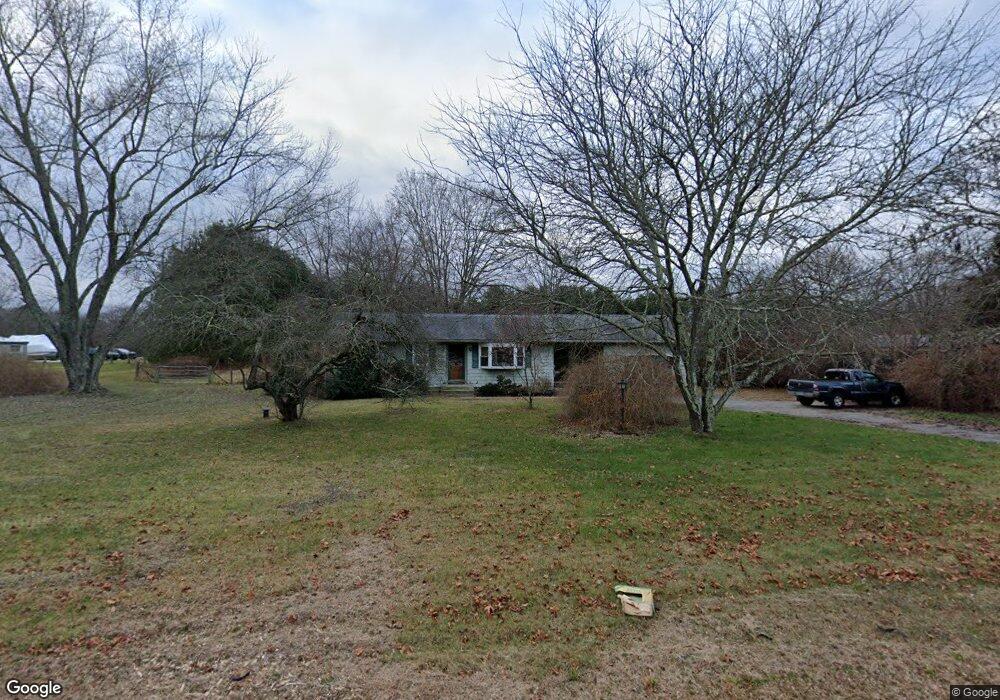
125 Pond Rd North Franklin, CT 06254
Estimated Value: $309,172 - $401,000
3
Beds
2
Baths
1,114
Sq Ft
$310/Sq Ft
Est. Value
About This Home
This home is located at 125 Pond Rd, North Franklin, CT 06254 and is currently estimated at $345,543, approximately $310 per square foot. 125 Pond Rd is a home located in New London County with nearby schools including St. Joseph Elementary School and Academy of the Holy Family.
Ownership History
Date
Name
Owned For
Owner Type
Purchase Details
Closed on
Oct 7, 2002
Sold by
Snyder John and Snyder Dawn
Bought by
Dyer Daniel and Dyer Diane
Current Estimated Value
Home Financials for this Owner
Home Financials are based on the most recent Mortgage that was taken out on this home.
Original Mortgage
$120,000
Outstanding Balance
$50,713
Interest Rate
6.27%
Estimated Equity
$294,830
Purchase Details
Closed on
Jul 1, 1996
Sold by
Lucey Norma and Andrew Estelle Benoit
Bought by
Snyder John J and Snyder Dawn
Home Financials for this Owner
Home Financials are based on the most recent Mortgage that was taken out on this home.
Original Mortgage
$110,150
Interest Rate
8.5%
Mortgage Type
Unknown
Create a Home Valuation Report for This Property
The Home Valuation Report is an in-depth analysis detailing your home's value as well as a comparison with similar homes in the area
Home Values in the Area
Average Home Value in this Area
Purchase History
| Date | Buyer | Sale Price | Title Company |
|---|---|---|---|
| Dyer Daniel | $150,000 | -- | |
| Snyder John J | $108,000 | -- | |
| Snyder John J | $108,000 | -- |
Source: Public Records
Mortgage History
| Date | Status | Borrower | Loan Amount |
|---|---|---|---|
| Open | Snyder John J | $120,000 | |
| Closed | Snyder John J | $22,500 | |
| Previous Owner | Snyder John J | $48,000 | |
| Previous Owner | Snyder John J | $110,150 |
Source: Public Records
Tax History Compared to Growth
Tax History
| Year | Tax Paid | Tax Assessment Tax Assessment Total Assessment is a certain percentage of the fair market value that is determined by local assessors to be the total taxable value of land and additions on the property. | Land | Improvement |
|---|---|---|---|---|
| 2025 | $3,594 | $169,120 | $49,980 | $119,140 |
| 2024 | $3,425 | $169,120 | $49,980 | $119,140 |
| 2023 | $2,905 | $126,450 | $43,190 | $83,260 |
| 2022 | $2,905 | $126,450 | $43,190 | $83,260 |
| 2021 | $11,605 | $126,450 | $43,190 | $83,260 |
| 2020 | $2,936 | $126,450 | $43,190 | $83,260 |
| 2019 | $2,999 | $126,450 | $43,190 | $83,260 |
| 2018 | $2,623 | $102,000 | $30,000 | $72,000 |
| 2017 | $2,572 | $102,000 | $30,000 | $72,000 |
| 2016 | $2,572 | $102,000 | $30,000 | $72,000 |
| 2015 | $2,504 | $101,310 | $30,000 | $71,310 |
| 2014 | $2,504 | $101,310 | $30,000 | $71,310 |
Source: Public Records
Map
Nearby Homes
- 201 Willimantic Rd
- 20 Holton Rd
- 22 Plains Rd
- 18 Pautipaug Hill Rd
- 34 Plains Rd
- 43 Connecticut 32
- 64 Whippoorwill Rd
- 450 Route 32
- 27 W Main St
- 123 High St
- 12 W Main St
- 145 Scotland Rd
- 114 Scotland Rd
- 125 Main St
- 110 Meeting House Hill Rd
- 38 White Plains Rd
- 6 Farm View Dr
- 33 Farm View Dr
- 26 Farm View Dr
- 78 Salt Rock Rd
- 128 Pond Rd
- 129 Pond Rd
- 137 Pond Rd
- 113 Pond Rd
- 3 Pautipaug Hill Rd
- 143 Pond Rd
- 136 Pond Rd
- 0 Pautipaug Hill Rd Unit E250271
- 5 Pautipaug Hill Rd
- 106 Pond Rd
- 11 Pautipaug Hill Rd
- 105 Pond Rd
- 151 Pond Rd
- 15 Pautipaug Hill Rd
- 19 Pautipaug Ln
- 17 Pautipaug Ln
- 102 Pond Rd
- 25 Pautipaug Ln
- 152 Pond Rd
- 157 Pond Rd