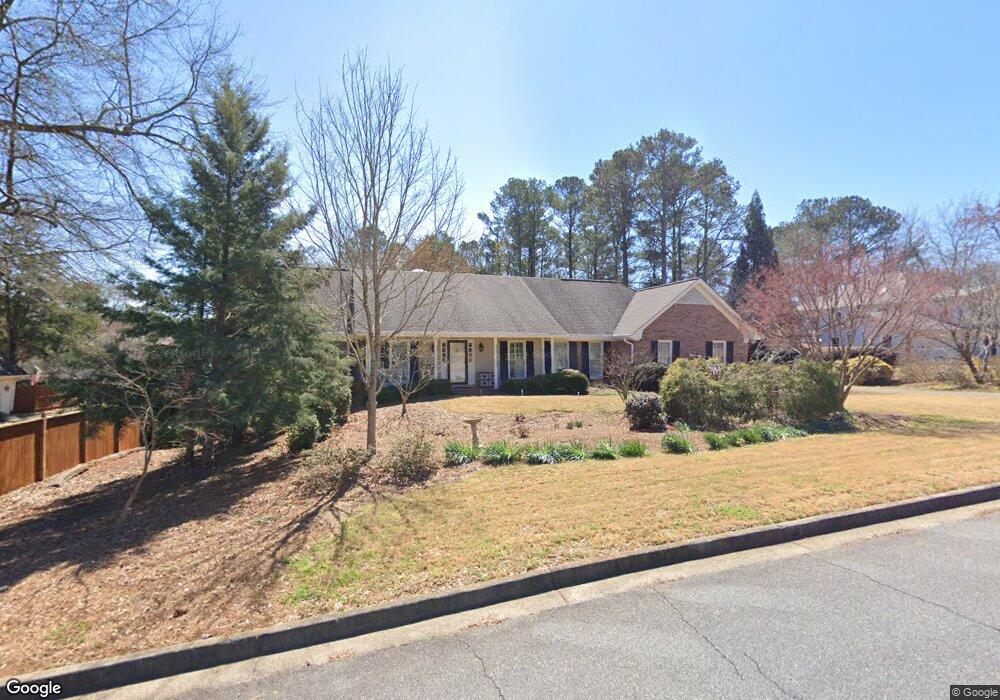
125 Station Pkwy Roswell, GA 30075
Estimated Value: $653,000 - $740,000
3
Beds
4
Baths
2,012
Sq Ft
$340/Sq Ft
Est. Value
About This Home
This home is located at 125 Station Pkwy, Roswell, GA 30075 and is currently estimated at $684,845, approximately $340 per square foot. 125 Station Pkwy is a home located in Fulton County with nearby schools including Sweet Apple Elementary School, Elkins Pointe Middle School, and Milton High School.
Ownership History
Date
Name
Owned For
Owner Type
Purchase Details
Closed on
Oct 14, 2008
Sold by
Swain Robert G
Bought by
Swain Carolyn D
Current Estimated Value
Home Financials for this Owner
Home Financials are based on the most recent Mortgage that was taken out on this home.
Original Mortgage
$300,000
Interest Rate
5.96%
Mortgage Type
Trade
Create a Home Valuation Report for This Property
The Home Valuation Report is an in-depth analysis detailing your home's value as well as a comparison with similar homes in the area
Home Values in the Area
Average Home Value in this Area
Purchase History
| Date | Buyer | Sale Price | Title Company |
|---|---|---|---|
| Swain Carolyn D | $300,000 | -- | |
| Swain Robert G | -- | -- | |
| Swain Robert G | -- | -- |
Source: Public Records
Mortgage History
| Date | Status | Borrower | Loan Amount |
|---|---|---|---|
| Closed | Swain Robert G | $300,000 |
Source: Public Records
Tax History Compared to Growth
Tax History
| Year | Tax Paid | Tax Assessment Tax Assessment Total Assessment is a certain percentage of the fair market value that is determined by local assessors to be the total taxable value of land and additions on the property. | Land | Improvement |
|---|---|---|---|---|
| 2025 | $784 | $271,920 | $65,040 | $206,880 |
| 2023 | $6,408 | $227,040 | $34,000 | $193,040 |
| 2022 | $2,418 | $227,040 | $34,000 | $193,040 |
| 2021 | $4,369 | $164,120 | $34,160 | $129,960 |
| 2020 | $4,384 | $153,520 | $34,480 | $119,040 |
| 2019 | $600 | $150,800 | $33,840 | $116,960 |
| 2018 | $3,814 | $147,240 | $33,040 | $114,200 |
| 2017 | $3,615 | $135,840 | $21,640 | $114,200 |
| 2016 | $3,465 | $135,840 | $21,640 | $114,200 |
| 2015 | $4,107 | $135,840 | $21,640 | $114,200 |
| 2014 | $3,381 | $125,240 | $19,960 | $105,280 |
Source: Public Records
Map
Nearby Homes
- 12655 New Providence Rd
- 137 Quinn Way
- 12867 Etris Walk
- 127 Quinn Way
- 12950 New Providence Rd
- 161 Brook Ln
- 113 Quinn Way
- 580 Stillhouse Ln Unit 2
- 12842 Waterside Dr Unit 2
- 130 Nova Ln
- 13150 New Providence Rd
- 1565 Parkside Dr
- 13015 Morningpark Cir Unit 1
- 13025 Morningpark Cir
- 85 Arabian Ave Unit 2
- 666 Abbey Ct
- 257 Ranchette Rd
- 13125 Morningpark Cir
- 257 Lask Ln
- 249 Lask Ln
- 12770 Arnold Mill Rd
- 140 Station Pkwy Unit 1
- 12775 Arnold Mill Rd
- 12805 Arnold Mill Rd
- 12750 New Providence Rd
- 12875 Arnold Mill Rd
- 12710 New Providence Rd
- 12770 New Providence Rd
- 12780 New Providence Rd
- 12700 New Providence Rd
- 12660 Arnold Mill Rd
- 355 Cagle Rd
- 12725 New Providence Rd
- 12725 New Providence Rd Unit LOT 1
- 12675 New Providence Rd
- 12840 New Providence Rd
- 12850 New Providence Rd
- 12285 New Providence Rd
- 225 Cagle Rd
- 12765 New Providence Rd