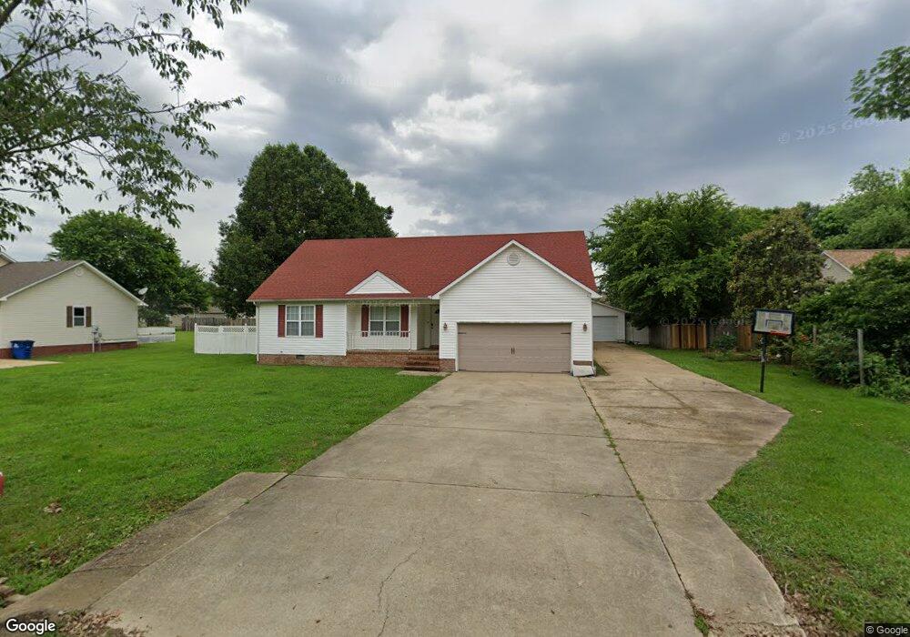
125 Stephenson Rd Martin, TN 38237
Estimated Value: $202,000 - $251,000
3
Beds
2
Baths
2,147
Sq Ft
$102/Sq Ft
Est. Value
About This Home
This home is located at 125 Stephenson Rd, Martin, TN 38237 and is currently estimated at $219,873, approximately $102 per square foot. 125 Stephenson Rd is a home located in Weakley County with nearby schools including Central Christian Academy and Unity Christian School.
Ownership History
Date
Name
Owned For
Owner Type
Purchase Details
Closed on
Aug 29, 2011
Sold by
Burns Sandra F
Bought by
Collier Chad T and Collier Jisun L
Current Estimated Value
Home Financials for this Owner
Home Financials are based on the most recent Mortgage that was taken out on this home.
Original Mortgage
$88,500
Outstanding Balance
$61,437
Interest Rate
4.55%
Mortgage Type
Commercial
Estimated Equity
$158,436
Purchase Details
Closed on
Sep 21, 1999
Sold by
Jon Austin
Bought by
Robert Burns and Robert Sandra
Purchase Details
Closed on
Dec 15, 1996
Bought by
Austin Jon and Austin Shirley Etl
Create a Home Valuation Report for This Property
The Home Valuation Report is an in-depth analysis detailing your home's value as well as a comparison with similar homes in the area
Home Values in the Area
Average Home Value in this Area
Purchase History
| Date | Buyer | Sale Price | Title Company |
|---|---|---|---|
| Collier Chad T | $115,000 | -- | |
| Robert Burns | $88,500 | -- | |
| Austin Jon | $60,000 | -- |
Source: Public Records
Mortgage History
| Date | Status | Borrower | Loan Amount |
|---|---|---|---|
| Open | Collier Chad T | $88,500 |
Source: Public Records
Tax History Compared to Growth
Tax History
| Year | Tax Paid | Tax Assessment Tax Assessment Total Assessment is a certain percentage of the fair market value that is determined by local assessors to be the total taxable value of land and additions on the property. | Land | Improvement |
|---|---|---|---|---|
| 2024 | -- | $46,675 | $8,750 | $37,925 |
| 2023 | $1,483 | $46,675 | $8,750 | $37,925 |
| 2022 | $1,156 | $31,025 | $3,250 | $27,775 |
| 2021 | $1,156 | $31,025 | $3,250 | $27,775 |
| 2020 | $1,156 | $31,025 | $3,250 | $27,775 |
| 2019 | $1,048 | $31,025 | $3,250 | $27,775 |
| 2018 | $1,048 | $31,025 | $3,250 | $27,775 |
| 2017 | $1,067 | $29,400 | $2,500 | $26,900 |
| 2016 | $1,067 | $29,400 | $0 | $0 |
| 2015 | $1,068 | $29,401 | $0 | $0 |
| 2014 | $1,068 | $29,401 | $0 | $0 |
Source: Public Records
Map
Nearby Homes
- 304 Tyler Austin Rd
- 126 Lilly Pond Ln
- 338 Mount Pelia Rd
- 131 Big John Dr
- 102 Cherry Dr
- 110 3 Point Rd
- 169 Hidden Hill Cove
- 0 Hawks Rd Unit Brooks
- 0 Kennedy Dr Unit RRA40830
- 0 Kennedy Dr Unit 187533
- 206 S Dodd Dr
- 0 Skyhawk Pkwy Unit Brooks RRA45195
- 142 Glenwood Dr
- 0 University St Unit 2504446
- 920 University St
- 933 University St
- 157 Mockingbird Ln
- 99 Bunny Ln
- 137 Courtright Rd
- 210 Oakland St
- 00 Stephenson Rd
- 119 Stephenson Rd
- 127 Stephenson Rd
- 114 Alex Todd Cir
- 112 Alex Todd Cir
- 115 Stephenson Rd
- 120 Stephenson Rd
- 131 Stephenson Rd
- 126 Stephenson Rd
- 108 Huxley Rd
- 116 Stephenson Rd
- 110 Huxley Rd
- 110 Alex Todd Cir
- 111 Stephenson Rd
- 107 Tyler Austin Rd
- 110 Stephenson Rd
- 109 Alex Todd Cir
- 114 Huxley Rd
- 109 Tyler Austin Rd
- 132 Stephenson Rd