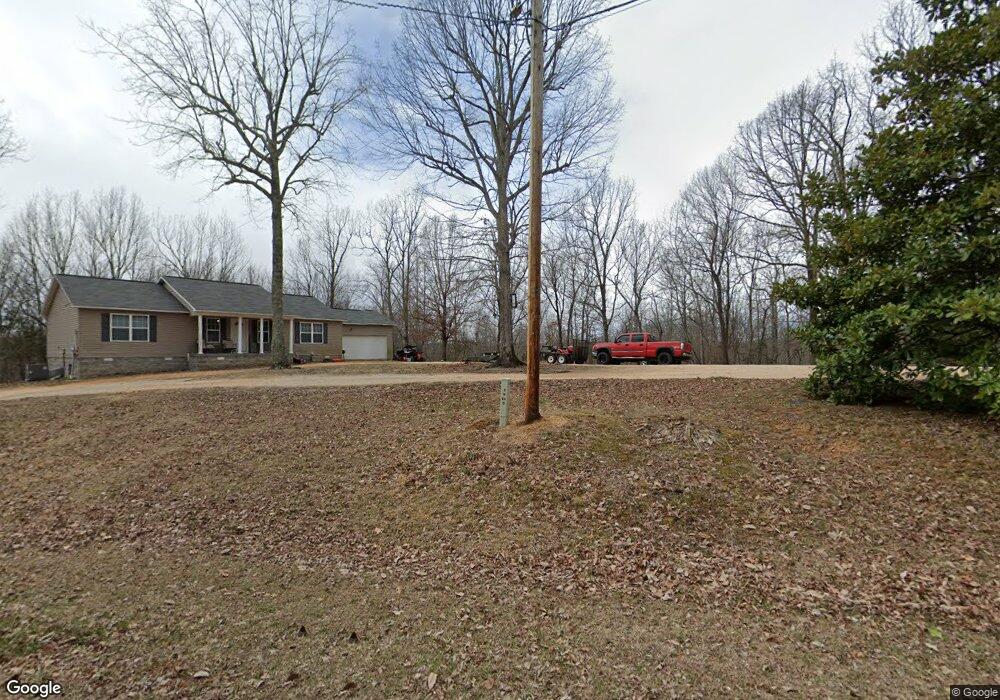
125 Swindle Creek Rd Linden, TN 37096
Estimated Value: $245,000 - $285,000
--
Bed
--
Bath
1,664
Sq Ft
$163/Sq Ft
Est. Value
About This Home
This home is located at 125 Swindle Creek Rd, Linden, TN 37096 and is currently estimated at $271,952, approximately $163 per square foot. 125 Swindle Creek Rd is a home located in Perry County.
Ownership History
Date
Name
Owned For
Owner Type
Purchase Details
Closed on
Jan 27, 2012
Sold by
Holder Jimmy T
Bought by
Holder Julia Devin
Current Estimated Value
Purchase Details
Closed on
May 7, 2009
Bought by
Holder Jimmy T and Holder Gwendolyn J
Purchase Details
Closed on
Feb 6, 2009
Bought by
New South Federal Savings Bank
Purchase Details
Closed on
Jan 5, 2002
Bought by
Bates Susan
Purchase Details
Closed on
Nov 15, 1991
Bought by
Bates Thomas Lee and Bates Susan
Create a Home Valuation Report for This Property
The Home Valuation Report is an in-depth analysis detailing your home's value as well as a comparison with similar homes in the area
Home Values in the Area
Average Home Value in this Area
Purchase History
| Date | Buyer | Sale Price | Title Company |
|---|---|---|---|
| Holder Julia Devin | -- | -- | |
| Holder Jimmy T | $15,000 | -- | |
| New South Federal Savings Bank | $49,800 | -- | |
| Bates Susan | -- | -- | |
| Bates Thomas Lee | $500 | -- |
Source: Public Records
Tax History Compared to Growth
Tax History
| Year | Tax Paid | Tax Assessment Tax Assessment Total Assessment is a certain percentage of the fair market value that is determined by local assessors to be the total taxable value of land and additions on the property. | Land | Improvement |
|---|---|---|---|---|
| 2025 | $1,108 | $43,550 | $0 | $0 |
| 2024 | $1,108 | $48,250 | $4,875 | $43,375 |
| 2023 | $220 | $9,575 | $4,875 | $4,700 |
| 2022 | $220 | $9,575 | $4,875 | $4,700 |
| 2021 | $220 | $9,575 | $4,875 | $4,700 |
| 2020 | $220 | $9,575 | $4,875 | $4,700 |
| 2019 | $215 | $8,675 | $4,875 | $3,800 |
| 2018 | $215 | $8,675 | $4,875 | $3,800 |
| 2017 | $213 | $8,675 | $4,875 | $3,800 |
| 2016 | $213 | $8,675 | $4,875 | $3,800 |
| 2015 | $208 | $8,675 | $4,875 | $3,800 |
| 2014 | $208 | $8,675 | $4,875 | $3,800 |
| 2013 | $241 | $10,044 | $0 | $0 |
Source: Public Records
Map
Nearby Homes
- 1591 Marsh Creek Rd
- 505 Big Buffalo Estates Cir
- 145 Big Buffalo Estates Cir
- 2172 Airport Ridge Rd
- 146 Wyatt Ln
- 2082 Airport Ridge Rd
- 117 Wyatt Ln
- 0 Linda Ln Unit RTC3046693
- 149 Highland Dr
- 2383 Airport Ridge Rd
- 2017 Airport Ridge Rd
- 7468 Old Hohenwald Rd
- 8072 Old Hohenwald Rd
- 5681 Old Hohenwald Rd
- 4439 Old Hohenwald Rd
- 7696 Old Hohenwald Rd
- 6004 Old Hohenwald Rd
- 5608 Old Hohenwald Rd
- 218 Cedar Ave
- 122 Shelton St
- 25 Swindle Creek Rd
- 85 Swindle Creek Rd
- 274 Swindle Creek Rd
- 106 Kimble Rd
- 334 Swindle Creek Rd
- 188 Kimble Rd
- 35 Kimble Rd
- 490 Swindle Creek Rd
- 4250 Highway 13 S
- 41 Kimble Rd
- 187 Kimble Rd
- 0 128 Hwy Unit 3253596
- 0 Tennessee 128
- 3996 Highway 13 S
- 189 Kimble Rd
- 4448 Highway 13 S
- 3804 Highway 13 S
- 124 Old Cedar Creek Rd
- 119 Old Cedar Creek Rd
- 607 Kimble Rd