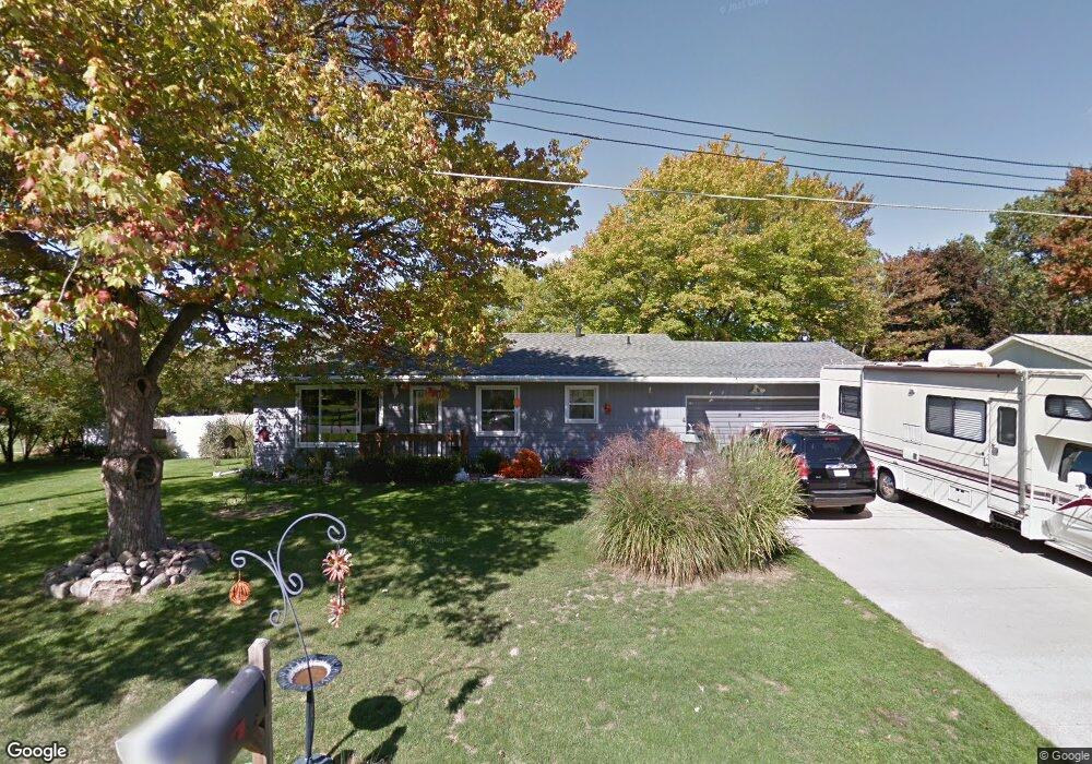
125 W Amy St Hastings, MI 49058
Estimated Value: $213,000 - $252,000
3
Beds
1
Bath
1,092
Sq Ft
$212/Sq Ft
Est. Value
About This Home
This home is located at 125 W Amy St, Hastings, MI 49058 and is currently estimated at $231,275, approximately $211 per square foot. 125 W Amy St is a home located in Barry County with nearby schools including Hastings High School and St. Rose of Lima School.
Ownership History
Date
Name
Owned For
Owner Type
Purchase Details
Closed on
May 31, 2005
Sold by
Landes Judith L and Rose M Guernsey Trust
Bought by
Markley Brent A and Markley Connie S
Current Estimated Value
Home Financials for this Owner
Home Financials are based on the most recent Mortgage that was taken out on this home.
Original Mortgage
$87,920
Outstanding Balance
$46,342
Interest Rate
5.91%
Mortgage Type
New Conventional
Estimated Equity
$184,933
Purchase Details
Closed on
Jan 11, 2005
Sold by
Guernsey Rose M
Bought by
Guernsey Rose M and Rose M Guernsey Trust
Create a Home Valuation Report for This Property
The Home Valuation Report is an in-depth analysis detailing your home's value as well as a comparison with similar homes in the area
Home Values in the Area
Average Home Value in this Area
Purchase History
| Date | Buyer | Sale Price | Title Company |
|---|---|---|---|
| Markley Brent A | $109,900 | Metropolitan Title Company | |
| Guernsey Rose M | -- | -- |
Source: Public Records
Mortgage History
| Date | Status | Borrower | Loan Amount |
|---|---|---|---|
| Open | Markley Brent A | $87,920 |
Source: Public Records
Tax History Compared to Growth
Tax History
| Year | Tax Paid | Tax Assessment Tax Assessment Total Assessment is a certain percentage of the fair market value that is determined by local assessors to be the total taxable value of land and additions on the property. | Land | Improvement |
|---|---|---|---|---|
| 2025 | $2,351 | $104,200 | $0 | $0 |
| 2024 | $2,351 | $103,700 | $0 | $0 |
| 2023 | $2,165 | $76,100 | $0 | $0 |
| 2022 | $2,165 | $76,100 | $0 | $0 |
| 2021 | $2,165 | $71,000 | $0 | $0 |
| 2020 | $2,165 | $67,500 | $0 | $0 |
| 2019 | $2,165 | $63,700 | $0 | $0 |
| 2018 | $0 | $57,800 | $0 | $0 |
| 2017 | $0 | $57,600 | $0 | $0 |
| 2016 | -- | $51,900 | $0 | $0 |
| 2015 | -- | $49,700 | $0 | $0 |
| 2014 | -- | $49,700 | $0 | $0 |
Source: Public Records
Map
Nearby Homes
- V/L S M 43 Hwy
- 1130 N Broadway St
- 903 N Michigan Ave
- 236 E Lincoln St
- 344 E North St Unit 23
- 727 N East St
- 1544 Liberty Ln
- 610 Riverwalk St Unit 18
- 618 Riverwalk St
- 520 E Thorn St
- 800 Bachman Rd
- 502 W State St
- 000 E Mill St
- 112 E Green St
- 520 E State St
- 612 E Green St
- 611 E Walnut St
- 714 W Green St
- 610 S Park St
- 617 S East St
- 117 W Amy St
- 215 W Amy St
- 109 W Amy St
- 1119 N Church St
- 120 W Amy St
- 235 W Amy St
- 1122 N Church St
- 1120 N Jefferson St
- 124 W Woodlawn Ave
- 224 W Amy St
- 135 W Benson St
- 243 W Amy St
- 113 W Benson St
- 1106 N Church St
- 107 W Benson St
- 211 W Benson St
- 1225 N Jefferson St
- 1205 N Jefferson St
- 219 W Benson St
- 1127 N Jefferson St