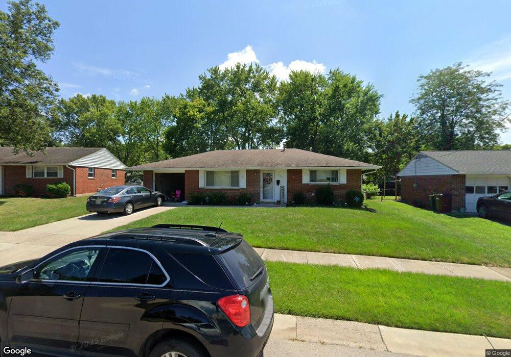
125 W State St Springboro, OH 45066
Estimated Value: $136,000 - $216,000
3
Beds
2
Baths
980
Sq Ft
$189/Sq Ft
Est. Value
About This Home
This home is located at 125 W State St, Springboro, OH 45066 and is currently estimated at $185,435, approximately $189 per square foot. 125 W State St is a home located in Warren County with nearby schools including Clearcreek Elementary School, Springboro Intermediate School, and Dennis Elementary School.
Ownership History
Date
Name
Owned For
Owner Type
Purchase Details
Closed on
Feb 10, 2021
Sold by
Page Brad and Page Angela D
Bought by
Amb Enterprises Llc
Current Estimated Value
Purchase Details
Closed on
Aug 16, 2016
Sold by
Dorrough Scot C and Dorrough Susan W
Bought by
Page Brad and Page Angela
Purchase Details
Closed on
Aug 31, 2011
Sold by
Dorrough Scot C and Dorrough Susan W
Bought by
Dorrough Scot C and Dorrough Susan W
Purchase Details
Closed on
Mar 27, 2000
Sold by
Est Nolan L Ryan
Bought by
Dorrough Scot C and Dorrough Susan W
Purchase Details
Closed on
Oct 27, 1992
Sold by
Ryan Nolan L and Ryan Delores
Bought by
Ryan and Ryan Nolan L
Create a Home Valuation Report for This Property
The Home Valuation Report is an in-depth analysis detailing your home's value as well as a comparison with similar homes in the area
Home Values in the Area
Average Home Value in this Area
Purchase History
| Date | Buyer | Sale Price | Title Company |
|---|---|---|---|
| Amb Enterprises Llc | -- | New Title Company Name | |
| Page Brad | $75,000 | Attorney | |
| Dorrough Scot C | -- | None Available | |
| Dorrough Scot C | $72,442 | -- | |
| Ryan | -- | -- |
Source: Public Records
Tax History
| Year | Tax Paid | Tax Assessment Tax Assessment Total Assessment is a certain percentage of the fair market value that is determined by local assessors to be the total taxable value of land and additions on the property. | Land | Improvement |
|---|---|---|---|---|
| 2025 | $1,993 | $49,770 | $17,500 | $32,270 |
| 2024 | $1,993 | $49,770 | $17,500 | $32,270 |
| 2023 | $1,695 | $39,434 | $10,762 | $28,672 |
| 2022 | $1,695 | $39,435 | $10,763 | $28,672 |
| 2021 | $1,577 | $39,435 | $10,763 | $28,672 |
| 2020 | $1,469 | $32,060 | $8,750 | $23,310 |
| 2019 | $1,357 | $32,060 | $8,750 | $23,310 |
| 2018 | $1,358 | $32,060 | $8,750 | $23,310 |
| 2017 | $1,381 | $29,376 | $8,134 | $21,242 |
| 2016 | $1,441 | $29,376 | $8,134 | $21,242 |
| 2015 | $1,444 | $29,376 | $8,134 | $21,242 |
| 2014 | $1,480 | $28,520 | $7,900 | $20,620 |
| 2013 | $1,480 | $31,600 | $8,750 | $22,850 |
Source: Public Records
Map
Nearby Homes
- 84 W Mill St
- 330 East St
- 10 Woods Rd
- 660 S Main St
- 60 Rosewood Dr
- 490 W Market St
- 50 Morris St
- 45 Morris St Unit 15
- 8 Glasgow St Unit 30
- 18 Glasgow St
- 65 Morris St Unit 17
- 45 Morris St
- 18 Glasgow St Unit 29
- 8 Glasgow St
- 30 Morris St
- 50 Morris St Unit 4
- 65 Morris St
- 80 Elkins Ln
- 765 Beckley Farm Way
- 70 Eleanor Dr
- 135 W State St
- 115 W State St
- 120 W Factory Rd
- 130 W Factory Rd
- 145 W State St
- 110 W Factory Rd
- 105 W State St
- 10 King Cir
- 140 W Factory Rd
- 100 W Factory Rd
- 155 W State St
- 110 W State St
- 95 W State St
- 15 King Cir
- 150 W Factory Rd
- 405 Gilpin Dr Unit 1
- 165 W State St
- 415 Gilpin Dr
- 150 W State St
- 145 W Factory Rd
Your Personal Tour Guide
Ask me questions while you tour the home.