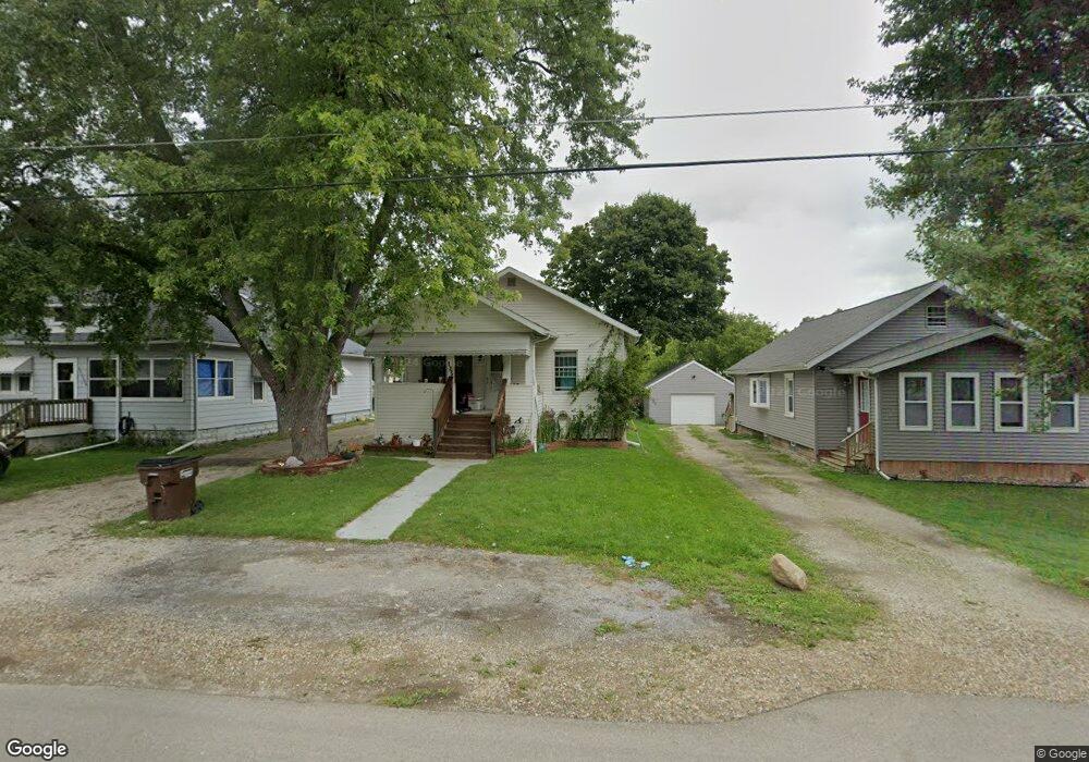
125 Watts St Jackson, MI 49203
Estimated Value: $80,000 - $131,000
3
Beds
1
Bath
1,566
Sq Ft
$73/Sq Ft
Est. Value
About This Home
This home is located at 125 Watts St, Jackson, MI 49203 and is currently estimated at $113,598, approximately $72 per square foot. 125 Watts St is a home located in Jackson County with nearby schools including East Jackson Elementary School, East Jackson Middle School, and East Jackson High School.
Ownership History
Date
Name
Owned For
Owner Type
Purchase Details
Closed on
Feb 8, 2006
Sold by
Cross Kenneth E and Cross Norma K
Bought by
Shepherd Douglas Shane
Current Estimated Value
Home Financials for this Owner
Home Financials are based on the most recent Mortgage that was taken out on this home.
Original Mortgage
$72,000
Outstanding Balance
$46,031
Interest Rate
8.6%
Mortgage Type
Purchase Money Mortgage
Estimated Equity
$67,567
Purchase Details
Closed on
Jul 21, 2003
Sold by
Cross Kenneth E and Cross Norma K
Bought by
Cross Kenneth E and Cross Norma K
Home Financials for this Owner
Home Financials are based on the most recent Mortgage that was taken out on this home.
Original Mortgage
$43,700
Interest Rate
5.3%
Mortgage Type
Purchase Money Mortgage
Create a Home Valuation Report for This Property
The Home Valuation Report is an in-depth analysis detailing your home's value as well as a comparison with similar homes in the area
Home Values in the Area
Average Home Value in this Area
Purchase History
| Date | Buyer | Sale Price | Title Company |
|---|---|---|---|
| Shepherd Douglas Shane | $90,000 | Mst | |
| Cross Kenneth E | -- | Midstate Title Co | |
| Cross Kenneth | $46,000 | -- |
Source: Public Records
Mortgage History
| Date | Status | Borrower | Loan Amount |
|---|---|---|---|
| Open | Shepherd Douglas Shane | $72,000 | |
| Previous Owner | Cross Kenneth | $43,700 |
Source: Public Records
Tax History Compared to Growth
Tax History
| Year | Tax Paid | Tax Assessment Tax Assessment Total Assessment is a certain percentage of the fair market value that is determined by local assessors to be the total taxable value of land and additions on the property. | Land | Improvement |
|---|---|---|---|---|
| 2025 | $1,224 | $44,500 | $0 | $0 |
| 2024 | $572 | $38,850 | $0 | $0 |
| 2023 | $544 | $35,600 | $0 | $0 |
| 2022 | $1,037 | $27,100 | $0 | $0 |
| 2021 | $1,024 | $21,100 | $0 | $0 |
| 2020 | $1,024 | $21,100 | $0 | $0 |
| 2019 | $1,004 | $20,800 | $0 | $0 |
| 2018 | $788 | $22,000 | $0 | $0 |
| 2017 | $890 | $21,900 | $0 | $0 |
| 2016 | $471 | $21,569 | $21,569 | $0 |
| 2015 | $875 | $19,661 | $19,661 | $0 |
| 2014 | $875 | $19,539 | $0 | $0 |
| 2013 | -- | $19,539 | $19,539 | $0 |
Source: Public Records
Map
Nearby Homes
- 324 Amos St
- 130 N Horton St
- 133 N Forbes St
- 210 S Forbes St
- vl Seymour Rd
- Unit 48 Sanctuary Dr
- Unit 55 Sanctuary Dr
- Unit 50 Sanctuary Dr
- Unit 28 Sanctuary Dr
- Unit 53, 5 Sanctuary Dr
- Unit 53 Sanctuary Dr
- Unit 48,49 Sanctuary Dr
- 2013 Tyson St
- Vl Watts St
- 539 S Dettman Rd
- 353 N Forbes St
- 318 Seneca Dr
- 339 N Dwight St
- 698 S Dettman Rd
- 509 S Gorham St