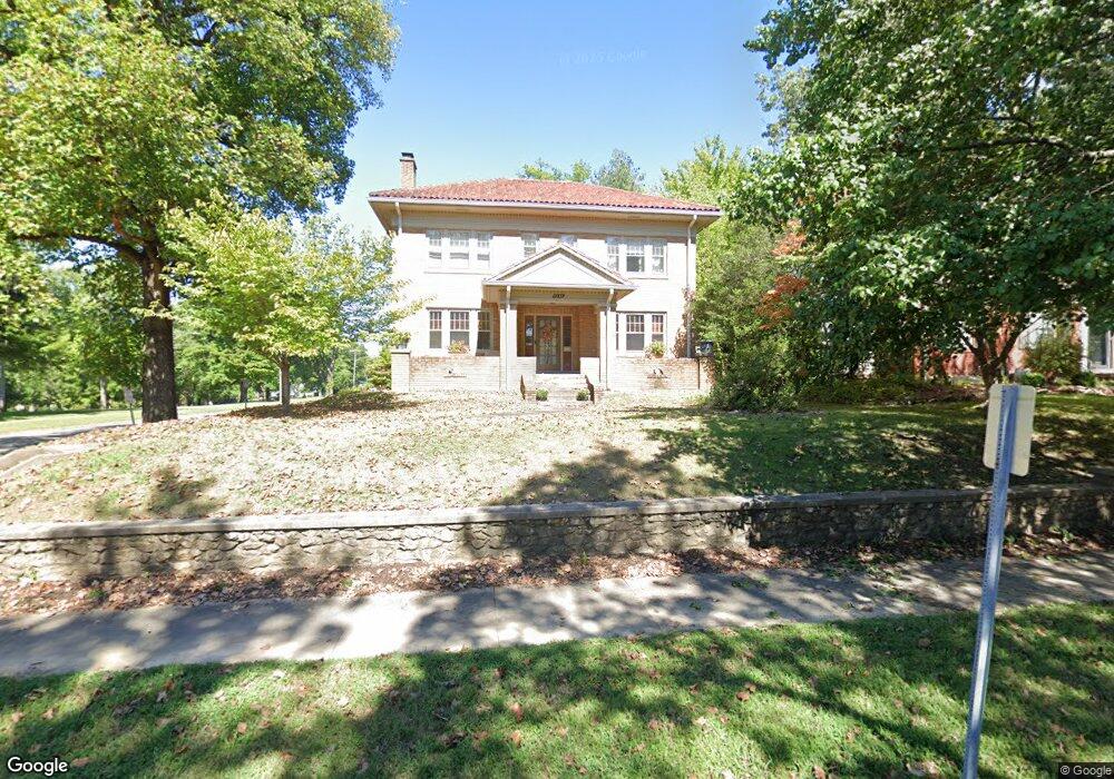
1250 Normal Ave Cape Girardeau, MO 63701
Estimated Value: $293,698 - $313,000
3
Beds
2
Baths
2,464
Sq Ft
$122/Sq Ft
Est. Value
About This Home
This home is located at 1250 Normal Ave, Cape Girardeau, MO 63701 and is currently estimated at $299,675, approximately $121 per square foot. 1250 Normal Ave is a home with nearby schools including Franklin Elementary School, Central Middle School, and Central Junior High School.
Ownership History
Date
Name
Owned For
Owner Type
Purchase Details
Closed on
Feb 18, 2005
Sold by
Eaton John M and Eaton Carol A
Bought by
Curtis William F and Curtis Tracy D
Current Estimated Value
Home Financials for this Owner
Home Financials are based on the most recent Mortgage that was taken out on this home.
Original Mortgage
$199,500
Outstanding Balance
$101,536
Interest Rate
5.77%
Mortgage Type
New Conventional
Estimated Equity
$198,139
Create a Home Valuation Report for This Property
The Home Valuation Report is an in-depth analysis detailing your home's value as well as a comparison with similar homes in the area
Home Values in the Area
Average Home Value in this Area
Purchase History
| Date | Buyer | Sale Price | Title Company |
|---|---|---|---|
| Curtis William F | -- | None Available |
Source: Public Records
Mortgage History
| Date | Status | Borrower | Loan Amount |
|---|---|---|---|
| Open | Curtis William F | $199,500 |
Source: Public Records
Tax History Compared to Growth
Tax History
| Year | Tax Paid | Tax Assessment Tax Assessment Total Assessment is a certain percentage of the fair market value that is determined by local assessors to be the total taxable value of land and additions on the property. | Land | Improvement |
|---|---|---|---|---|
| 2025 | $21 | $43,120 | $2,860 | $40,260 |
| 2024 | $21 | $41,060 | $2,720 | $38,340 |
| 2023 | $2,134 | $41,060 | $2,720 | $38,340 |
| 2022 | $1,968 | $37,850 | $2,510 | $35,340 |
| 2021 | $1,968 | $37,850 | $2,510 | $35,340 |
| 2020 | $1,974 | $37,850 | $2,510 | $35,340 |
| 2019 | $1,971 | $37,850 | $0 | $0 |
| 2018 | $1,967 | $37,850 | $0 | $0 |
| 2017 | $1,972 | $37,850 | $0 | $0 |
| 2016 | $1,839 | $35,440 | $0 | $0 |
| 2015 | $1,840 | $35,440 | $0 | $0 |
| 2014 | $1,849 | $35,440 | $0 | $0 |
Source: Public Records
Map
Nearby Homes
- 381 N Park Ave
- 374 N Park Ave
- 242 Orange Bowl Dr
- 1401 Bessie St
- 701 Penny Ave
- 1419 Themis St
- 1014 N Henderson Ave
- 715 Terrace Dr
- 63 N Hanover St
- 733 Watkins Dr
- 344 N Ellis St
- 423 N Sunset Blvd
- 1742 Dunklin St
- 12 N West End Blvd
- 1455 Whitener St
- 325 N Sprigg St
- 1522 Independence St
- 424 Marie St
- 1738 Luce St
- 26 N Pacific St
- 1248 Normal Ave
- 1240 Normal Ave
- 1236 Normal Ave
- 1251 Normal Ave
- 1243 Rockwood Dr
- 1257 Rockwood Dr
- 1245 Normal Ave
- 1232 Normal Ave
- 1237 Rockwood Dr
- 564 NW End Blvd
- 1222 Normal Ave
- 1235 Rockwood Dr
- 560 N West End Blvd
- 560 NW End Blvd
- 6 the Highlands of Dalhousie
- 112 the Highlands at Dalhousie
- 110 the Highlands at Dalhousie
- 108 the Highlands at Dalhousie
- 106 the Highlands at Dalhousie
- 104 the Highlands at Dalhousie