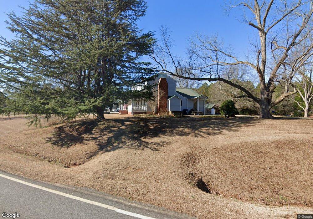
1250 Ruth Jackson Rd Bogart, GA 30622
Estimated Value: $426,000 - $587,000
--
Bed
--
Bath
2,412
Sq Ft
$222/Sq Ft
Est. Value
About This Home
This home is located at 1250 Ruth Jackson Rd, Bogart, GA 30622 and is currently estimated at $534,891, approximately $221 per square foot. 1250 Ruth Jackson Rd is a home located in Oconee County with nearby schools including Rocky Branch Elementary School, Malcom Bridge Middle School, and North Oconee High School.
Ownership History
Date
Name
Owned For
Owner Type
Purchase Details
Closed on
Jul 20, 2015
Sold by
Simmons Lee
Bought by
Cooper Theordore C and Cooper Rachel G
Current Estimated Value
Home Financials for this Owner
Home Financials are based on the most recent Mortgage that was taken out on this home.
Original Mortgage
$237,500
Outstanding Balance
$186,346
Interest Rate
4.04%
Mortgage Type
New Conventional
Estimated Equity
$348,545
Purchase Details
Closed on
Aug 25, 2006
Sold by
Not Provided
Bought by
Hurt Lee S
Purchase Details
Closed on
Jul 31, 1997
Sold by
Robertson Kay Lemon
Bought by
Hurt James W
Purchase Details
Closed on
Oct 19, 1994
Bought by
Robertson Kay Lemon
Create a Home Valuation Report for This Property
The Home Valuation Report is an in-depth analysis detailing your home's value as well as a comparison with similar homes in the area
Home Values in the Area
Average Home Value in this Area
Purchase History
| Date | Buyer | Sale Price | Title Company |
|---|---|---|---|
| Cooper Theordore C | $250,000 | -- | |
| Hurt Lee S | -- | -- | |
| Hurt James W | $116,000 | -- | |
| Robertson Kay Lemon | $97,500 | -- |
Source: Public Records
Mortgage History
| Date | Status | Borrower | Loan Amount |
|---|---|---|---|
| Open | Cooper Theordore C | $237,500 |
Source: Public Records
Tax History Compared to Growth
Tax History
| Year | Tax Paid | Tax Assessment Tax Assessment Total Assessment is a certain percentage of the fair market value that is determined by local assessors to be the total taxable value of land and additions on the property. | Land | Improvement |
|---|---|---|---|---|
| 2024 | $3,584 | $175,240 | $53,172 | $122,068 |
| 2023 | $3,237 | $164,264 | $49,234 | $115,030 |
| 2022 | $2,937 | $138,917 | $39,386 | $99,531 |
| 2021 | $2,867 | $125,834 | $35,806 | $90,028 |
| 2020 | $2,684 | $117,775 | $32,551 | $85,224 |
| 2019 | $2,524 | $110,880 | $28,305 | $82,575 |
| 2018 | $2,459 | $105,833 | $25,732 | $80,101 |
| 2017 | $2,218 | $95,656 | $21,443 | $74,213 |
| 2016 | $1,936 | $83,716 | $19,494 | $64,222 |
| 2015 | $1,754 | $75,898 | $19,494 | $56,404 |
| 2014 | $1,705 | $72,199 | $17,722 | $54,477 |
| 2013 | -- | $69,427 | $16,724 | $52,703 |
Source: Public Records
Map
Nearby Homes
- 2479 Eisenhower Ave
- 1665 Eisenhower Ave
- 0 Monroe Hwy Unit 1025452
- 1640 Madison Ct
- 0 Ruth Jackson Rd Unit 10582108
- 00 Ruth Jackson Rd
- 1010 Garland Dr
- 6601 Hog Mountain Hwy - Hwy 53 Unit PARCEL B
- 2082 Wade Dr
- 1120 Liberty Ln
- 2163 Heather Ln
- 1216 Ray's River Run
- 3377 Clayton Dr
- 3451 Clayton Dr
- 1021 Bedford Trail
- 3240 Monroe Hwy
- 0 Clotfelter Rd Unit 1025303
- 0 Whitehead Rd Unit CL335631
- 0 Whitehead Rd Unit 10574962
- 3164 Malcom Estates Dr
- 1324 Ruth Jackson Rd
- 1310 Ruth Jackson Rd
- 1354 Ruth Jackson Rd
- 1336 Ruth Jackson Rd
- 1294 Ruth Jackson Rd
- 1280 Ruth Jackson Rd
- 1230 Ruth Jackson Rd
- 1201 Ruth Jackson Rd
- 1231 Ruth Jackson Rd
- 1261 Ruth Jackson Rd
- 1170 Ruth Jackson Rd
- 1281 Ruth Jackson Rd
- 1131 Ruth Jackson Rd
- 1360 Ruth Jackson Rd
- 1361 Ruth Jackson Rd
- 2435 Clotfelter Rd
- 2433 Clotfelter Rd
- 2360 Eisenhower Ave
- 2398 Eisenhower Ave
- 2398 Eisenhower Ave