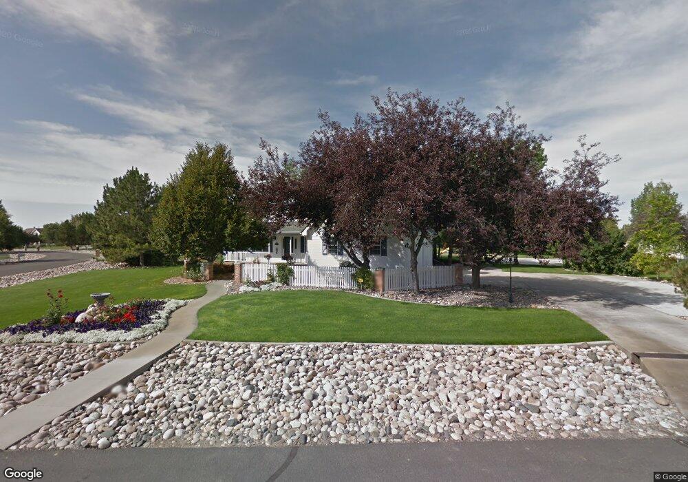
1250 Timothy Place Billings, MT 59106
Shiloh NeighborhoodEstimated Value: $938,000 - $984,498
4
Beds
4
Baths
3,187
Sq Ft
$303/Sq Ft
Est. Value
About This Home
This home is located at 1250 Timothy Place, Billings, MT 59106 and is currently estimated at $964,833, approximately $302 per square foot. 1250 Timothy Place is a home located in Yellowstone County with nearby schools including Meadowlark School, Ben Steele Middle School, and Billings West High School.
Ownership History
Date
Name
Owned For
Owner Type
Purchase Details
Closed on
Feb 2, 2009
Sold by
Clarke Kelly M and Clarke Amy E
Bought by
Grossman Jess Franklin and Grossman Kelly Jo
Current Estimated Value
Home Financials for this Owner
Home Financials are based on the most recent Mortgage that was taken out on this home.
Original Mortgage
$391,400
Outstanding Balance
$247,941
Interest Rate
5.14%
Mortgage Type
Unknown
Estimated Equity
$716,892
Purchase Details
Closed on
Feb 13, 2006
Sold by
Richau Construction Inc
Bought by
Clarke Kelly M and Clarke Amy E
Home Financials for this Owner
Home Financials are based on the most recent Mortgage that was taken out on this home.
Original Mortgage
$1,373,084
Interest Rate
6.85%
Mortgage Type
New Conventional
Create a Home Valuation Report for This Property
The Home Valuation Report is an in-depth analysis detailing your home's value as well as a comparison with similar homes in the area
Home Values in the Area
Average Home Value in this Area
Purchase History
| Date | Buyer | Sale Price | Title Company |
|---|---|---|---|
| Grossman Jess Franklin | -- | St | |
| Clarke Kelly M | -- | None Available |
Source: Public Records
Mortgage History
| Date | Status | Borrower | Loan Amount |
|---|---|---|---|
| Open | Grossman Jess Franklin | $391,400 | |
| Previous Owner | Clarke Kelly M | $1,373,084 |
Source: Public Records
Tax History
| Year | Tax Paid | Tax Assessment Tax Assessment Total Assessment is a certain percentage of the fair market value that is determined by local assessors to be the total taxable value of land and additions on the property. | Land | Improvement |
|---|---|---|---|---|
| 2025 | $6,630 | $976,100 | $175,073 | $801,027 |
| 2024 | $6,630 | $785,900 | $134,565 | $651,335 |
| 2023 | $6,912 | $785,900 | $134,565 | $651,335 |
| 2022 | $4,901 | $638,500 | $0 | $0 |
| 2021 | $5,729 | $592,900 | $0 | $0 |
| 2020 | $4,993 | $519,600 | $0 | $0 |
| 2019 | $4,903 | $519,600 | $0 | $0 |
| 2018 | $5,144 | $539,900 | $0 | $0 |
| 2017 | $4,144 | $539,900 | $0 | $0 |
| 2016 | $4,478 | $487,100 | $0 | $0 |
| 2015 | $4,099 | $487,100 | $0 | $0 |
| 2014 | $4,102 | $262,032 | $0 | $0 |
Source: Public Records
Map
Nearby Homes
- 1200 Bluegrass Dr W
- 661 Light Stream Ln
- 4816 Dovetail Ave
- 4126 Julaura Ln
- 4342 Rangeview Dr
- 4620 Sun Basin Rd
- 1813 Chandelier Cir
- 4649 N Hollow Brook Dr
- 5130 Granite Peak Way
- 2213 Westfield Dr
- 1501 Granite Peak Trail
- 4816 Silver Creek Trail
- 4902 Silver Creek Trail
- TBD 52nd St W
- 2514 Silver Pine Ct
- 1039 Vineyard Way
- 2514 Mountain Range Ct
- 2518 Silver Pine Ct
- 103 Double Tree Place
- 4459 Driftboat Trail
- 1300 Timothy Place
- 1225 Bluegrass Dr W
- 1330 Bluegrass Dr
- 1305 Bluegrass Dr W
- 1365 Timothy Place
- 1340 Timothy Place
- 1150 Bluegrass Dr W
- 1345 Bluegrass Dr E
- 1145 Bluegrass Dr W
- 1270 Bluegrass Dr E
- 4615 Cliff View Cir
- 1365 Bluegrass Dr
- 1010 Larkspur Place
- 1245 Bluegrass Dr E
- 1030 Bluegrass Dr W
- 1220 Bluegrass Dr E
- 945 Larkspur Place
- 1120 46th St W
- 4625 Cliff View Cir
- 1110 46th St W
Your Personal Tour Guide
Ask me questions while you tour the home.