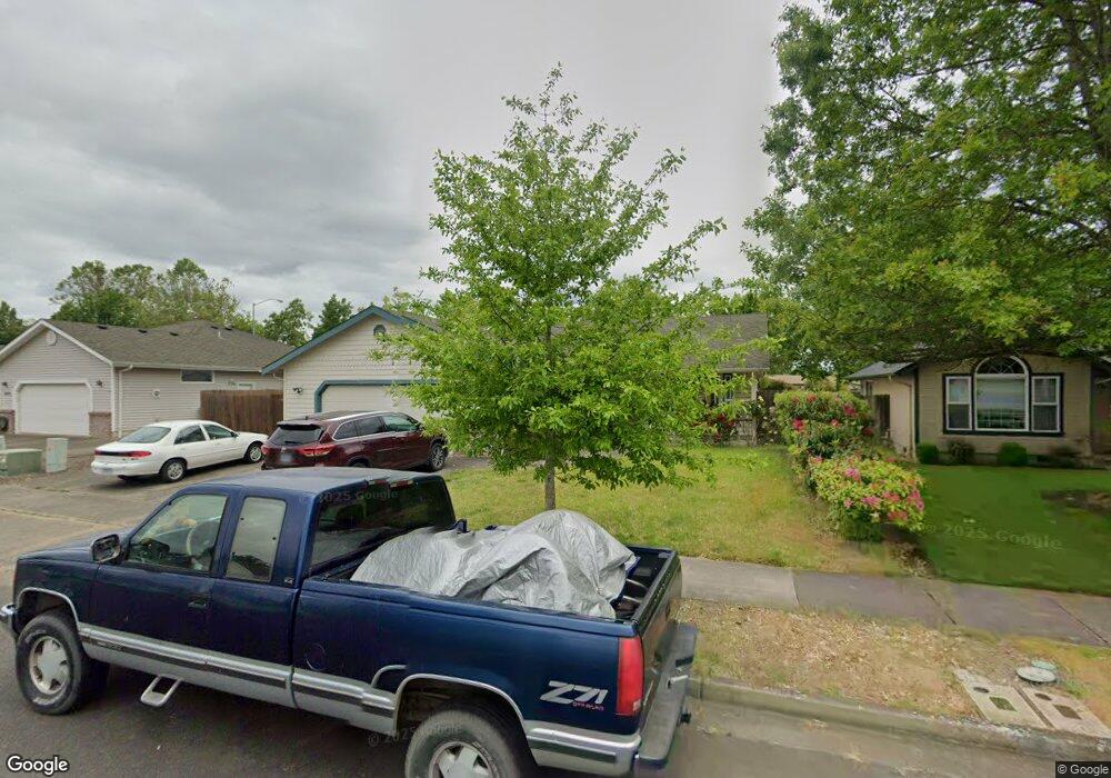
1251 Adelman Loop Eugene, OR 97402
Bethel NeighborhoodEstimated Value: $426,037 - $441,000
3
Beds
2
Baths
1,464
Sq Ft
$296/Sq Ft
Est. Value
About This Home
This home is located at 1251 Adelman Loop, Eugene, OR 97402 and is currently estimated at $433,509, approximately $296 per square foot. 1251 Adelman Loop is a home located in Lane County with nearby schools including Prairie Mountain School and Willamette High School.
Ownership History
Date
Name
Owned For
Owner Type
Purchase Details
Closed on
May 28, 2013
Sold by
Finneman Sharon
Bought by
Finneman Sharon and Finneman Family Trust
Current Estimated Value
Purchase Details
Closed on
Nov 30, 2005
Sold by
Curts Kenneth S
Bought by
Finneman Dale N and Finneman Sharon L
Home Financials for this Owner
Home Financials are based on the most recent Mortgage that was taken out on this home.
Original Mortgage
$125,400
Outstanding Balance
$67,601
Interest Rate
6.07%
Mortgage Type
Purchase Money Mortgage
Estimated Equity
$365,908
Purchase Details
Closed on
Mar 29, 2000
Sold by
Sly Richard E
Bought by
Curts Kenneth S
Home Financials for this Owner
Home Financials are based on the most recent Mortgage that was taken out on this home.
Original Mortgage
$135,173
Interest Rate
8.38%
Mortgage Type
FHA
Create a Home Valuation Report for This Property
The Home Valuation Report is an in-depth analysis detailing your home's value as well as a comparison with similar homes in the area
Home Values in the Area
Average Home Value in this Area
Purchase History
| Date | Buyer | Sale Price | Title Company |
|---|---|---|---|
| Finneman Sharon | -- | None Available | |
| Finneman Dale N | $220,000 | Western Title & Escrow Compa | |
| Curts Kenneth S | $140,000 | Western Pioneer Title Co |
Source: Public Records
Mortgage History
| Date | Status | Borrower | Loan Amount |
|---|---|---|---|
| Open | Finneman Dale N | $125,400 | |
| Previous Owner | Curts Kenneth S | $135,173 |
Source: Public Records
Tax History
| Year | Tax Paid | Tax Assessment Tax Assessment Total Assessment is a certain percentage of the fair market value that is determined by local assessors to be the total taxable value of land and additions on the property. | Land | Improvement |
|---|---|---|---|---|
| 2025 | $4,207 | $241,854 | -- | -- |
| 2024 | $4,101 | $234,810 | -- | -- |
| 2023 | $4,101 | $227,971 | $0 | $0 |
| 2022 | $3,817 | $221,332 | $0 | $0 |
| 2021 | $3,737 | $214,886 | $0 | $0 |
| 2020 | $3,628 | $208,628 | $0 | $0 |
| 2019 | $3,449 | $202,552 | $0 | $0 |
| 2018 | $3,353 | $190,925 | $0 | $0 |
| 2017 | $3,204 | $190,925 | $0 | $0 |
| 2016 | $3,123 | $185,364 | $0 | $0 |
| 2015 | $3,061 | $179,965 | $0 | $0 |
| 2014 | $3,015 | $174,723 | $0 | $0 |
Source: Public Records
Map
Nearby Homes
- 5410 Donohoe Ave
- 1280 Reding Ave
- 1199 N Terry St
- 1199 N Terry St Unit 248
- 1199 N Terry St Unit 259
- 1199 N Terry St Unit 139
- 1199 N Terry St Unit 258
- 1199 N Terry St Unit SP113
- 1199 N Terry St Unit 309
- 1199 N Terry St Unit SP282
- 1199 N Terry St Unit 128
- 1199 N Terry St Unit 366
- 1199 N Terry St Unit 404
- 5243 Wales Dr
- 5298 Wales Dr
- 4941 Stagecoach Rd
- 5367 Elk Ridge Dr
- 1159 Throne Dr
- 5276 Olympic Cir
- 5320 Royal Ave
- 1229 Adelman Loop
- 1273 Adelman Loop
- 5155 Donohoe Ave
- 5151 Donohoe Ave
- 1285 Adelman Loop
- 1240 Adelman Loop
- 1264 Adelman Loop
- 5151/5155 Donohoe Ave
- 1220 Adelman Loop
- 1280 Adelman Loop
- 1293 Adelman Loop
- 5255 Donohoe Ave
- 1296 Adelman Loop
- 1265 Dee Ct
- 1297 Adelman Loop
- 1241 Dee Ct
- 5142 Donohoe Ave
- 5174 Donohoe Ave
- 5222 Donohoe Ave
- 5271 Donohoe Ave
Your Personal Tour Guide
Ask me questions while you tour the home.